Water Supply and Irrigation Papers of the United States Geological Survey
Original price was: $350.00.$250.00Current price is: $250.00.
Cataloging the impressive efforts of the USGS at the turn of the century.
1 in stock


Description
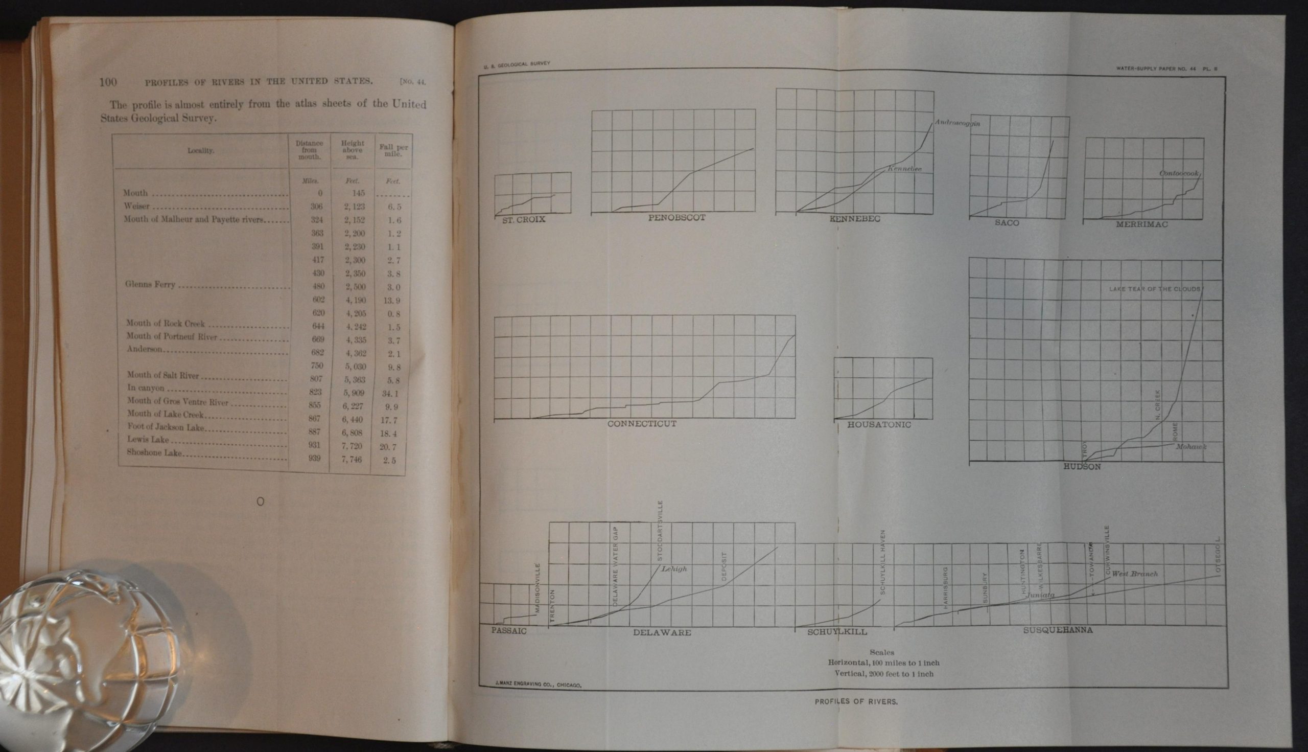
This fascinating collection of reports and papers was published by the Government Printing Office in 1901 as a public record of the workings of Congress. This particular volume presents one of the mandates of the United States Geological Survey – America’s water resources. A fascinating variety of topics are covered; including the development of an economic and efficient windmill by Edward Charles Murphy, operations at river stations (extensive tables of observations), profiles of rivers in the United States by Henry Gannett, and water storage at Cache Creek, California, by Albert E. Chandler.
Of particular interest is Paper No. 40, The Austin Dam by University of Texas Geology Professor Thomas U. Taylor. Taylor provides a critical examination of the Great Granite Dam, completed by the cash-strapped city in 1893 to tempt local investment with cheap hydroelectric power. In early April 1900, heavy rains along the Colorado River resulted in the dam’s complete failure, flooding downtown and killing at least fifty people. The city, now deeply in debt, was without electrical power for several months. Taylor places the blame largely on insufficient design and poor placement. Numerous photographs and illustrations outline the construction process and the aftereffects of the flood.
Source: Austin Statesman; KUT News Austin
Map Details
Publication Date: 1901
Author: United States Geological Survey
Sheet Width (in): 8.75
Sheet Height (in): 5.5
Condition: B+
Condition Description: Compilation of Papers No. 40 - 47, each individually paginated to a total exceeding 750 pages, bound in original leather with embossed spine and gilt details. Hinges are loose and the boards are heavily spotted, with the front flyleaf starting to pull away from the string binding. The contents, apparently complete, are otherwise in good shape; somewhat brittle from age with light toning concentrated along the outer edges of the pages. Includes numerous tables and illustrations, plus 11 fold-outs of river elevation profiles.
Original price was: $350.00.$250.00Current price is: $250.00.
1 in stock