War Map of Europe
$210.00
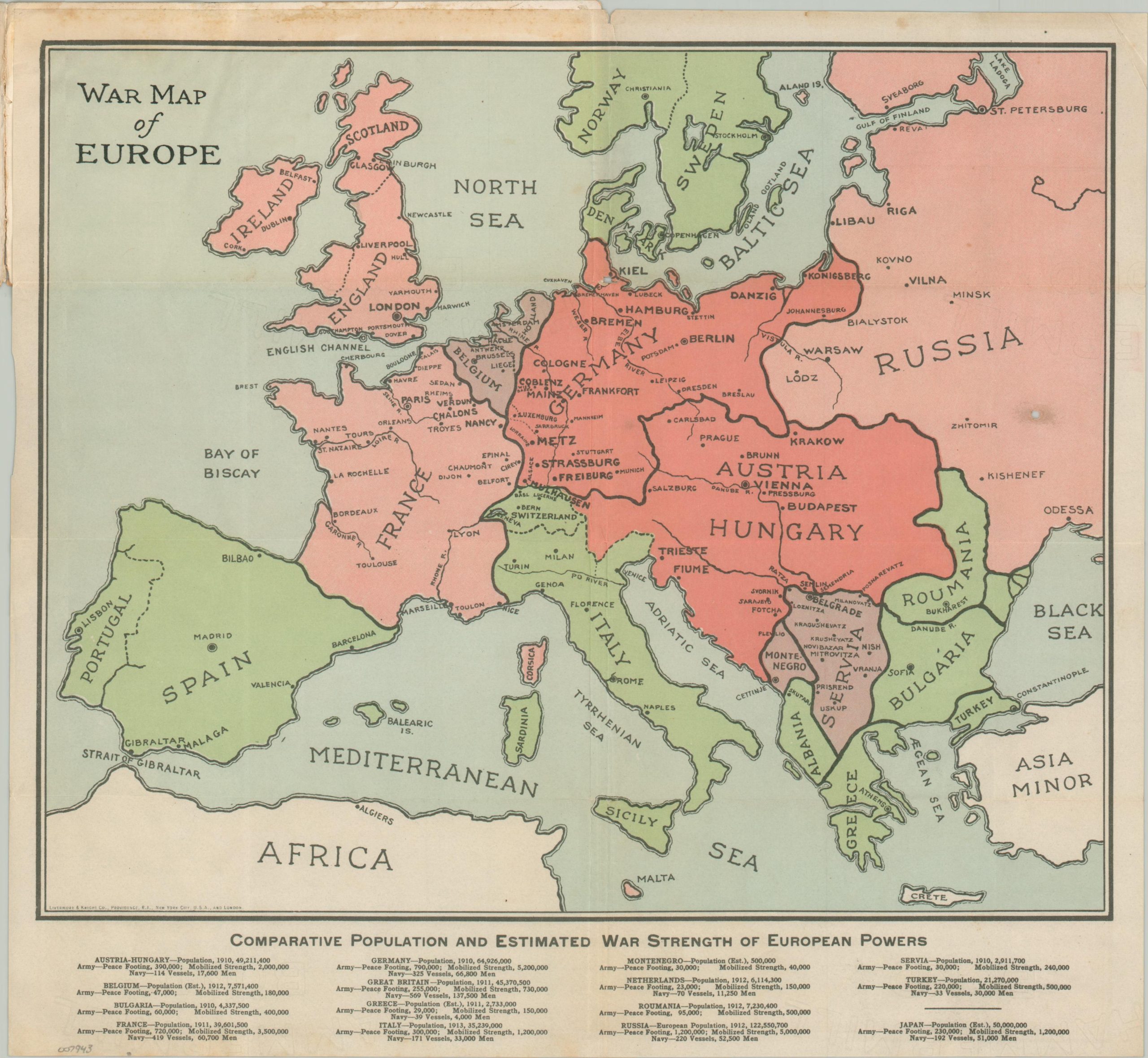
Informing a curious American public on the outbreak of the European War.
1 in stock
Description
This straightforward ‘primer map’ of Europe was issued shortly after the outbreak of World War I. Independent nations, major geographic features, and important cities are labeled, including several key fortified positions along the border of France and Germany. Statistics at the bottom of the page provide population information and approximate military sizes for the belligerents. Though the participation of the United States was still several years away, the inclusion of Turkey and Japan (plus all the overseas territories) ensured a truly global conflict.
Published, probably in late 1914, by the Livermore & Knight Company. Small text in the lower left notes firm locations in Providence, London, and New York. The back cover offers an advertisement for E. Crosby & Company, mill agents and grain shippers in Brattleboro, VT, so I suspect the origin of this example is Providence.
Map Details
Publication Date: c. 1914
Author: Livermore & Knight Company
Sheet Width (in): 14.50
Sheet Height (in): 13.40
Condition: B
Condition Description: Color printed map folded into 8 segments and affixed to stiff paper covers. The spine on the wraps (moderately soiled and damp stained on the back) is partially separated. A small hole, possibly from a burn, visible in the center right of the map, as well as some creasing and wrinkling along folds. Light spotting visible along the upper edge, mostly confined to the margins. About good condition overall.
$210.00
1 in stock