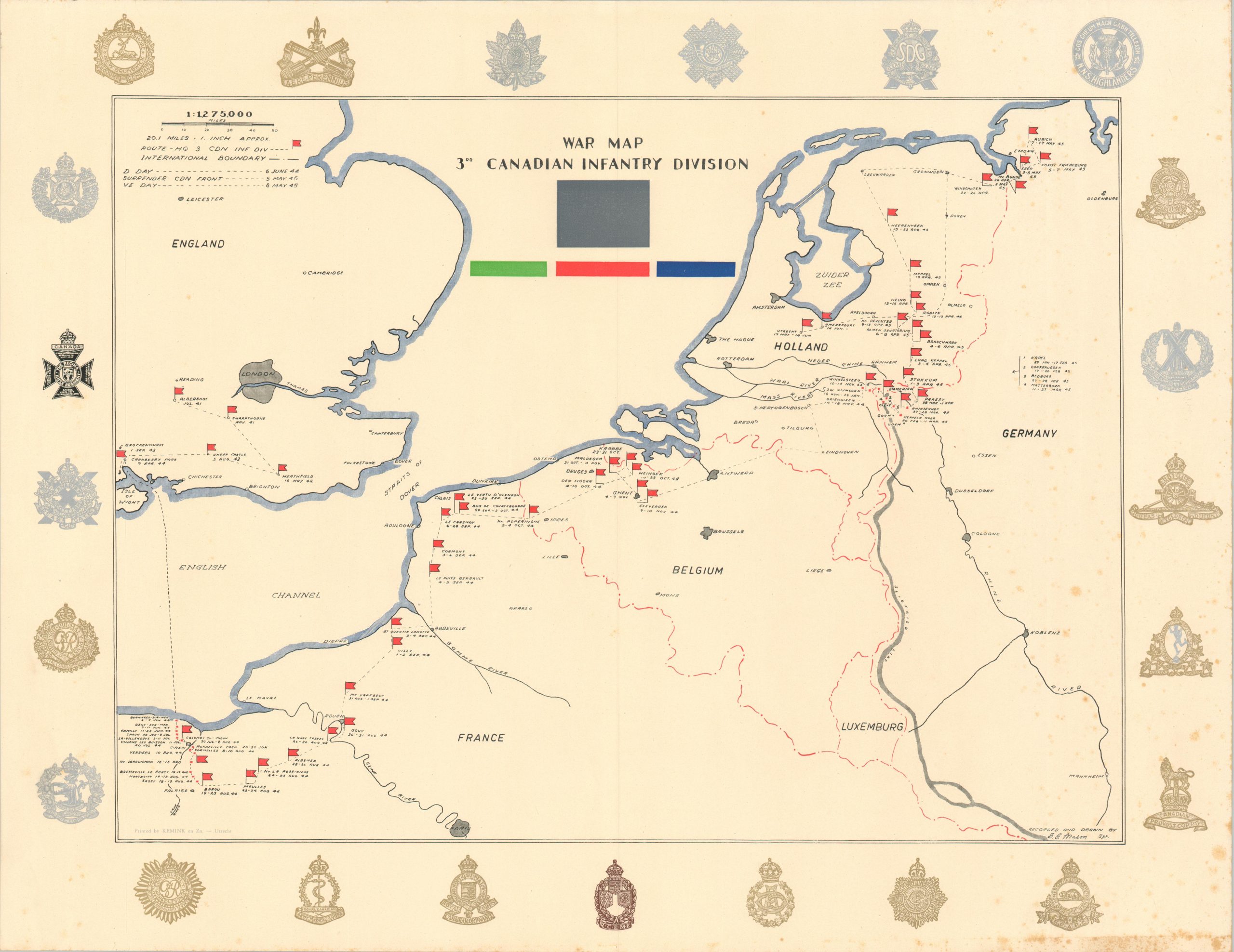
War Map 3rd Canadian Infantry Division
Nearly four years in the E.T.O. by the 3rd Canadian Infantry Division
Out of stock
Description
This informative map of the European Theater plots the route of the 3rd Canadian Infantry Division across England, France, Belgium, Holland, and Germany during World War II. Nearly 3 years of training in southern England was followed by the historic assault at Juno Beach on D-Day in 1944. The Battle of Normandy was just the beginning, as the 3rd would then march across the continent before being assigned occupation duty after V-E Day.
Liberating Calais, capturing the Fortress of Mimoyecques, and crossing the Rhine are among the division’s many wartime achievements, though its fame lies in the bloody fight for the beaches of France. In addition to the path of advance, the map identifies the locations and dates of divisional headquarters. Major urban centers and geographic features are also labeled. The unadorned formation patch, a simple gray box, is shown in the upper center. Various regimental insignia, most highlighted in gold and silver ink, are presented around the border.
The map, signed in the lower right, was drawn by G.E. Mason. Printed by Kemink & Zoon in Utrecht in 1945. The piece is uncommon on the market (this is the first example I have handled) and unlisted in WorldCat as of August 2024. One example has been identified in the collections of the Canadian War Museum.
Source: Canadian War Museum
Map Details
Publication Date: 1945
Author: G.E. Mason
Sheet Width (in): 27.5
Sheet Height (in): 21.2
Condition: B+
Condition Description: Scattered spotting visible along the outer edges of the sheet, concentrated most heavily on the right side and in the lower right corner. A bit of faint wrinkling where previously rolled. Good condition overall. Blank on verso.
Out of stock