Wagner’s Complete Map of Springfield and Environs
$129.00
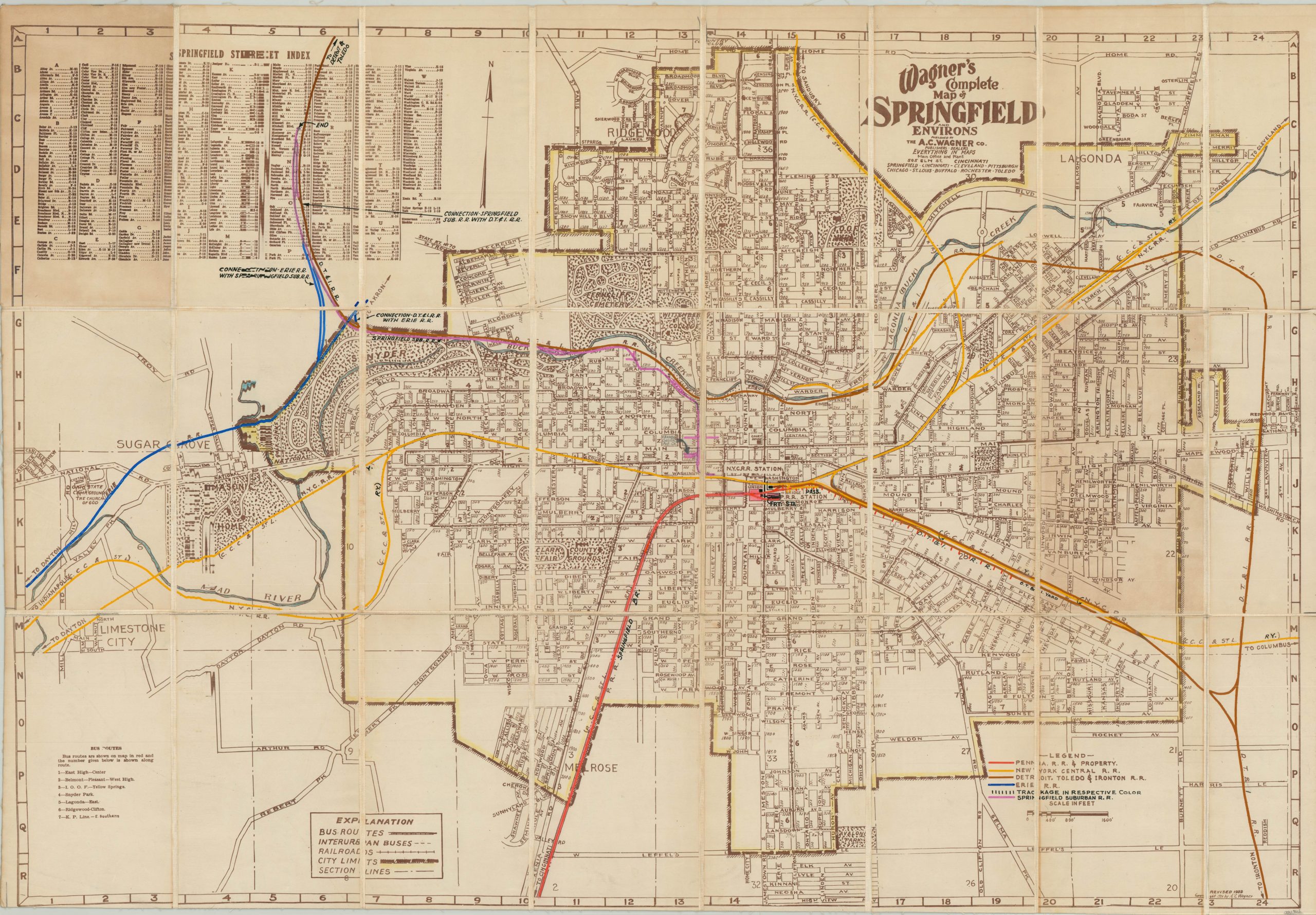
Prewar city map of Springfield, Ohio modified for use by the Pennsylvania Railroad.
1 in stock
Description
This detailed map of Springfield, Ohio and accompanying street index was first published by the A.C. Wagner Company in 1939. The image provides a comprehensive overview of the city’s transportation routes, park system and sectional organization.
This particular copy has been created and customized for use in the Central Engineering Department of the Pennsylvania Railroad, and has been dissected and mounted on linen for preservation and convenient storage. Vivid color has been applied by hand to denote property and track ownership throughout the city, and a custom legend has been affixed to the lower right to identify the primary railroad operators throughout the city.
Of particular interest is the Springfield Suburban Railroad – one of the numerous electric interurban rails that operated in medium and large American cities in the first half of the 20th century. Also of note is the Detroit, Toledo, and Ironton Railway – by this time a subsidiary of the Penn, the D.T. & I. had been previously used by Henry Ford to control the supply of raw materials to his automobile plants in Detroit.
Map Details
Publication Date: 1939
Author: A.C. Wagner Company
Sheet Width (in): 33.75
Sheet Height (in): 24.00
Condition: B+
Condition Description: Dissected into 24 panels and mounted on linen with black leather covers. Two panels exhibit moderate discoloration due to the adhesive used to affix the covers to the verso. Otherwise the map is in very good condition, with faint wear and scattered soiling consistent with age and use.
$129.00
1 in stock

