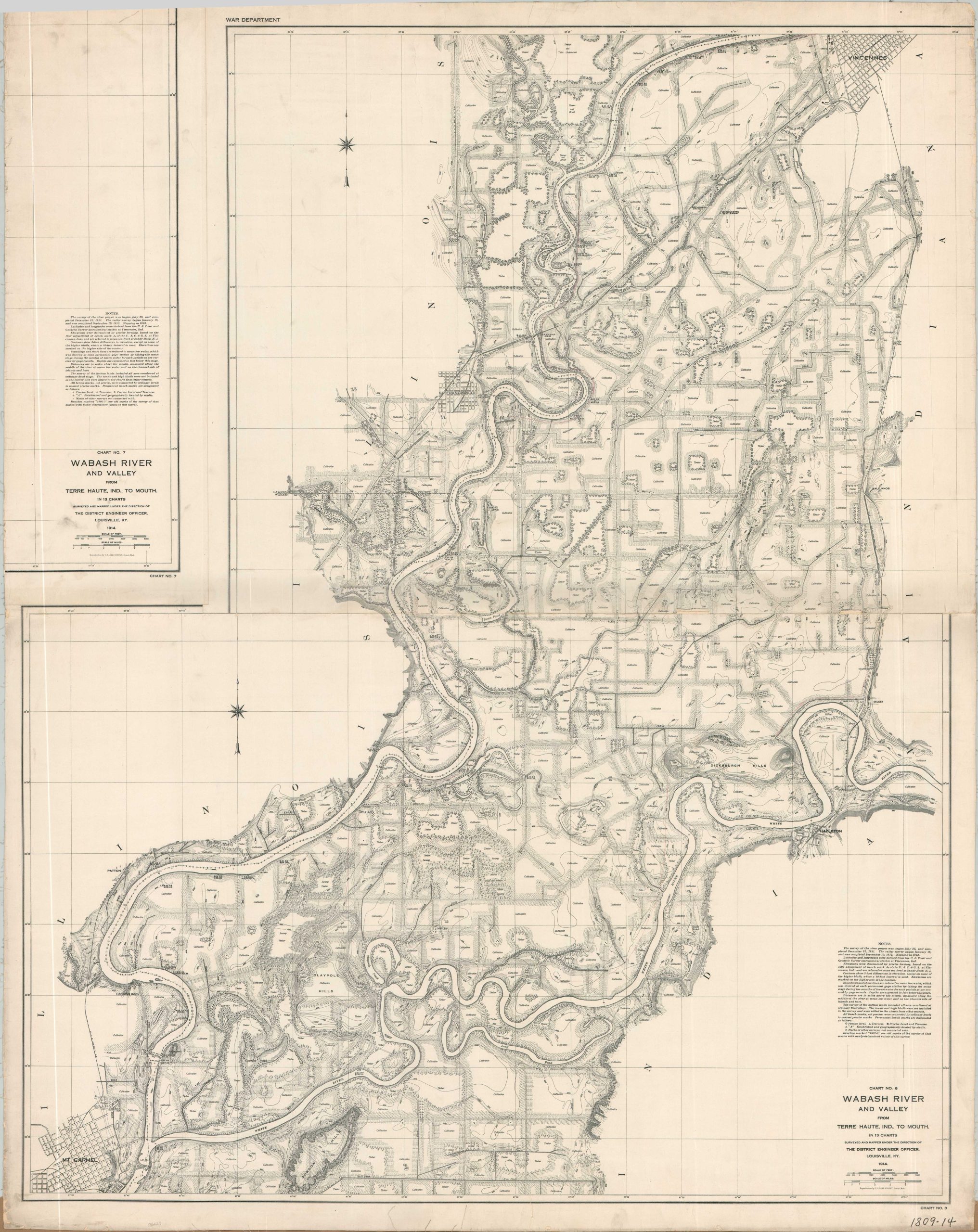
Wabash River and Valley from Terre Haute, Ind. to Mouth
$350.00
From Vincennes, IN to Mt. Carmel, IL along the Wabash River.
1 in stock
Description
This pair of incredibly detailed maps was compiled by members of the U.S. Army Corps of Engineers and published in 1914 under the authority of the War Department. The sheet presents two charts (of thirteen, originally) that plot the course of the Wabash River between Terre Haute, Indiana, and its mouth at the Ohio River. The area covered includes large portions of southwestern Indiana and southeastern Illinois between Vincennes and Mt. Carmel.
A large scale of 1″ = 1/4 mile allows for the transmission of an incredible amount of information about the physical landscape, local infrastructure, geographic features, and settlement patterns. Individual buildings are outlined, while large tracts of land are labeled as Timber, Cultivation, etc. While constantly threatened by floods, much of the region offered bountiful agricultural output. Notes in the lower right provide further details about the survey methodology.
Map Details
Publication Date: 1914
Author: United States Army Corps of Engineers
Sheet Width (in): 41.5
Sheet Height (in): 52.25
Condition: B+
Condition Description: Custom compilation of two sheets (of 13 total) cut and mounted onto old, but sturdy, linen to make a continual image. As a result, the title block for Sheet 7 is on the left side, whereas the same information for Sheet 8 is presented on the right. Moderate wear along the outer edges of the sheet, including some fraying to the linen and numerous small tears. A handful of dirty fingerprints in the upper left corner and a visible horizontal seam, starting to curl, along the center where the two sheets connect. Good condition overall.
$350.00
1 in stock