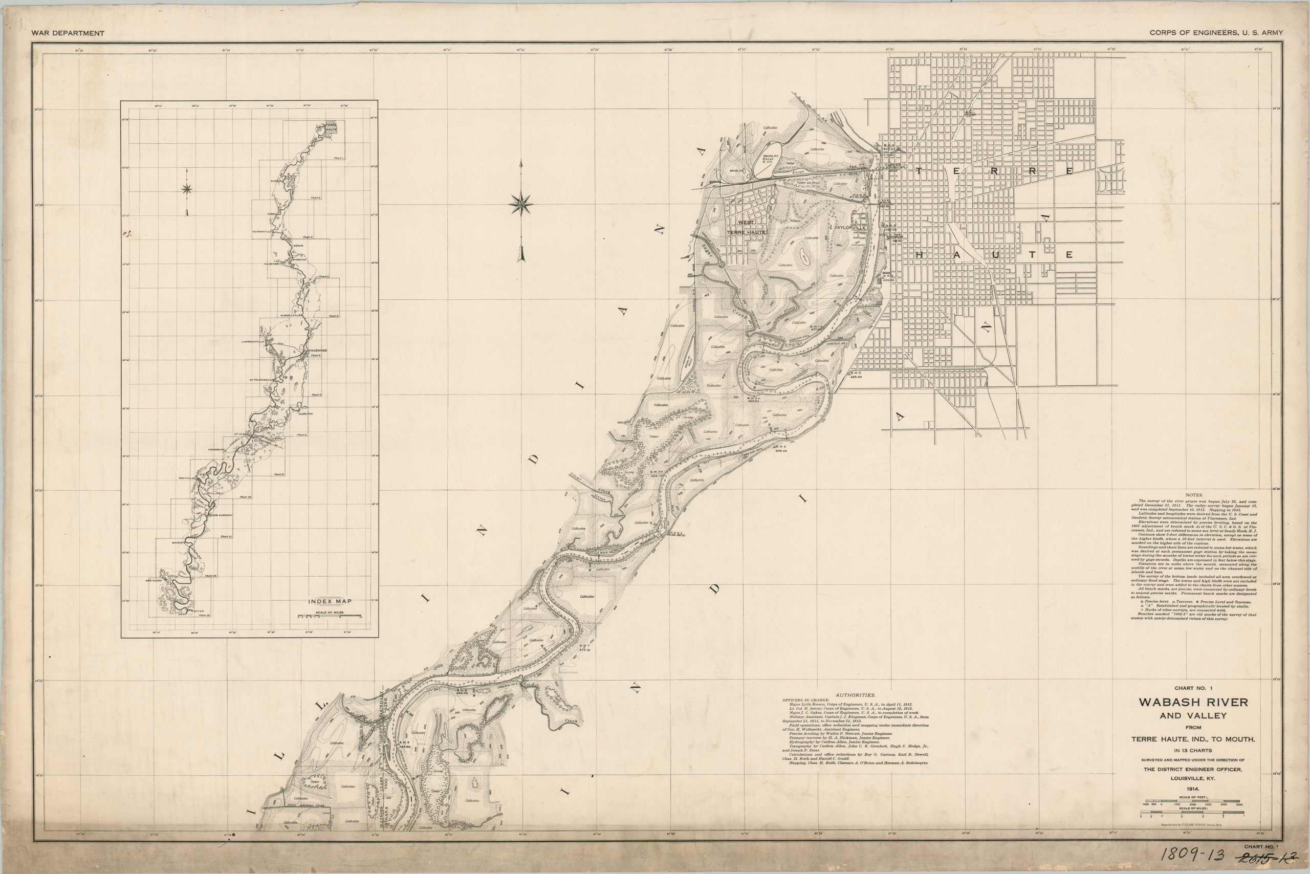
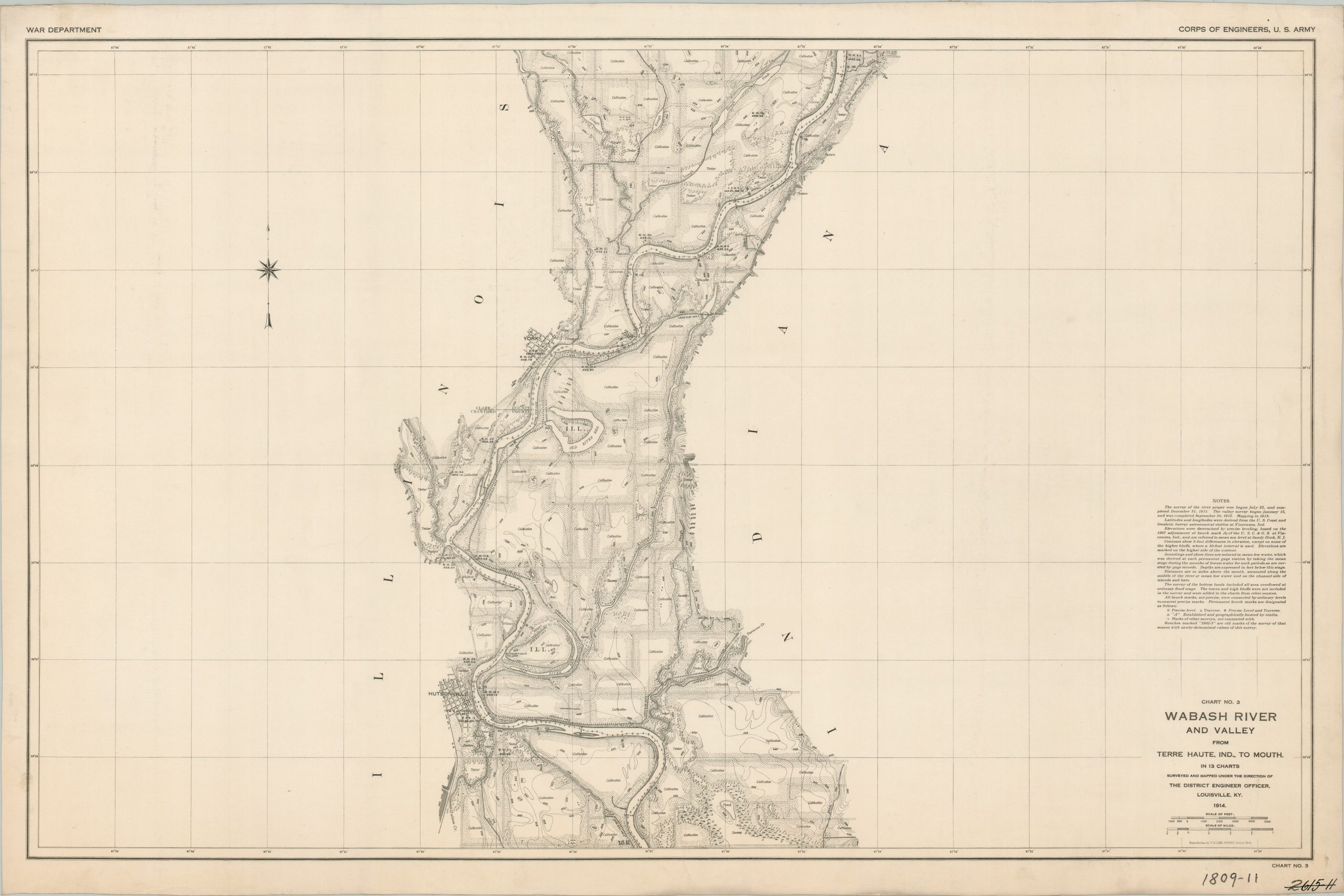
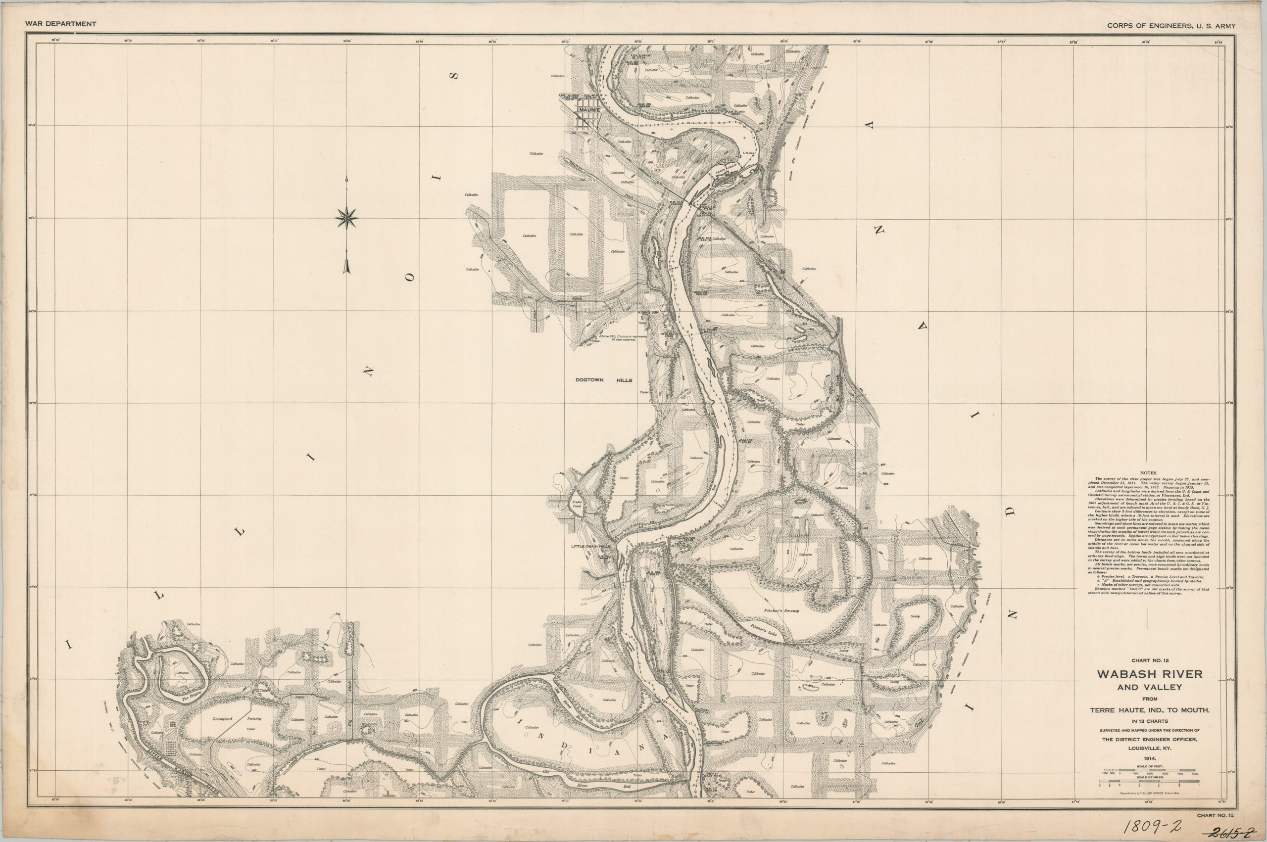
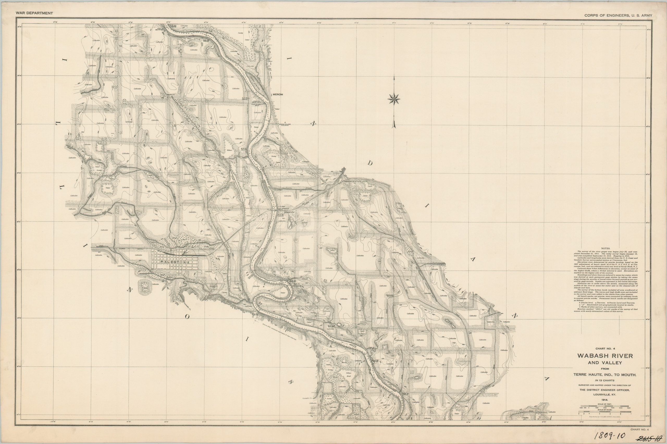
Wabash River and Valley from Terre Haute, Ind. To Mouth, in 13 Charts
Pre-WWI survey of Indiana’s Wabash River, courtesy of the Army Corps of Engineers.
Out of stock


Description
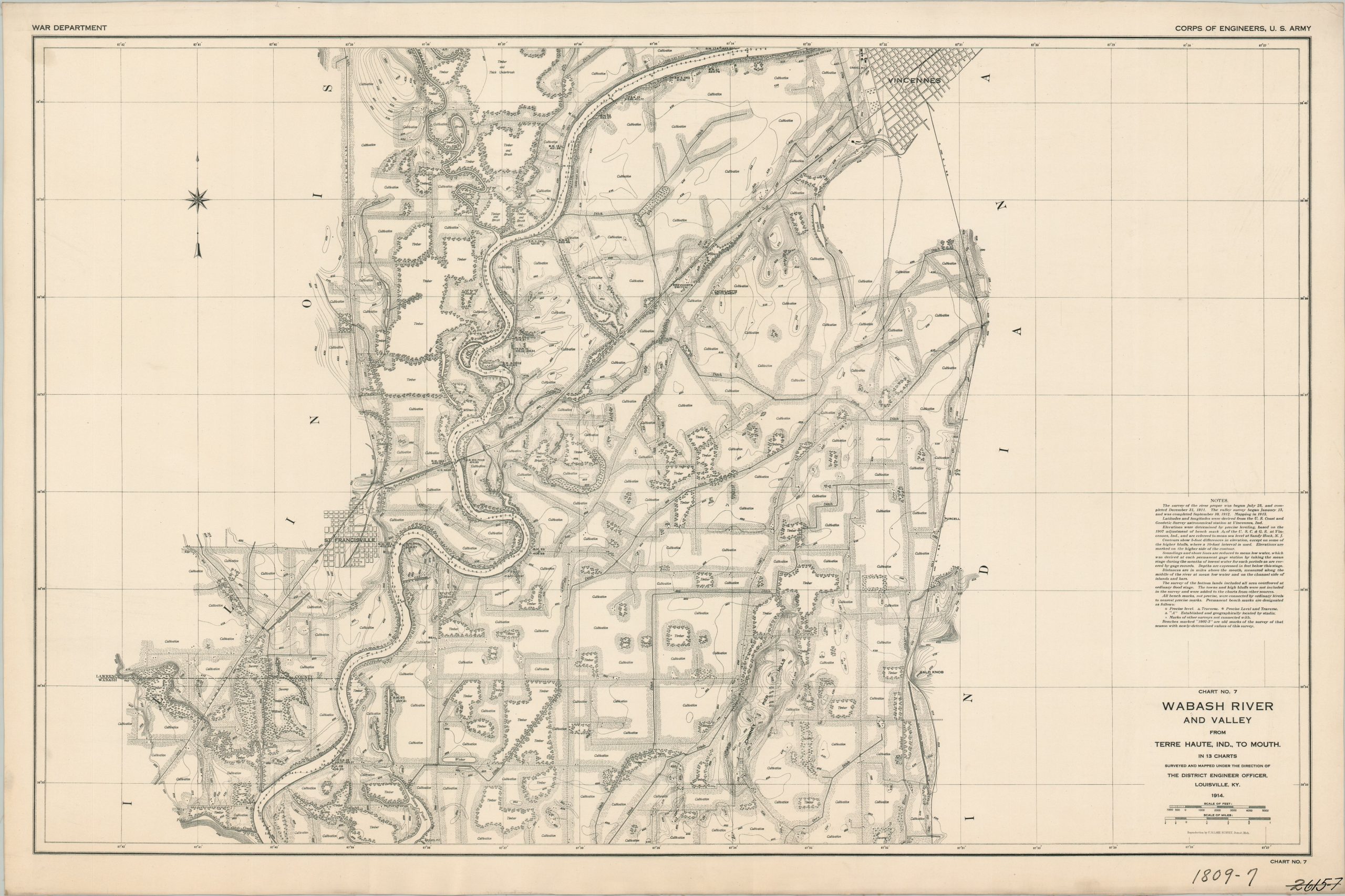
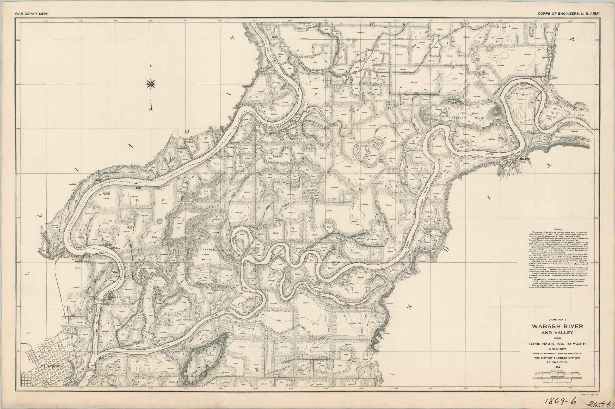
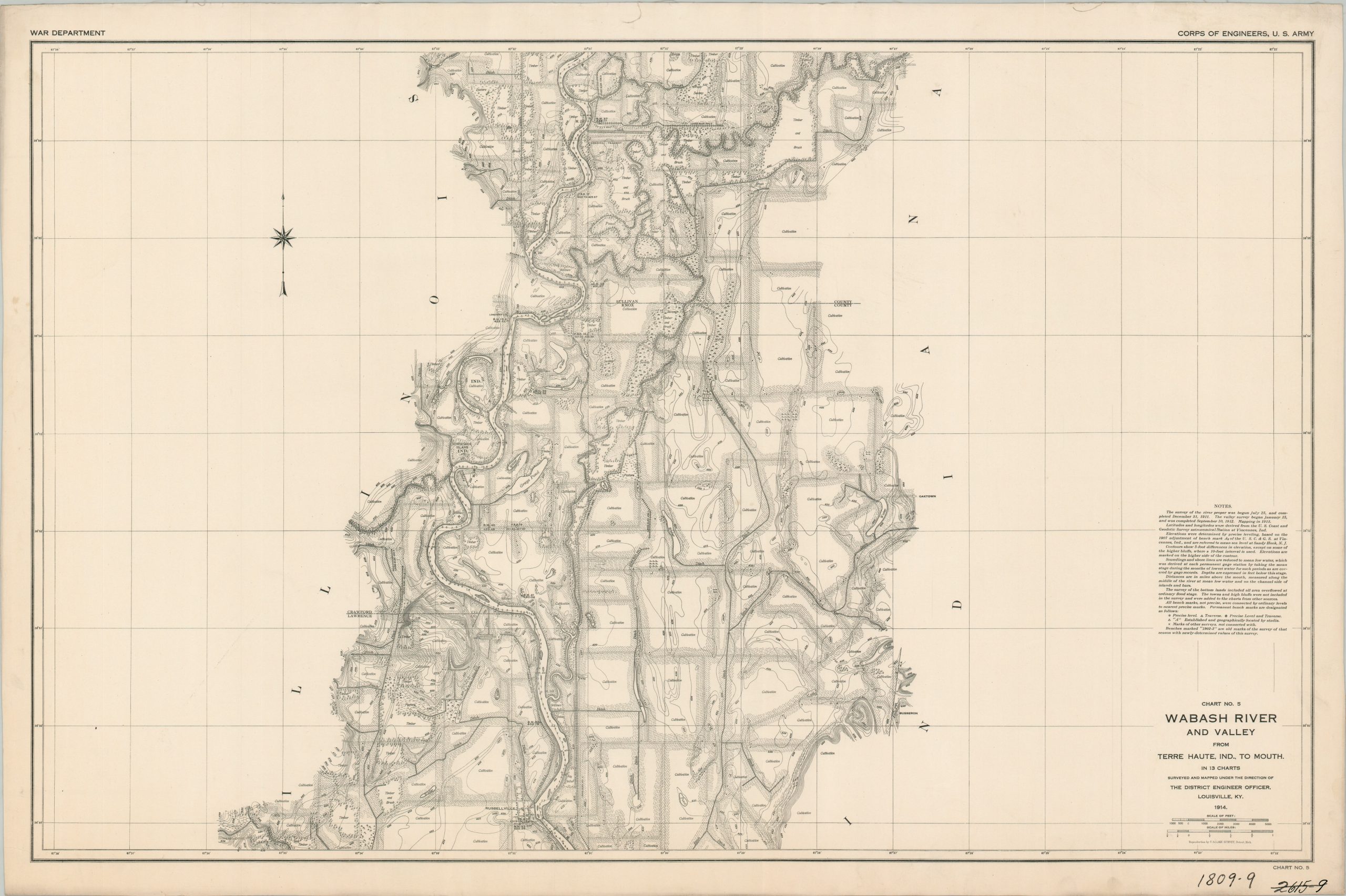
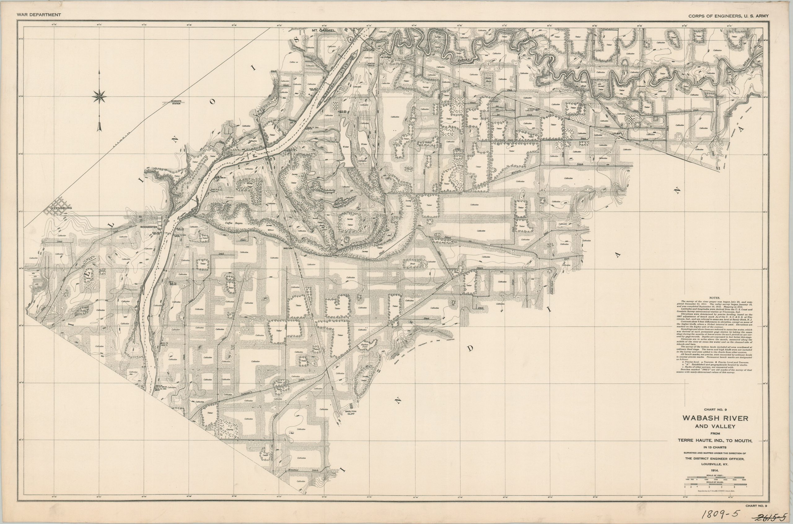
This phenomenally detailed set of thirteen maps shows the course of the Wabash River between Terre Haute, Indiana, and its mouth at the Ohio River, near the state line. The requisite surveys were performed by members of the Louisville District of the Army Corps of Engineers from 1911 to 1913, with printing in Detroit in 1914 by the U.S. Lake Survey. A list of authorities in the lower center of Chart 1 gives credit to the various officers in charge.
Within each image, around a mile or two on either side of the river are shown at any given spot. Notes above the title give further details about the survey methodology and symbols used. Depth soundings are noted at regular intervals throughout the course of the river. Details on the levee are also provided, where applicable. A wealth of information is provided about the adjacent physical landscape – areas under cultivation, timber, lowlands, etc. Topography is shown in contour with corresponding elevation data. Major transportation routes, notable landmarks (including those used as survey points), and geographic features are labeled. Primary towns include Terre Haute, Vincennes, and Mt. Carmel, with several other smaller settlements also outlined.
The complete collection is certainly rare. WorldCat identifies only one institution with a holding for the 1914 edition – the Indiana State Library. A later revised version, issued in 1931, is noted in 13 locations as of September 2024. OCLC #1286066253 (1914) OCLC# 28158741 (1931). This particular group was obtained from a railroad engineering archive. Several of the lines have been lightly marked with old pencil.
Map Details
Publication Date: 1914
Author: United States Army Corps of Engineers
Sheet Width (in): 41.75
Sheet Height (in): 27.75
Condition: A-
Condition Description: Complete collection of thirteen sheets (size given for each), printed on somewhat glossy paper that's been mounted on linen (probably as issued). The first chart includes an index and shows a 2" strip of soiling along the lower edge.The final chart shows some cracking and scattered staining along the lower edge. Apart from there, there are a handful of dirty fingerprints, old manuscript annotations, some frayed edges, and markings in the lower right corner of each page. Very good condition overall for the uncommon full set.
Out of stock