
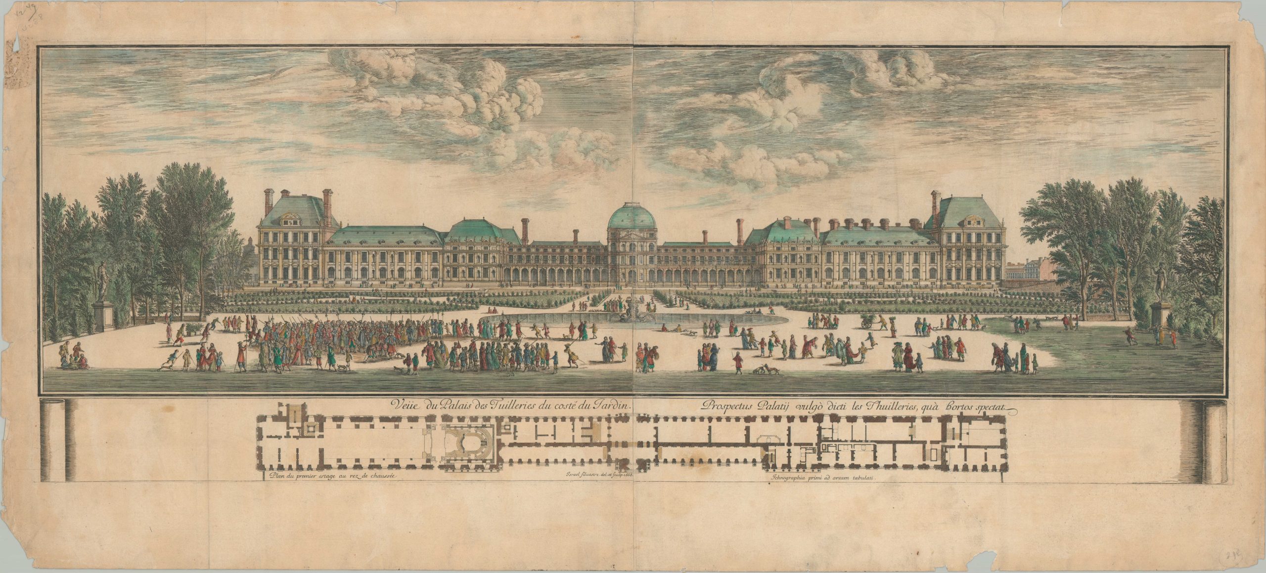
Vue du Palais des Tuileries du cote du Jardin
Late 17th century view of the former home of France’s imperial power.
Out of stock
Description
This attractive view of France’s Tuileries Palace was designed by Israel Silvestre and published in Paris in 1668. Crowds of well-dressed (and well-armed) visitors can be seen standing about the expansive grounds and walking through the manicured gardens. While clearly a number of aristocrats are depicted, other figures around the edges are shown wearing more tattered clothing. A floor plan designed by Charles Allard can be seen at the bottom of the page.
Standing on the ‘right’ bank of the Seine, next to the Louvre, the opulent complex was home to French monarchs from Henry IV to Napoleon III. It eventually became a despised symbol of the ‘Ancien Regime’ and was eventually destroyed by the Paris Commune in 1871. The year prior to publication, Louis XV moved his court to the palace until relocating to Versailles in 1672.
Source: Victoria & Albert Museum.
Map Details
Publication Date: 1668
Author: Israel Silvestre
Sheet Width (in): 40.25
Sheet Height (in): 18.25
Condition: B
Condition Description: Moderate to heavy wear along the outer edges of the sheet, including several chips and spots of discoloration, most evident in the upper left corner. Some separation and curling visible along the vertical centerfold and there are several small spots of discoloration and soiling present in the image. Issued on thick paper with attractive hand color. Almost good condition overall.
Out of stock