Viue de L’Aqueduc d’Arcueil
$70.00
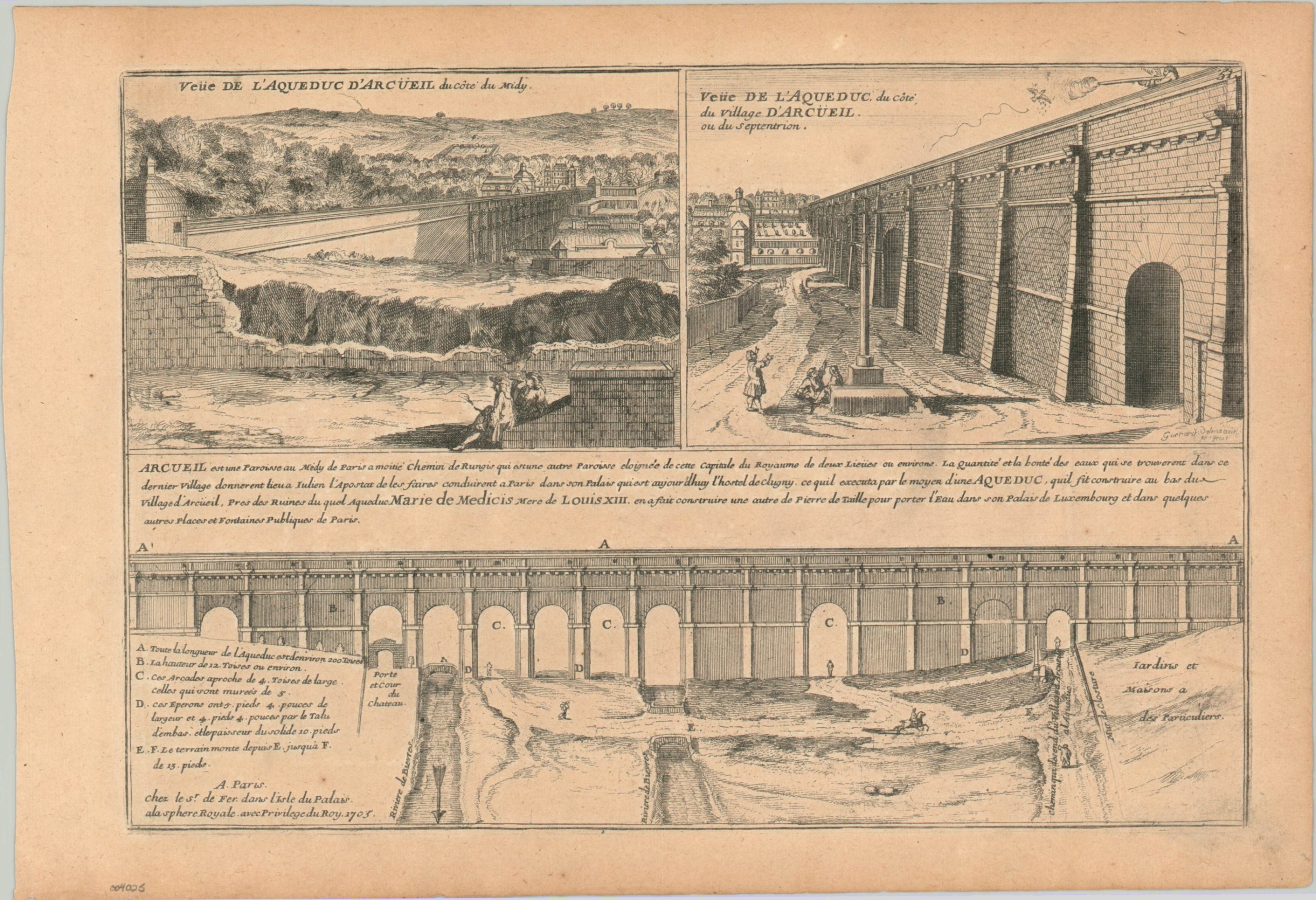
The massive aqueduct near the French town of Arcueil.
1 in stock
Description
This lovely sheet shows several views of the aqueduct at Arcueil, in the southern suburbs of Paris. The town and commune originated as the Latin Arcoloi (place of the arches), named as such for the Roman aqueduct that was constructed to carry water to the ancient city of Lutetia (modern-day Paris, about 3 miles away). Subsequent structures followed, such as a gigantic 1300-foot bridge built in the first quarter of the 17th century to deliver water to the Luxembourg Palace in the capital.
It is that ‘Aqueduct d”Arcueil’ pictured here in three separate scenes. The upper panels show two separate views from the south and north, while the bottom half presents a diagram of the entire span across the River Bievre. Published in Paris around 1705 as part of Nicholas de Fer’s Atlas Curieux.
Map Details
Publication Date: c. 1705
Author: Nicholas de Fer
Sheet Width (in): 15.3
Sheet Height (in): 10.5
Condition: A-
Condition Description: Sheet is slightly toned, consistent with age, and a bit of a dark spot from the plate mark in the lower right corner. One or two small spots in the margins, but overall in very good or better condition.
$70.00
1 in stock