Vita Levu “Fiji Islands”
$750.00
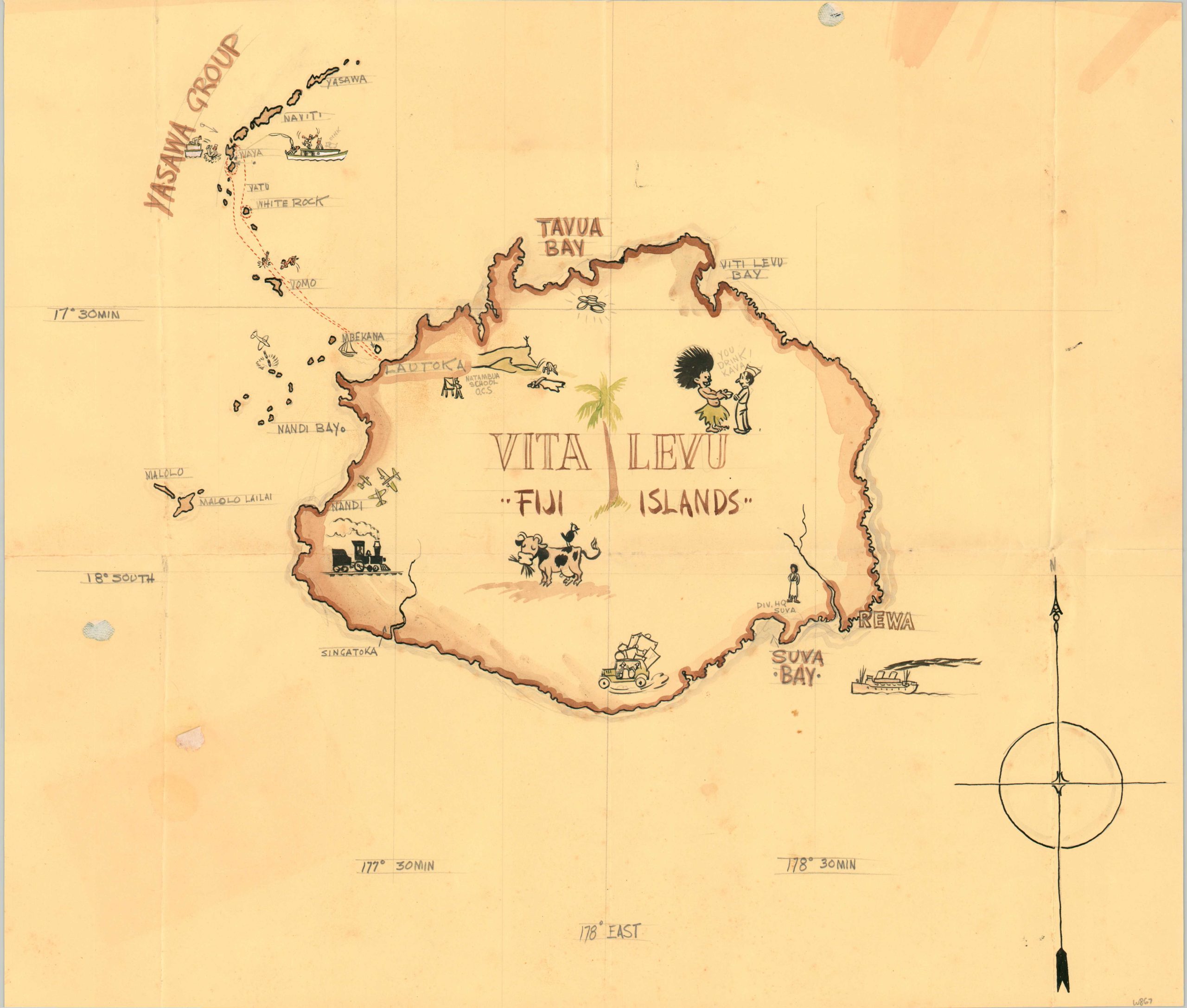
Hand-drawn postwar perspective of Fiji.
1 in stock
Description
This lovely manuscript map presents Vita Levu, the largest of the islands comprising the South Pacific nation of Fiji. Based on the content, the image was likely drafted by an American soldier or sailor stationed on the island in the years immediately after World War II. Several military facilities are prominently featured, including the Natambua O.C.S. School, Divisional Headquarters at Suva, and the USAAF airport at Nandi (today’s Nadi International Airport). Other vignettes reflect the leisurely priorities of the servicemen, including swimming, fishing, and receiving kava from natives.
While Fiji (then a British colony) was able to avoid direct conflict with Japan during the Second World War, it hosted several forward Allied bases and supply depots. Native inhabitants served a number of roles in supporting the war effort, including labor, food procurement, and direct combat. The experiences directly transformed Fijian society and culture, prompting significant economic development and eventually leading to calls for self-governance.
Further Reading: The Material Remains of World War II on Viti Levu: A Historical Archaeological Inventory
Map Details
Publication Date: c. 1946
Author: Anonymous
Sheet Width (in): 18.5
Sheet Height (in): 15.9
Condition: B+
Condition Description: Pencil and watercolor map with moderate creasing along old folds. A handful of scattered spots and some old paint runs in the upper right corner. A handful of old adhesive residue spots in the upper right and center left. Good condition overall. Blank on verso.
$750.00
1 in stock