Vincennes Indiana Street Guide and City Map
$95.00
Excellent prewar city map of Vincennes, Indiana with numerous contemporary advertisements.
1 in stock

Description
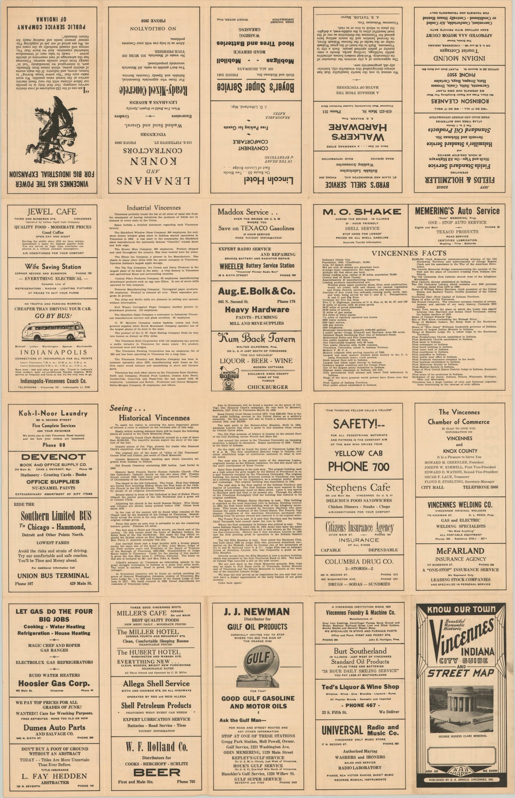
This map of Vincennes, Indiana is an excellent example of small town promotional cartography. In the years prior to the United States’ entry to WWII, most cities throughout the country were still recovering from the financial upheaval of the Great Depression. Unemployment rates were high and the standard of living had plummeted for many Americans coast to coast.
This map seeks to alleviate those fears for tourists and potential residents alike. The image itself is functional and legible, combining historical information (alluding to the town’s long history, and thus, security) with modern map elements labeling streets, important buildings, and locations of interest. Surrounding the city is a border of local advertisements, which provide the most engaging component of the map.
Transportation, construction, restaurants, clothing stores and hotels can all be found, representing economic success and the “complete package” Vincennes can offer to its inhabitants. Of particular interest to the author is Washington Athletic Field, where high school football games were held, and the George Rogers Clark Memorial, where he married his wife in 2018.
Map Details
Publication Date: c. 1941
Author: A. A. Arnold
Sheet Width (in): 34
Sheet Height (in): 22
Condition: A
Condition Description: Apart from very minor wear along the originally issued fold lines, the map exhibits few defects and is like new.
$95.00
1 in stock