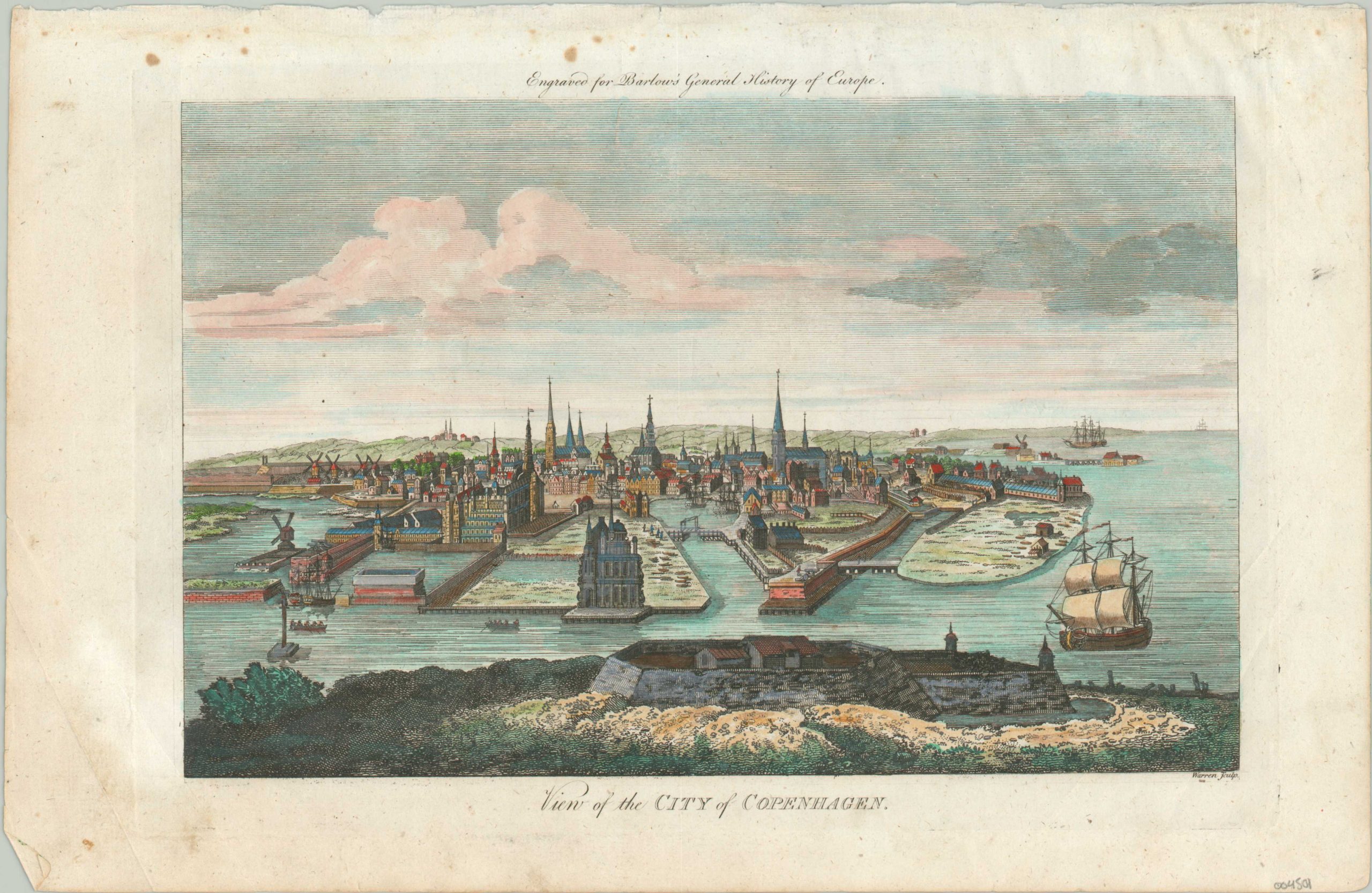
View of the City of Copenhagen
$80.00
Detailed view of Copenhagen from Barlow’s General History of Europe.
1 in stock
Description
This elaborately engraved view shows the Danish capital of Copenhagen near the end of the 18th century. The heavily fortified city is situated at a key approach between the North and Baltic Seas and has a long history of fishing and shipbuilding. Both industries are vaguely discernable amid the detailed scene, with small vessels piled on the shore and drydocks capable of accommodating massive ships of the line (one of which can be seen entering the harbor from the right). Fortifications (the citadel is in the foreground), royal palaces, warehouses, churches, and windmills can all be spotted amid the busy skyline.
Published around 1790 as part of Percival Barlow’s A General History of Europe. Just a few years later, in 1795, the city’s medieval center was ravaged by a large fire.
Map Details
Publication Date: c. 1790
Author: Percival Barlow
Sheet Width (in): 14.75
Sheet Height (in): 17.1
Condition: B+
Condition Description: Moderate soiling and spotting visible in the margins, along with a few small tears confined to the outer edges of the sheet. Printed on somewhat thin paper that's lightly wrinkled. A few spots visible within the image, but barely detectable thanks to the attractive modern hand color.
$80.00
1 in stock

