Vietnam and Neighboring Countries in 1968
“The Beginning of the End” of the Vietnam War.
Out of stock
Description
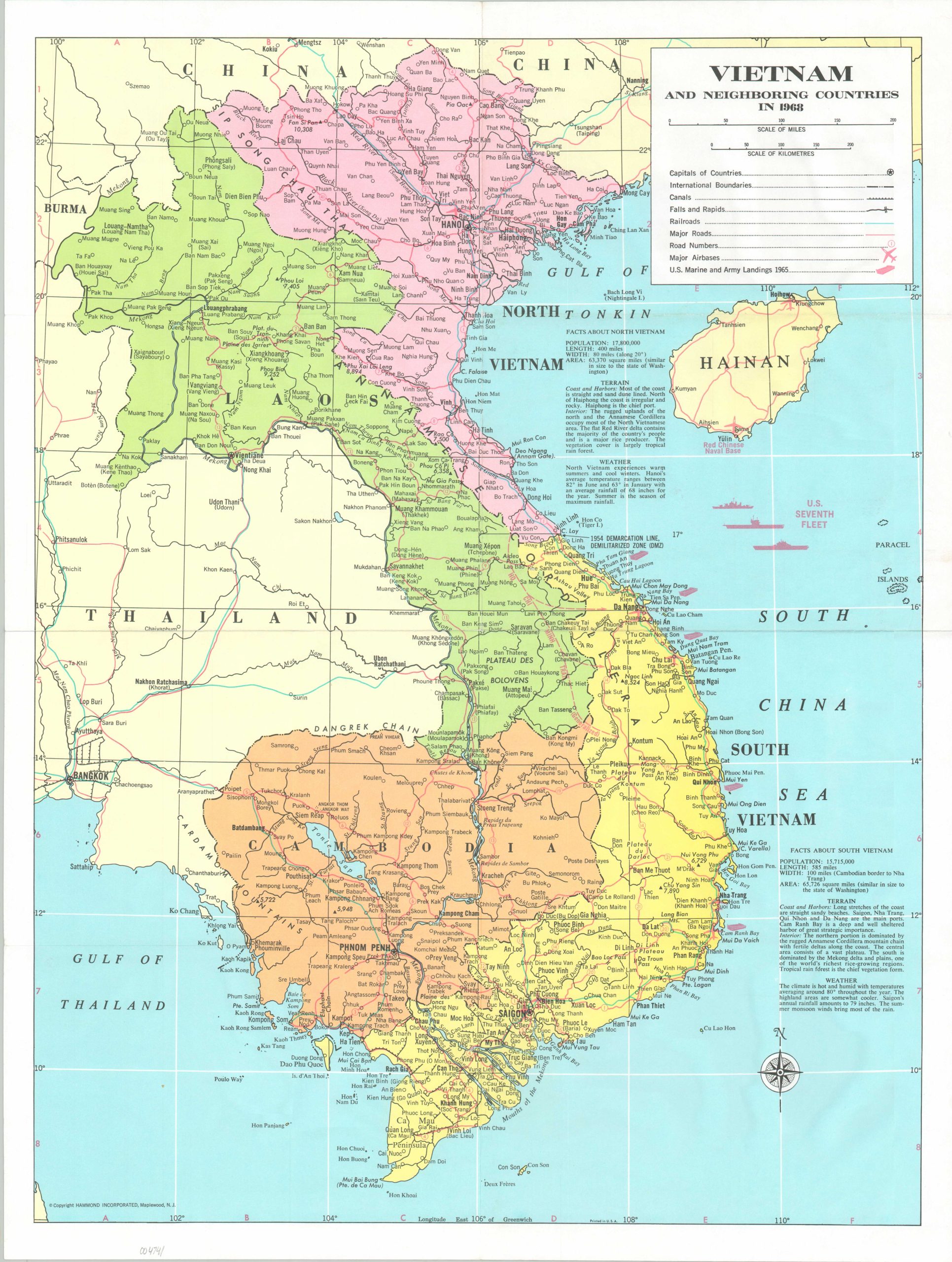
This informative map of Vietnam, Laos, and Cambodia shows the primary infrastructure across the theater of the Vietnam War as of 1968, the same year Communist forces launched The Tet Offensive. Roads, canals, railroads, military installations, and the site of U.S. Landings in 1965 are identified according to the legend below the title block. The U.S. Seventh Fleet is also pictured in the South China Sea.
Accompanying descriptive text provides statistics on both North and South Vietnam, drastically understating the harsh environment experienced by Allied troops. Published by Hammond Incorporated in Maplewood, New Jersey in 1968.
Map Details
Publication Date: 1968
Author: C.S. Hammond
Sheet Width (in): 18.9
Sheet Height (in): 24.75
Condition: A-
Condition Description: Creased along old fold lines and moderately wrinkled throughout. Some light spotting visible around the outer edges of the sheet. Very good overall.
Out of stock