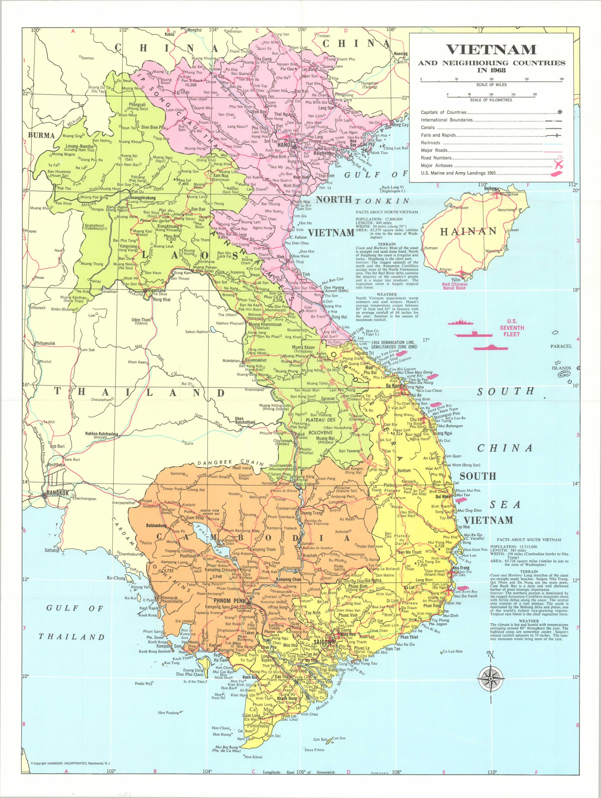
Vietnam and Neighboring Countries in 1968
“It seems now more certain than ever that the bloody experience of Vietnam is to end in a stalemate.” – Walter Cronkite, Feb. 27, 1968
Out of stock
Description
This apparently straightforward military map of a divided Vietnam, Laos, and Cambodia was published in 1968 by Hammond Incorporated of New York. It shows the U.S. perspective on a conflict that had been raging for nearly fifteen years by that point, though the outcome was perhaps never more in doubt.
The transportation network is emphasized, including a generalized depiction of the Ho Chi Minh Trail. A Red Chinese Naval Base is noted on Hainan, not far from the U.S. Seventh Fleet. Military landings from 1965 are noted, though thousands of additional American soldiers would soon be shipped overseas to combat the North Vietnamese Tet Offensive, which began in January, 1968.
In May, the infamous My Lai Massacre took place near the city of Quang Ngai. Hundreds of unarmed civilians, mostly women, children, and the elderly, were murdered by members of the 23rd (Americal) Division. The American military presence would peak in April 1969, with nearly 550,000 troops in the theater.
Map Details
Publication Date: 1968
Author: Hammond Incorporated
Sheet Width (in): 18.75
Sheet Height (in): 25
Condition: A
Condition Description: Light creasing along fold lines (probably as issued). Near fine condition. Blank on verso.
Out of stock