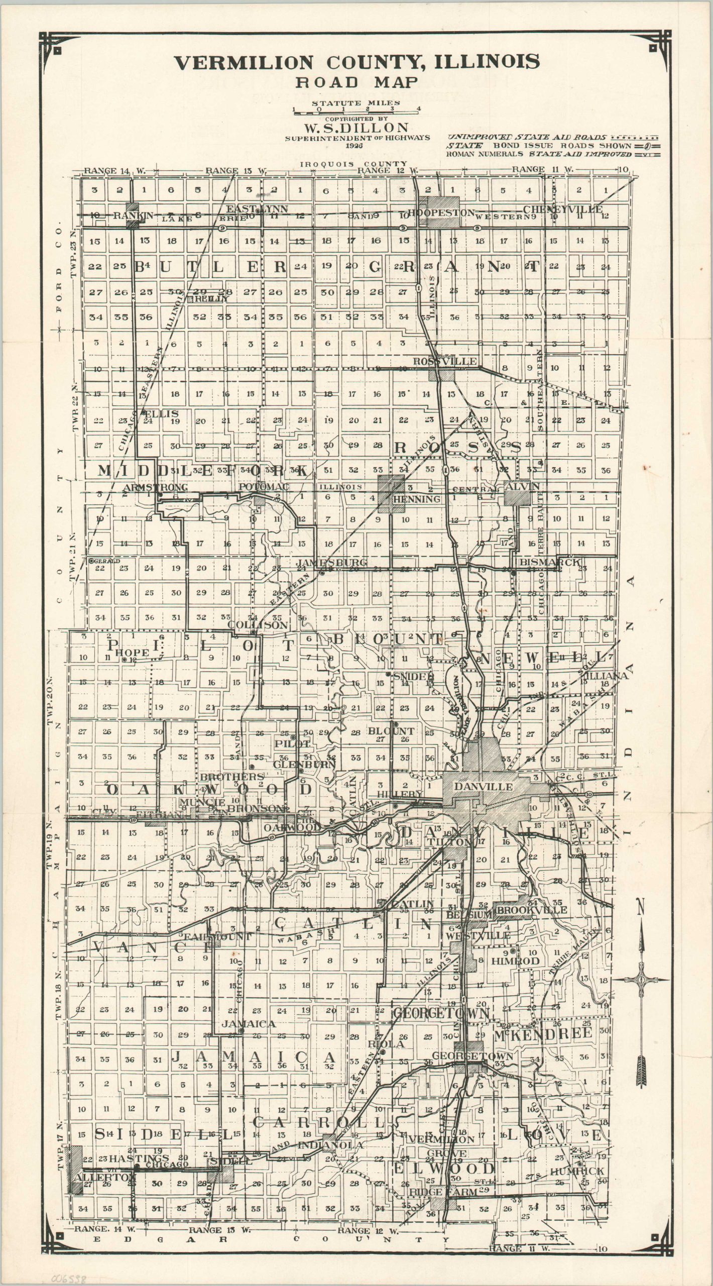
Vermillion County, Illinois Road Map
$75.00
The road network around Danville, Il during the mid-1920s.
1 in stock
Description
This map of Vermilion County, IL was copyrighted in 1926 by W.S. Dillon, the county Superintendent of Highways, and likely published in Danville by the Board of Supervisors. It presents a complex network of improved/unimproved state aid and bond roads crisscrossing the county. Sections are numbered within each township and numerous towns and railroads are labeled.
Illinois was among the prolific road paving states of the 1920s, fueled by a system of state bonds that helped to finance various highway upgrades. By the end of 1926, the Land of Lincoln had completed nearly 5,500 miles of paved roads – more than any other state.
Source: Northern Illinois University
Map Details
Publication Date: 1926
Author: W.S. Dillon
Sheet Width (in): 9.5
Sheet Height (in): 17
Condition: B+
Condition Description: Two closed tears, about .75" each, on the left side (repaired on verso). A tiny pinhole in the upper center and some light toning and wrinkling along the edges of the sheet. Good condition overall.
$75.00
1 in stock