USSR
$150.00
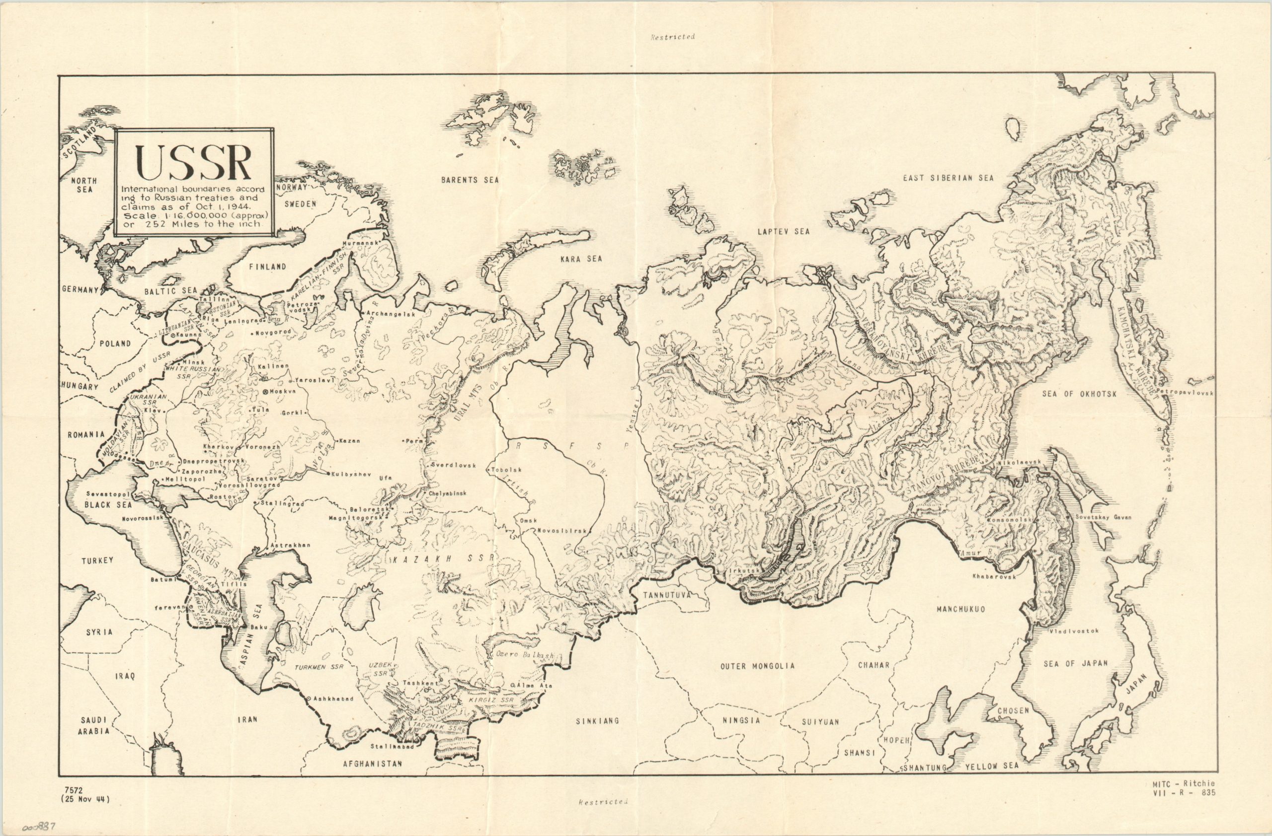
“Restricted” map of the Soviet Union reflecting ongoing negotiations about postwar borders.
Description
It’s evident that, even before the war, Stalin had his eyes on expanding Soviet territory to the east. A pact with Nazi Germany in 1939 split Poland between the two countries, but Hitler’s betrayal pushed the Red Army to the Allied cause. Even so, near the end of the war the Russian leader convinced Churchill and Roosevelt to recognize Soviet territory east of the 1939 borders. Negotiations on the exact specifics would continue through 1945.
This map identifies the international boundaries of the U.S.S.R. as of October 1, 1944 and shows the country’s topography and political organization. Numerous newly created socialist republics can be seen in the Caucasus region and Eastern Europe, along with a broad swath of territory marked as “Claimed by USSR.” The map is marked “Restricted” at the top and bottom. It was printed by the intelligence sector of VII Corps in November of 1944 at the Military Intelligence Training Center at Camp Ritchie, Maryland. The map is scarce, and I was unable to find a copy in either the LoC or OCLC databases.
Map Details
Publication Date: 1944
Author: VII Corps
Sheet Width (in): 16.00
Sheet Height (in): 10.50
Condition: B+
Condition Description: A few small tears in the margins, repaired on the verso, and minor wear along the fold lines.
$150.00