Universal Map of Outer Space
Colorful view of the solar system issued at the height of the Space Race.
Out of stock
Description
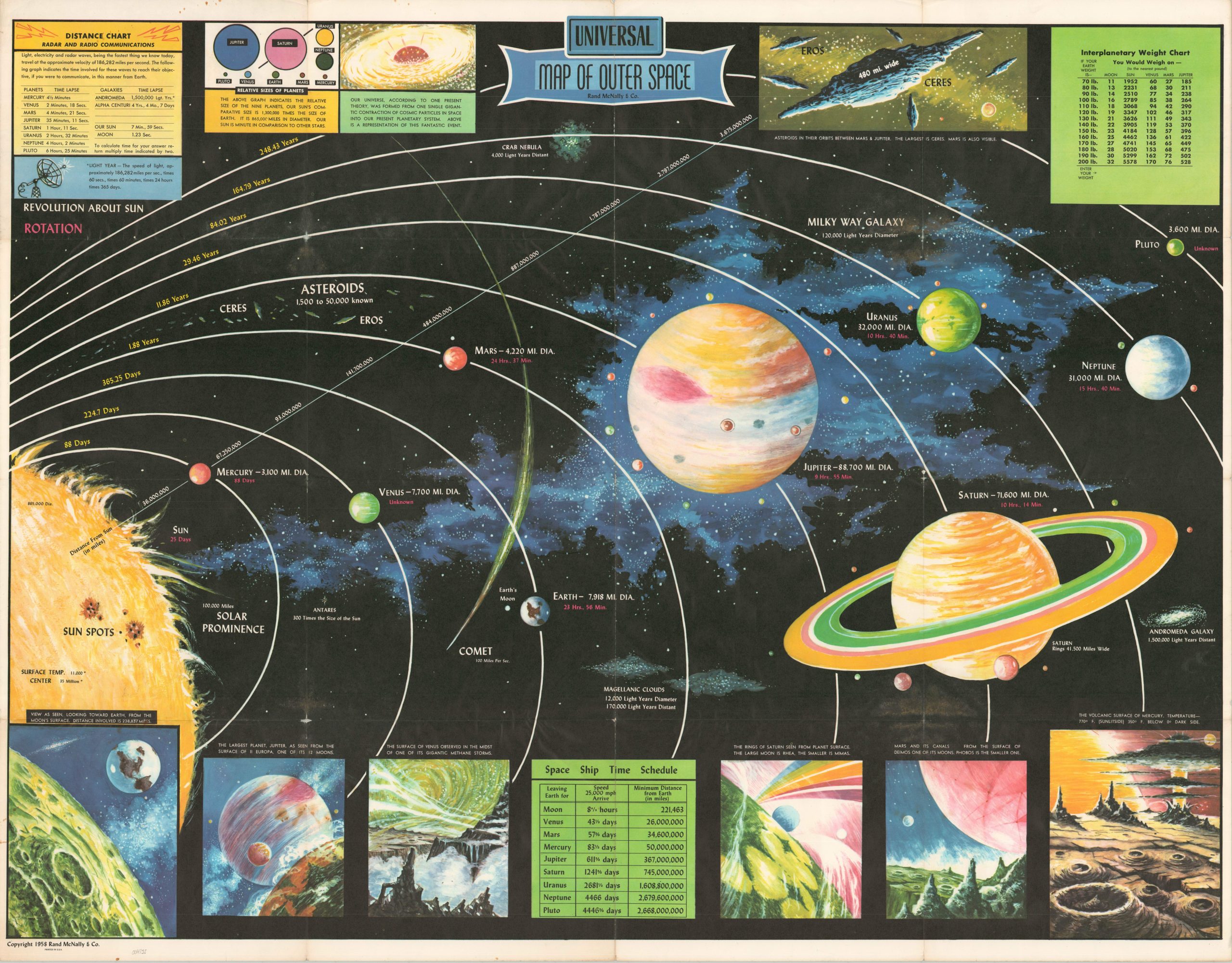
This vibrantly illustrated plan of the solar system was published in Chicago by Rand McNally in 1958, the year after the Soviet Union launched the first successful satellite into orbit. Public interest in outer space was immense (NASA was established the same year) and numerous commercial publishers rushed to issue fantastical representations of the latest advances and what the future may hold.
The primary diagram shows a representative outline of the nine planets (including Pluto) and their orbits around the Sun. Distances between each are provided in miles and each planet’s time of revolution is listed, when known (note Venus and Pluto). Diagrams and charts across the top of the page outline the speed of light and radio communications, the relative size of the planets, the Big Bang Theory, planetary weights, and the asteroid Ceres. Scenes on the bottom of the page give the impression of comic book panels, presenting largely speculative views from various points in the solar system.
Source: NASA;
Map Details
Publication Date: 1958
Author: Rand McNally
Sheet Width (in): 42
Sheet Height (in): 32.75
Condition: B+
Condition Description: Creasing and minor wear along old fold lines. Holes and small areas of separation (about 1" or less) visible at several of the fold intersections, a few resulting in very minor image loss. Several small tears around the outer edges of the sheet, confined to the margins. Good condition.
Out of stock