
United States of America Showing the Extent of Public Land Surveys
$95.00
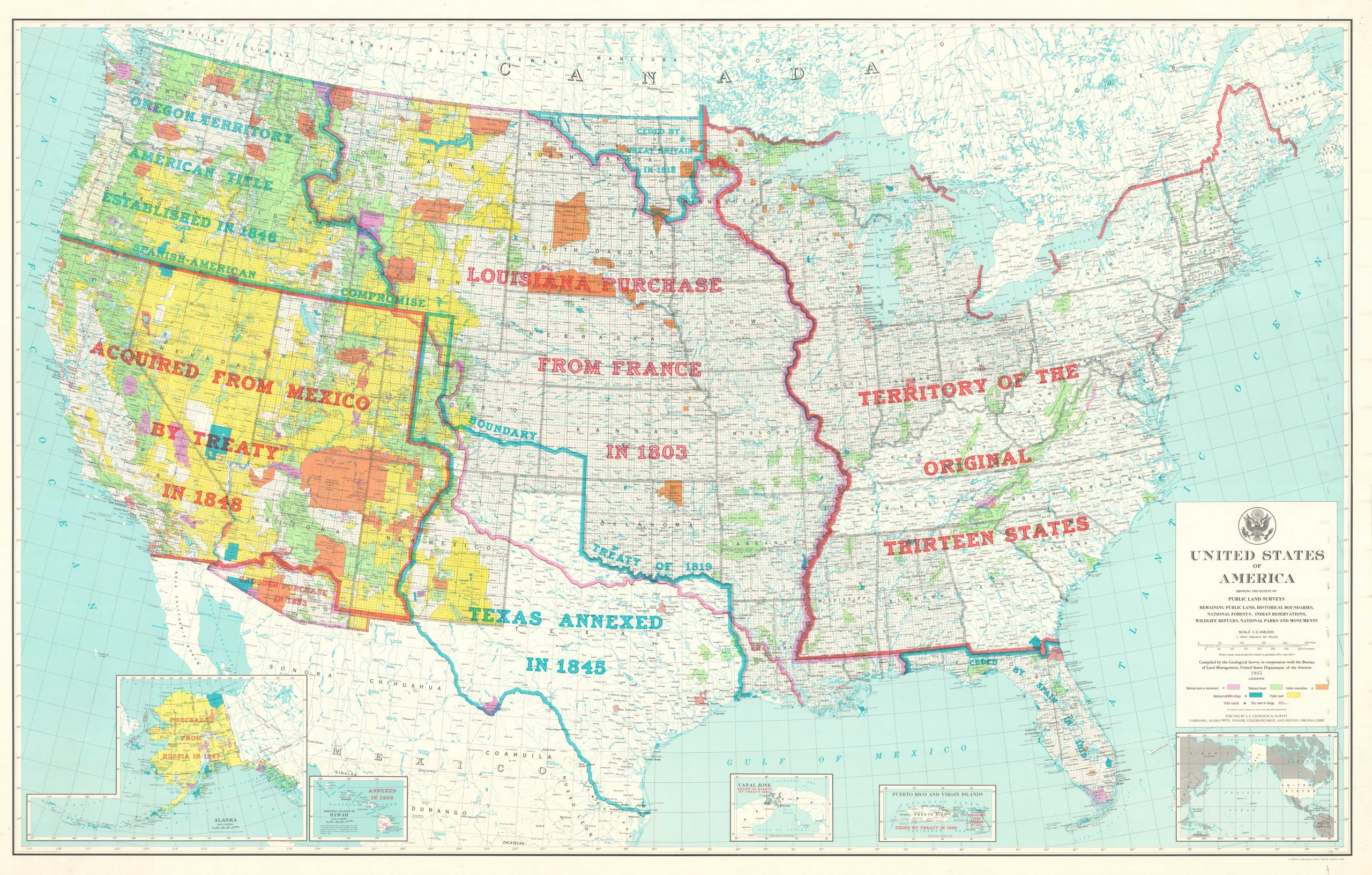
A 5 ft. wall map that literally defines America.
1 in stock
Description
This huge map of the United States was compiled by the United States Geological Survey in cooperation with the Bureau of Land Management and published in Reston, Virginia in 1974. its detailed image shows the progress by which the America came to be, from the territory of the original colonies to the acquisition of the Canal Zone and Hawaiian statehood. Those areas subject to the Public Land Survey System (PLSS), beginning with the Northwest Territory, are subdivided into an orderly grid. Bright splashes of color highlights the lands for National parks, forests and wildlife refuges, Native American reservations, and public use.
Map Details
Publication Date: 1978
Author: United States Geological Survey
Sheet Width (in): 41
Sheet Height (in): 64.5
Condition: A
Condition Description: Light wear from where previously rolled and stored. Very good to near fine condition overall.
$95.00
1 in stock