United States of America
Illustrated overview of the ‘Land of the Free’ and ‘Home of the Brave.’
Out of stock
Description
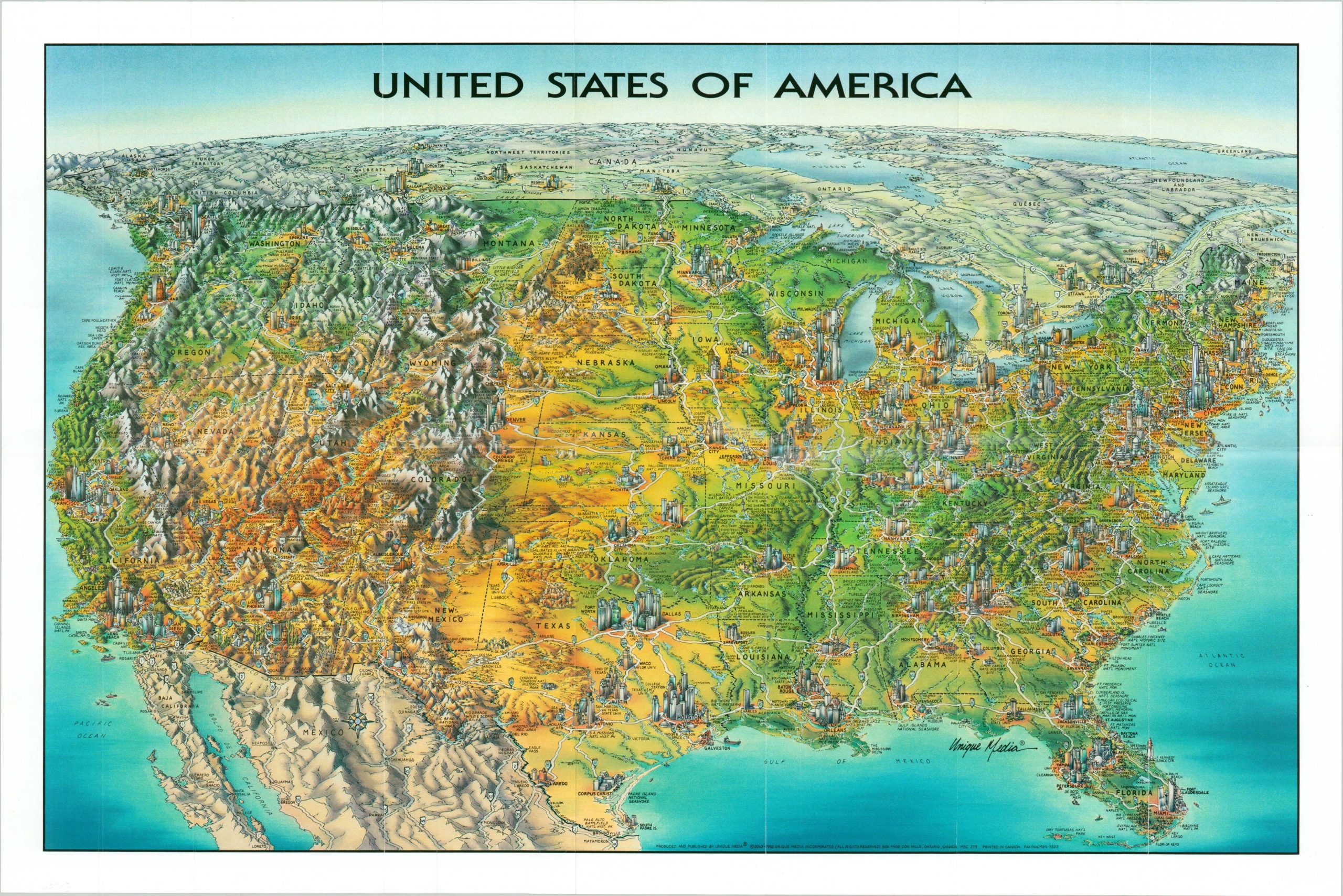
This charming cartoon map of the United States was published by Unique Media in 2015 and highlights the vast and diverse landscape across the country. Small, though surprisingly accurate, city skylines are nestled amid an exaggerated pictorial topography. Shades of green and brown emphasize the wide-ranging ecosystems that can be found between the coasts.
Many of America’s most iconic historic sites, natural landmarks, National Parks, and more are labeled across the image. A stylized Interstate system, dotted with signposts, is shown connecting the various locations. Similarly designed maps of Alaska and Hawaii can be found on the verso.
The distinctive cartoon style is a hallmark of the Ontario, Canada-based Unique Media, Inc. Starting in the late 1970s, the company created a number of maps with a similar aesthetic of locations across the United States and continues to do so to this day.
Map Details
Publication Date: 2015
Author: Unique Media
Sheet Width (in): 26.75
Sheet Height (in): 17.75
Condition: A
Condition Description: Near fine condition, with light creasing and faint wear along originally issued fold lines.
Out of stock