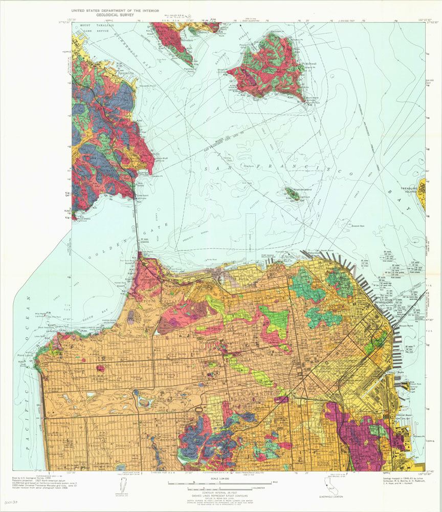
United States Geological Survey of San Francisco
$125.00
Colorful U.S. Geologic chart of San Francisco, Marin county and Angel Island.
Description
This unique perspective of the San Francisco area was published by the United States Geological Survey, and provides detailed scientific information regarding both land and water. Topographical contours with different color schema detailing rock types can be seen, and the various letters present throughout represent geologic age and formation name. For example, “Kg” represents Cretaceous granite. Sand (represented by light brown) dominates the makeup of the city – one reason why earthquakes pose such a threat.
Alongside the geologic information can be found basic details about the urban environment, such as principal buildings, streets, and recreation areas. In the waters of San Francisco Bay can be found additional contour lines of shoals and reefs, sounding depths, and ferry routes. The Transbay Tube is under construction and would not be completed until 1974.
Map Details
Publication Date: 1971
Author: U.S. Geologic Survey
Sheet Width (in): 22.25
Sheet Height (in): 26
Condition: A
Condition Description: The chart is in excellent condition, with one small hole at a fold intersection on the right side.
$125.00

