United States featuring Transcontinental Mileage and Driving Time
$40.00
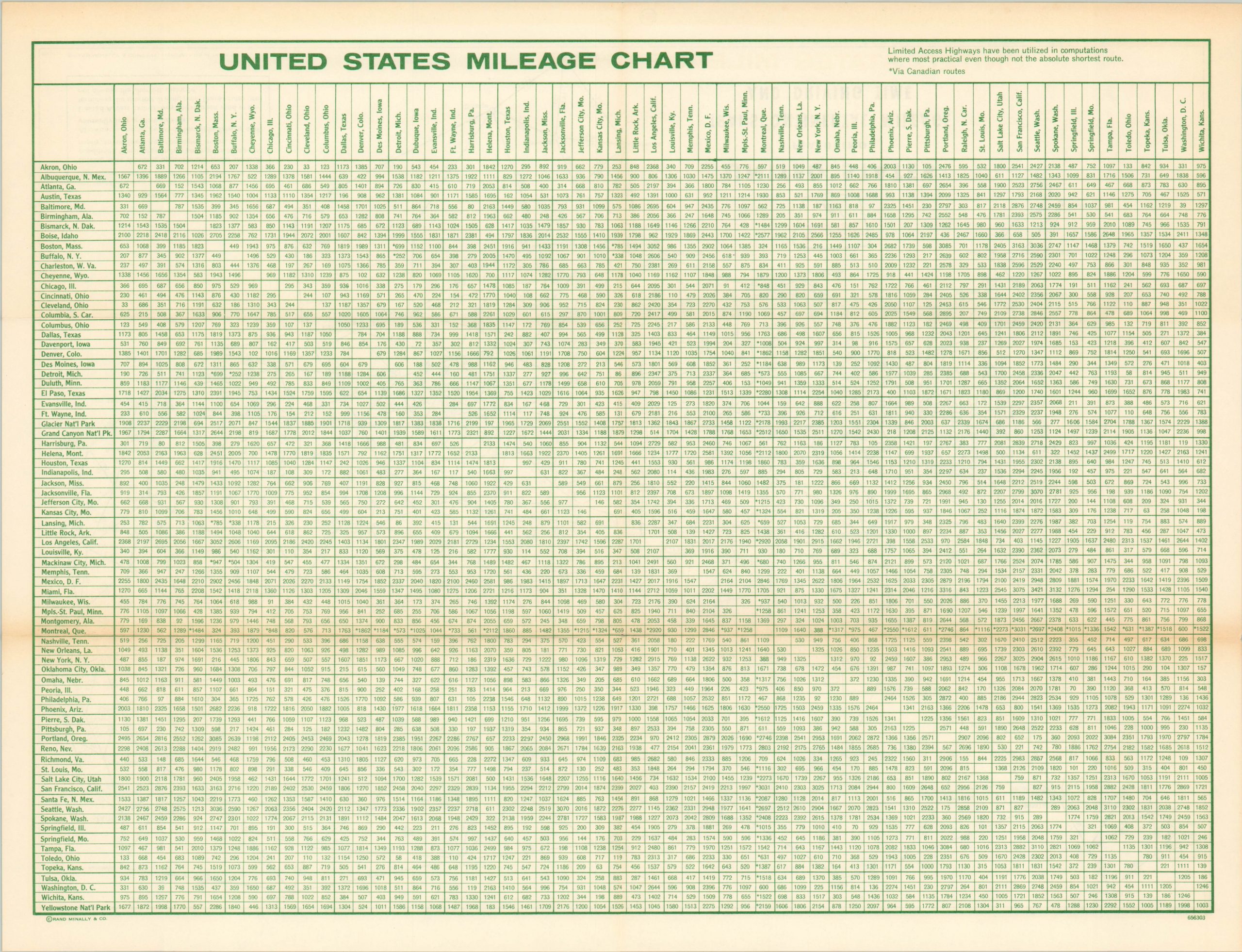
Point by point driving distances and times across the United States.
1 in stock

Description
This novel depiction of America was issued around 1965 by Rand McNally on behalf of Sinclair Oil. Seeking to provide an easy to comprehend trip-planning guide, the map provides the distance and driving times between hundreds of various destinations in the U.S., Mexico, and Canada.
Popular National Parks such as Yellowstone, Glacier, and the Grand Canyon are outlined, but otherwise the image is comprised almost entirely of straight lines, labeled cities, and corresponding times and distances. A detailed mileage chart on the verso provides further details on distance between notable points from Akron, Ohio to Wichita, Kansas.
Map Details
Publication Date: c. 1965
Author: Rand McNally
Sheet Width (in): 15.75
Sheet Height (in): 11.90
Condition: B+
Condition Description: Wear and faint discoloration along original fold lines, notably in the upper right.
$40.00
1 in stock