United States.
$150.00
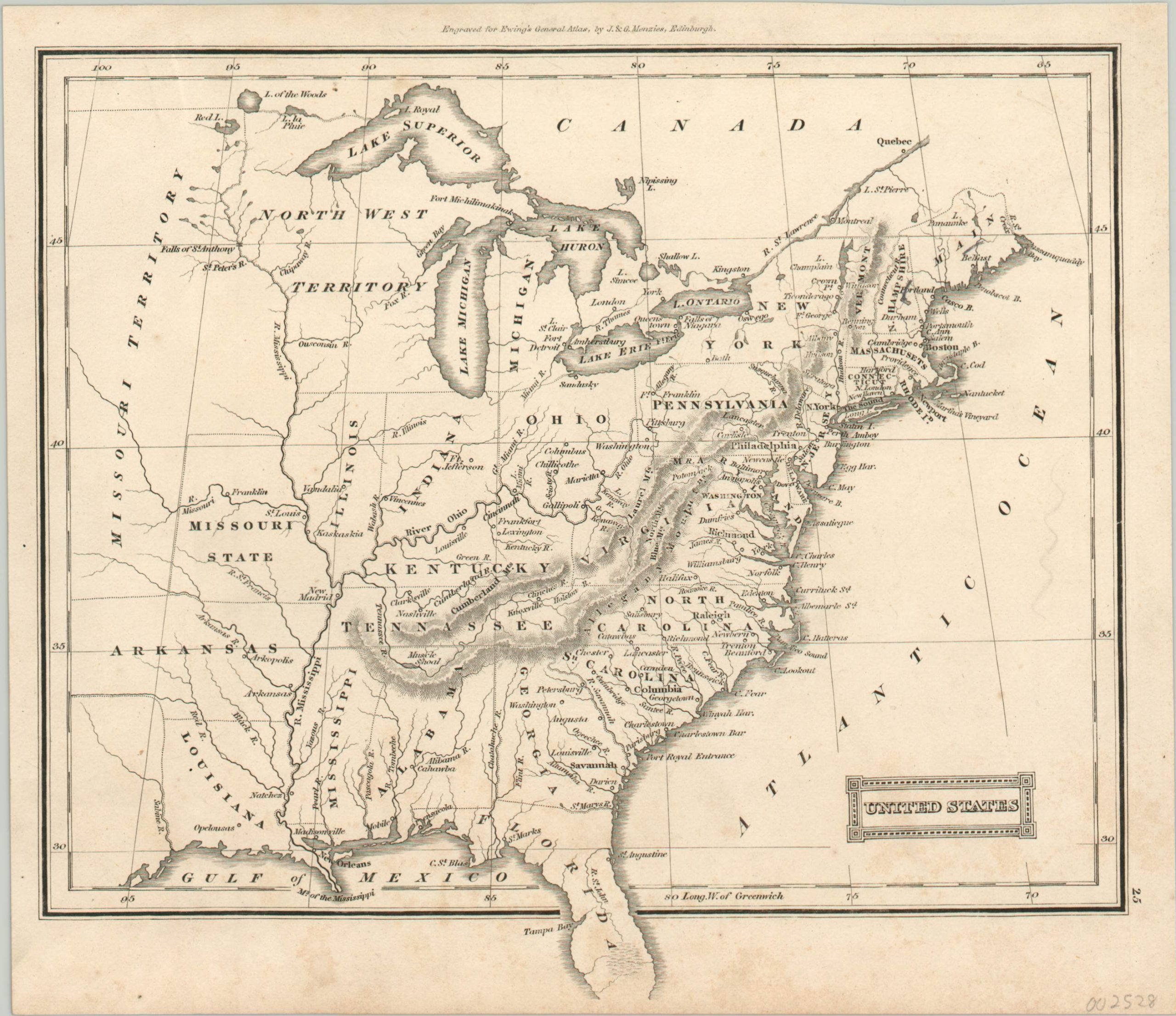
Small map of the United States showing a transitional period in territorial development.
1 in stock
Description
This quaint map of the early United States shows the piecemeal nature by which the states that comprised the Old Northwest Territory were gradually admitted to the Union. Even though the map was published nearly a decade after statehood, the borders of Indiana and Illinois are skewed and their neighbors all generally retain territorial status (with the exception of Ohio and Kentucky).
Major towns, forts, and geographic features are identified throughout the image (note Chicago’s absence – it wasn’t founded until 1833). It also includes a number of hard borders that were still widely disputed, such as those in northern Maine, the region around the Lake of the Woods, and the exact line between Arkansas Territory and Spanish Texas.
The map was engraved by J. & G. Menzies in Edinburgh for Ewing’s General Atlas. It was published in 1828 by Oliver & Boyd.
Map Details
Publication Date: 1828
Author: Oliver & Boyd
Sheet Width (in): 9.00
Sheet Height (in):
Condition: A-
Condition Description: Light scattered soiling in the lower right corner and along the bottom margin. Remains in very good condition.
$150.00
1 in stock

