[United States]
$150.00
The First Transcontinental Railroad you’ve never heard of, between Dubuque and Astoria.
1 in stock
Description
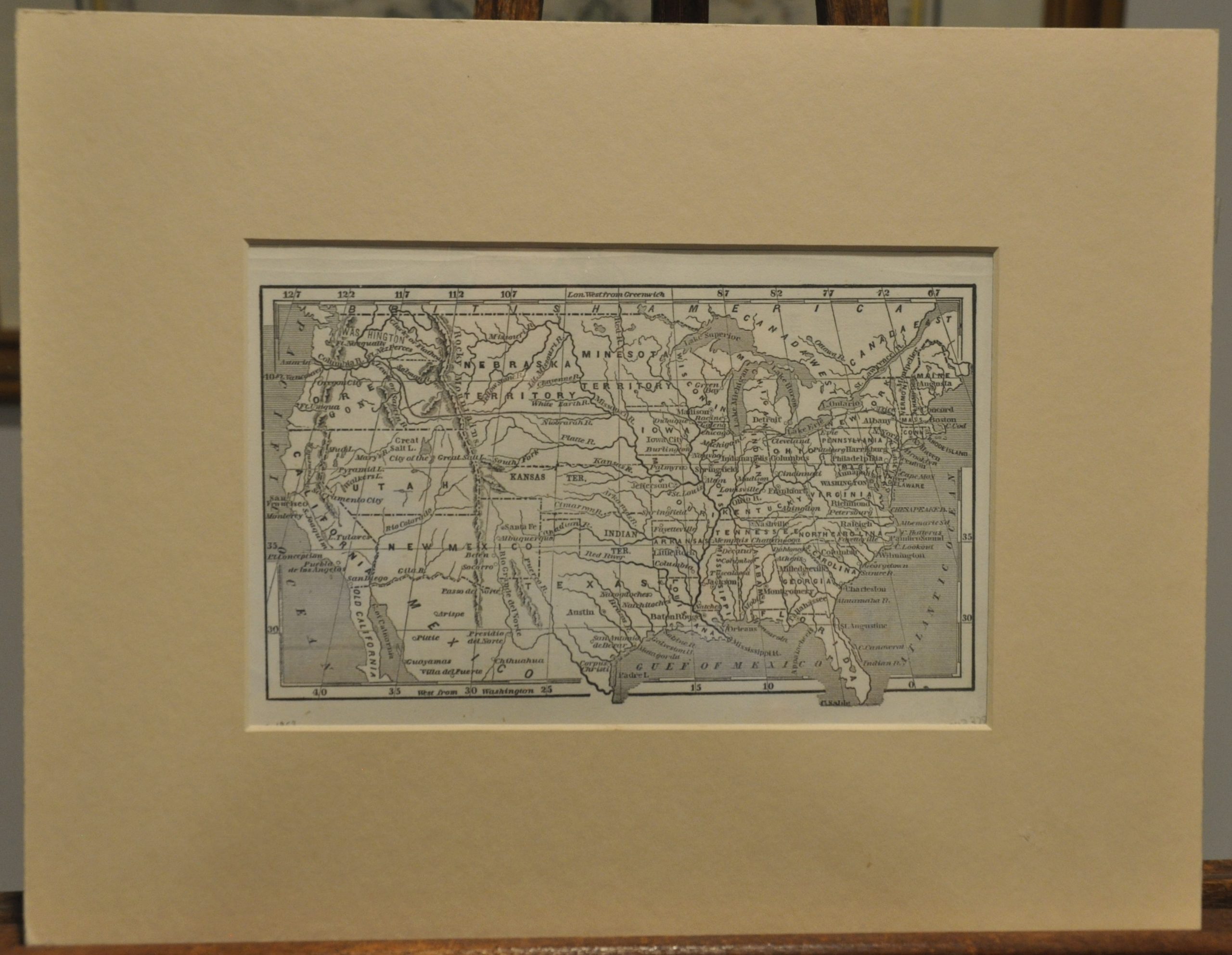
This woodblock map presents an incongruous depiction of the United States around 1854. The Kansas–Nebraska Act (1854) has passed, splitting a large portion of the former Missouri Territory into two new ones; ready for settlement and slavery, if the local residents decided as much. This effectively repealed the Missouri Compromise and precipitated the era of turmoil leading up to the Civil War known as ‘Bleeding Kansas.’ The Washington Territory (1853) is labeled, if haphazardly outlined, but the conditions of the Gadsden Purchase (1853) in New Mexico Territory have not yet materialized.
Also of note is the ambitious transcontinental railroad project depicted across the top of the sheet. It can be seen running in a nearly direct line between Astoria and Dubuque (almost as if drawn by Astor’s heirs), then on to Chicago and Boston. Though the Pacific Railroad surveys were well underway by this time, this route is nowhere close to following the northern proposal (surveyed largely by Captain George B. McClellan). Possibly indicative of contemporary excitement about the admission of the Washington Territory?
The simple design, interesting place names (Old California, City of the Great Salt Lake), and large western territorial configurations all provide great appeal. Created anonymously, but text on the verso likely indicates it was issued in a geography book.
Map Details
Publication Date: c. 1854
Author: Anonymous
Sheet Width (in): 8.75
Sheet Height (in): 5.40
Condition: A-
Condition Description: Light discoloration around the outer edges of the sheet and faint scattered spotting in the lower margin, but in near fine condition overall.
$150.00
1 in stock


