United States
$250.00
An interesting overview of a rapidly expanding America in the early 19th century.
1 in stock
Description
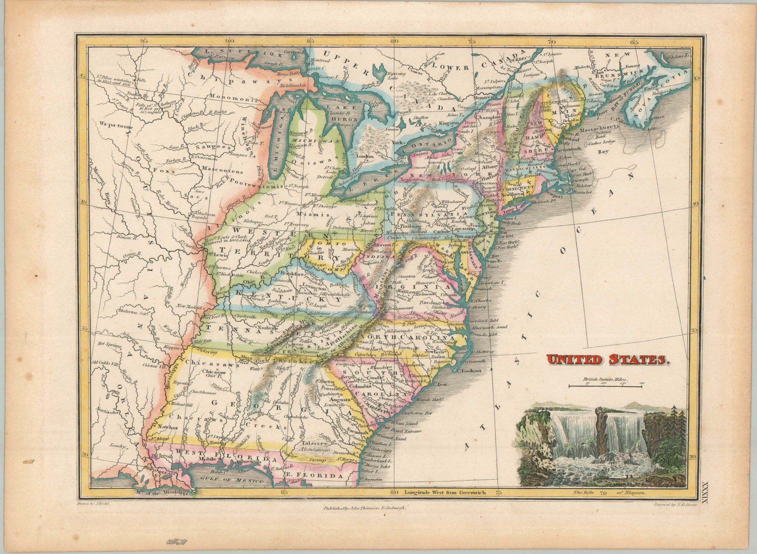
This beautiful antique map captures the growing United States at a pivotal period in the first two decades of the 19th century. In large numbers, settlers were moving across the Appalachian Mountains, which offer an imposing physical barrier between the Atlantic seaboard and the interior. Unusual borders include the Northwest Territory, Ohio Company Lands, a strange outline of Indiana, and the proposed state of Franklinia. Beyond the boundary of the Mighty Mississippi lay the mostly unsettled and unexplored American West. Only a handful of frontier fortifications and settlements are labeled amid the numerous Native American tribes.
The map was drawn by talented British cartographer James Wyld and engraved by N.R. Hewitt. Published in Edinburgh around 1820 by John Thompson and originally issued as Plate XXXIX in his influential General Atlas. An attractive vignette in the lower right captures the Niagara Falls, one of the country’s most iconic natural features (then and now).
Map Details
Publication Date: c. 1820
Author: James Wyld
Sheet Width (in): 13.80
Sheet Height (in): 10.20
Condition: A-
Condition Description: Attractive hand colored map on a single-sided sheet, moderately toned and lightly spotted in the margins. A few faint spots within the image. Very good condition overall.
$250.00
1 in stock