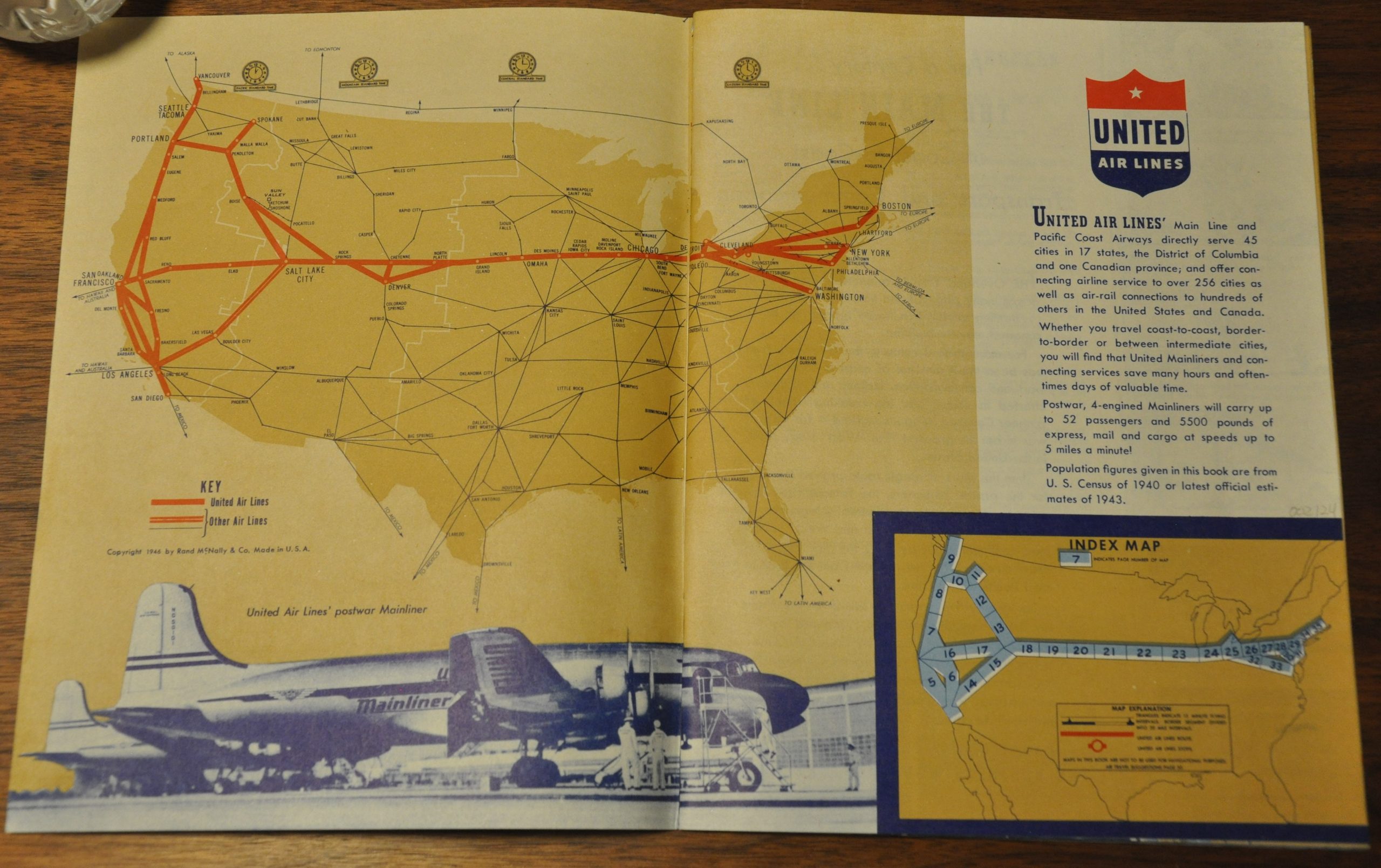
United Air Lines Maps of the Main Line Airway
Postwar flight atlas of the United Air Lines routes in operation across the United States.
Out of stock


Description
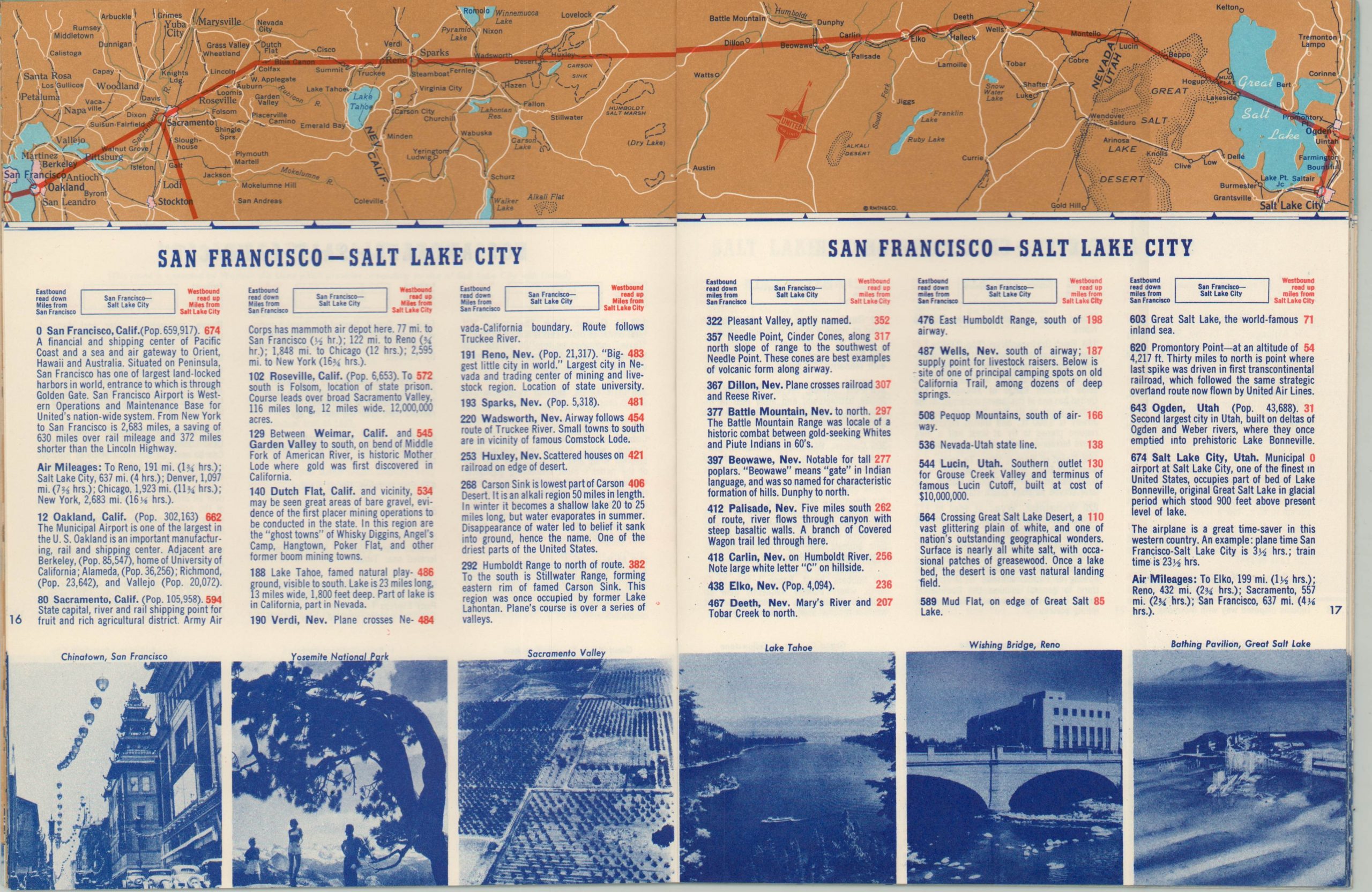
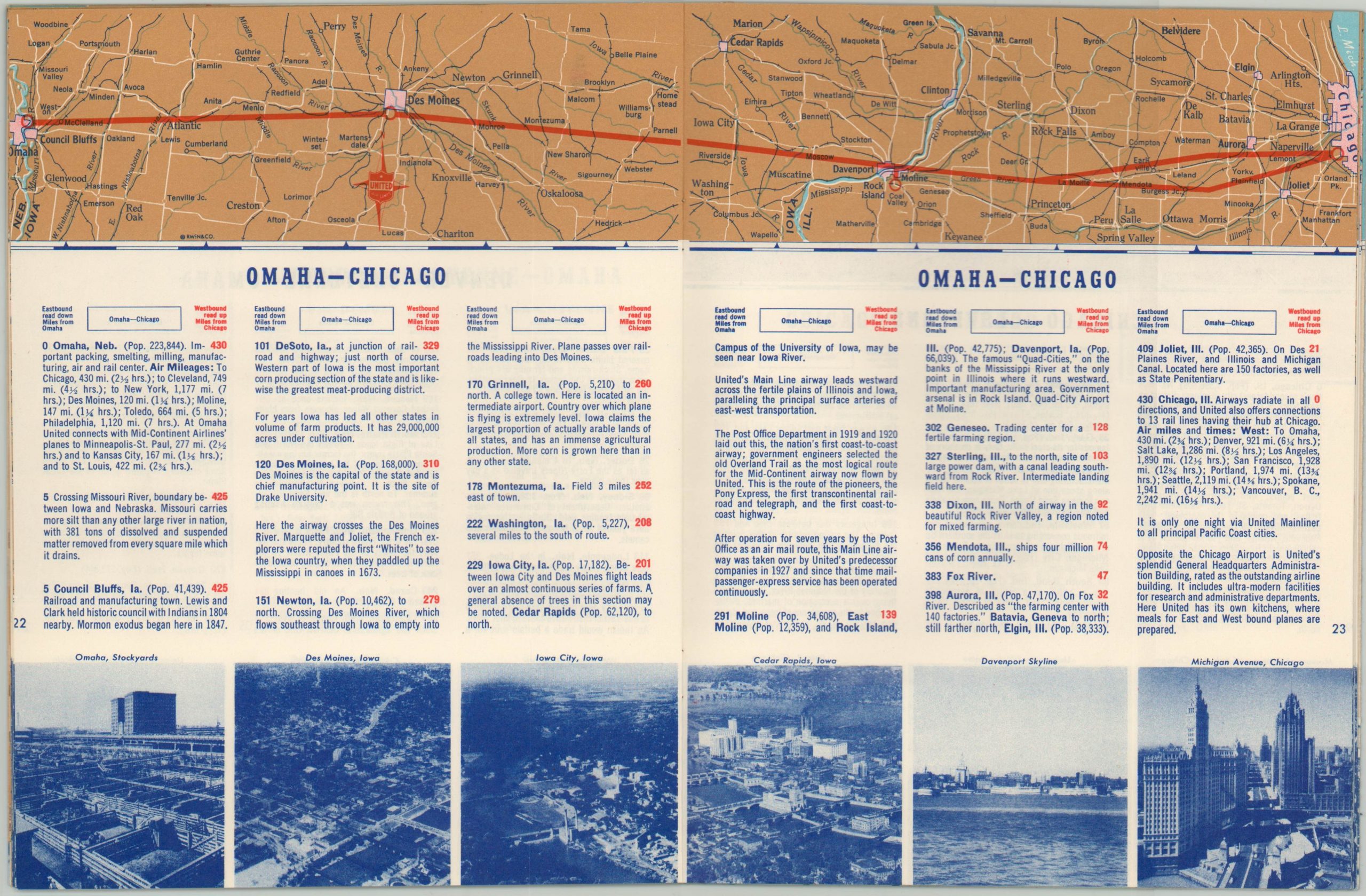
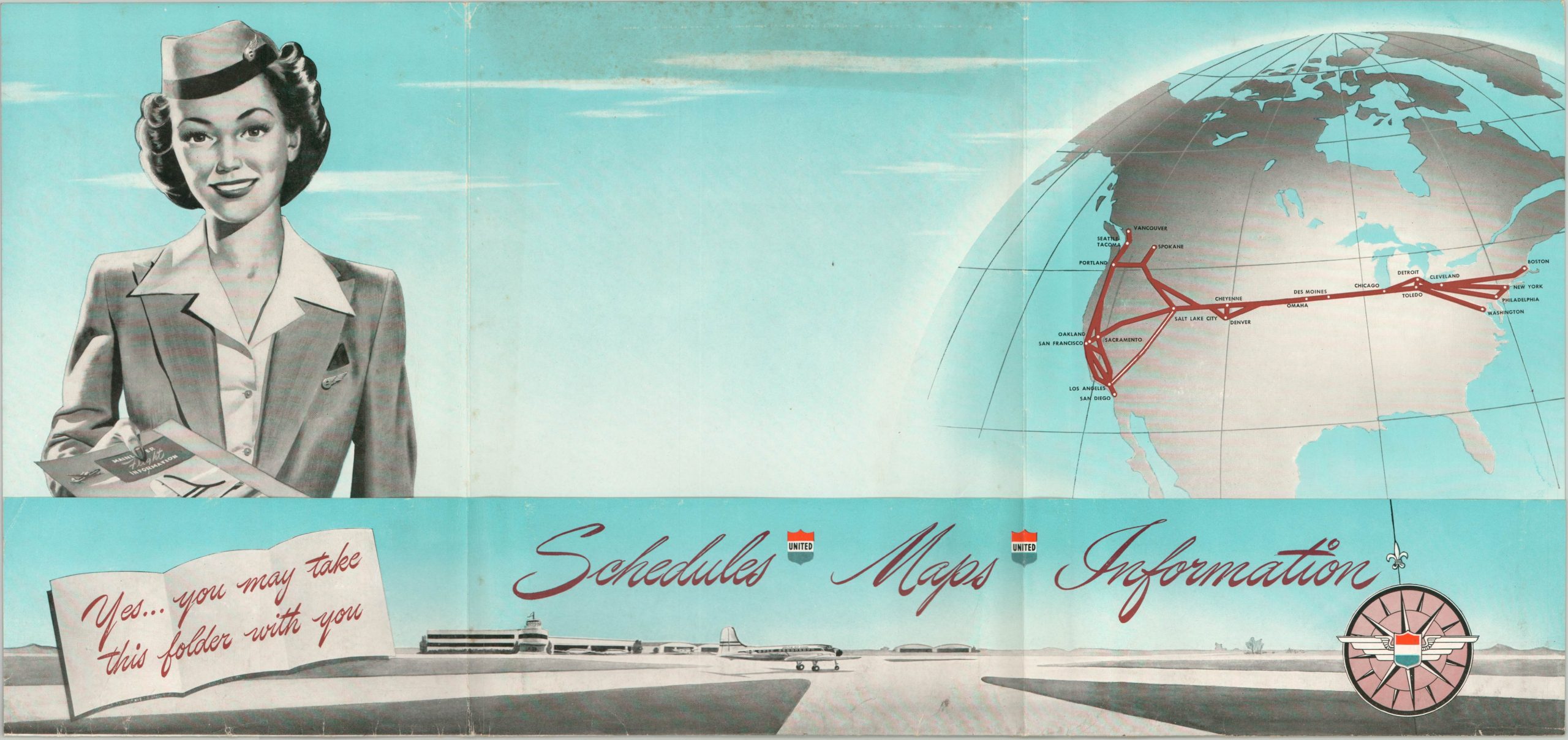
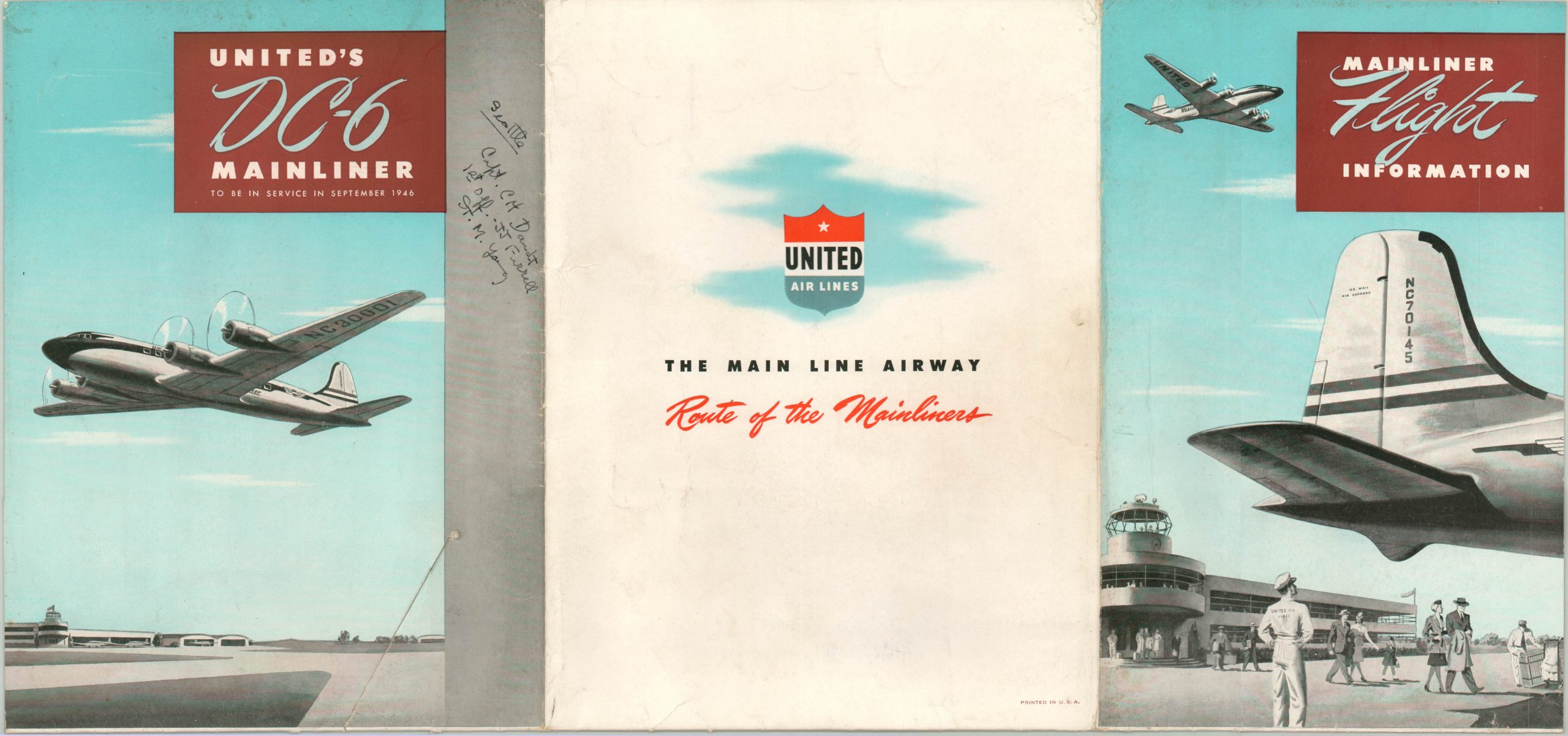
This fascinating atlas captures a snapshot of early domestic flight travel in the United States. An index of the contents is followed by a brief introduction comparing the east/west primary route to the century-old Overland Trail. Each subsequent page details a different flight path taken by the four engine ‘Mainline’ aircraft of United Air Lines, with an accompanying itinerary, photographs, and list of notable attractions.
Due to fuel constraints and multi-purpose planes (i.e. freight and passenger), frequent stops were significantly more commonplace in air travel than they are today. Includes the original pictorial flight folder, which presents a slightly different map and advertisement for the soon-to-be-released DC-6 airplane.
Map Details
Publication Date: 1946
Author: Rand McNally
Sheet Width (in): See Description
Sheet Height (in): See Description
Condition: A
Condition Description: 36 pp. flight atlas measuring approximately 7" x 9" with stapled binding. Very good condition, and includes original flight folder (slightly worn, 8" x 10.75", tri-fold) with contemporary manuscript flight information.
Out of stock