Understanding Maps and Scale
$95.00
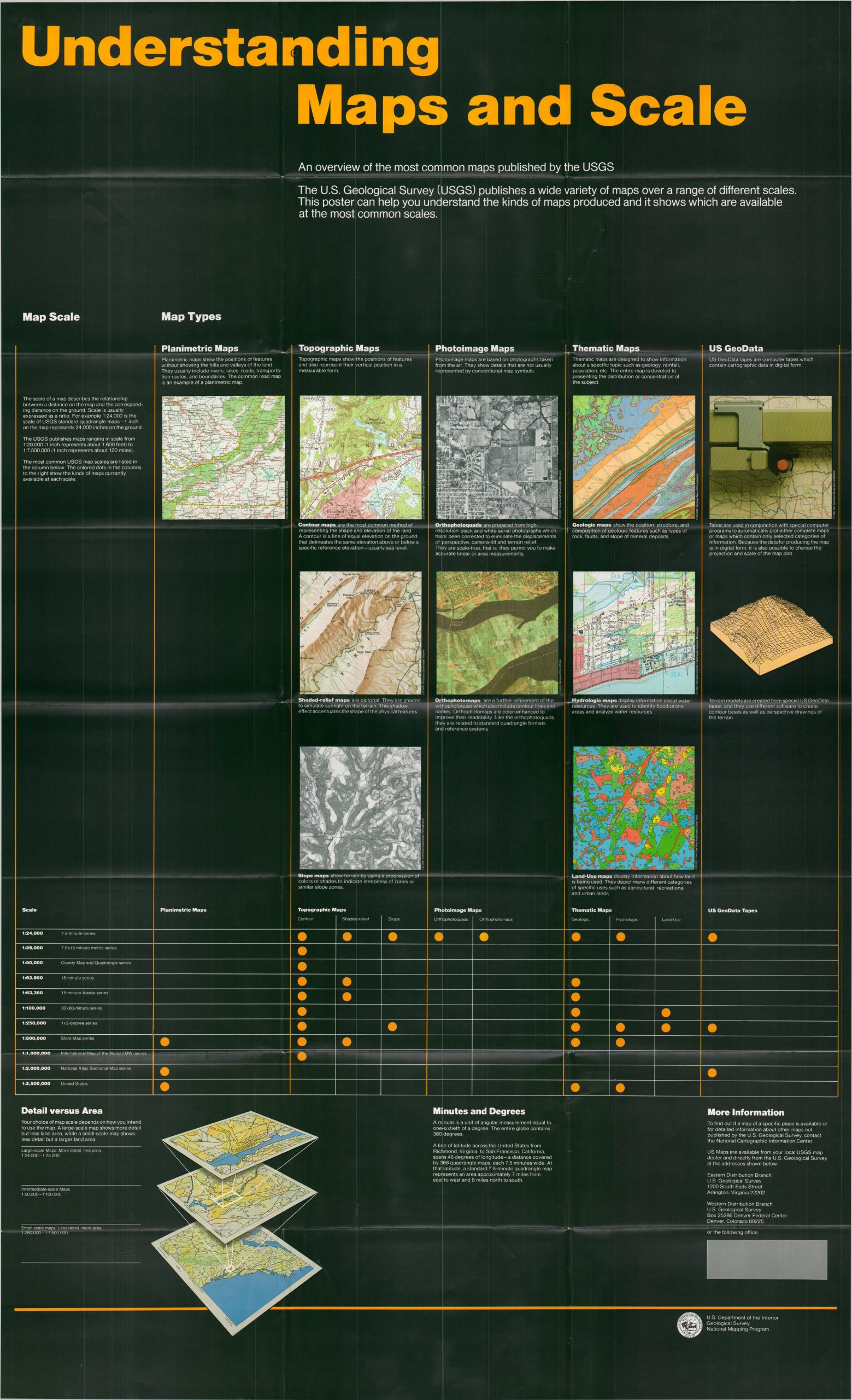
An overview of the most common maps published by the USGS.
1 in stock
Description
This helpful visual cross-reference outlines the different types of maps issued by the United States Geological Survey. Various scales and types are listed, with features for each explained via captioned images.
Map Details
Publication Date: c. 1990
Author: United States Geological Survey
Sheet Width (in): 33.00
Sheet Height (in): 54.25
Condition: A
Condition Description: Large single-sided sheet, creased along old folds but otherwise in near fine condition.
$95.00
1 in stock