
Ukrania quae et Terra Cosaccorum…
$2,000.00
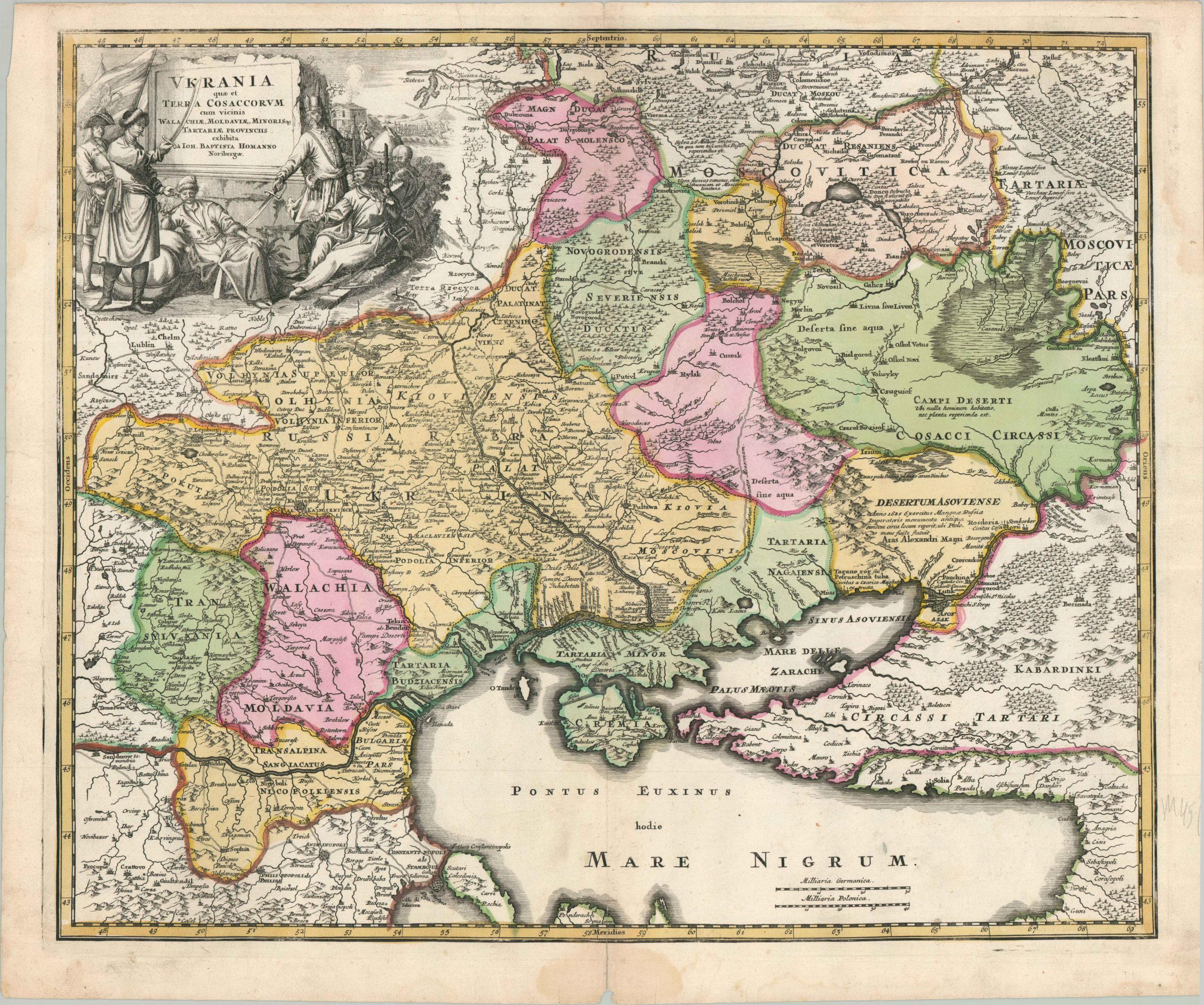
An uncommon early 18th century map of Ukraine.
1 in stock
Description
This significant early 18th-century map, published in Nuremberg by the celebrated cartographer Johann Baptist Homann, provides a detailed geographic and political overview of Ukraine and its surrounding territories. Titled Ukrania quae et Terra Cosaccorum (‘Ukraine, which is also the Land of the Cossacks’), the map was issued during the Great Northern War – a period of immense upheaval that saw the region transformed into a critical theater of conflict between the Swedish Empire, the Tsardom of Russia, and the Ottoman Turks.
The engraving, enhanced by bright hand-coloring, identifies a fascinating variety of kingdoms, fortified settlements, and geographic features. The Dnieper River serves as the central axis, with towns crowded along its banks as it flows toward the Black Sea north of the Crimean Peninsula. Marshes, mountains, and forests – all vital barriers to trade and military maneuvers – are rendered pictorially in Homann’s stylized German fashion.
The map is anchored by one of Homann’s most striking and famous decorative cartouches. It depicts a group of Cossack soldiers lounging with sabres, bows, and muskets (one even shown smoking a pipe) while disciplined troops march in the background. The diverse array of headwear and clothing provides a rare, contemporary European glimpse into the unique military culture and composition of the Cossack hosts.
Map Details
Publication Date: c. 1720
Author: Johann Baptist Homann
Sheet Width (in): 24.8
Sheet Height (in): 20.7
Condition: B+
Condition Description: Copperplate engraved image on a sheet of watermarked paper with full old hand color. Faint wear along vertical centerfold. Dampstain in the lower center, mostly confined to the margin, and moderate discoloration and wear elsewhere along the outer edges of the sheet. A few spots of surface soiling visible in the Black Sea. Very good overall.
$2,000.00
1 in stock