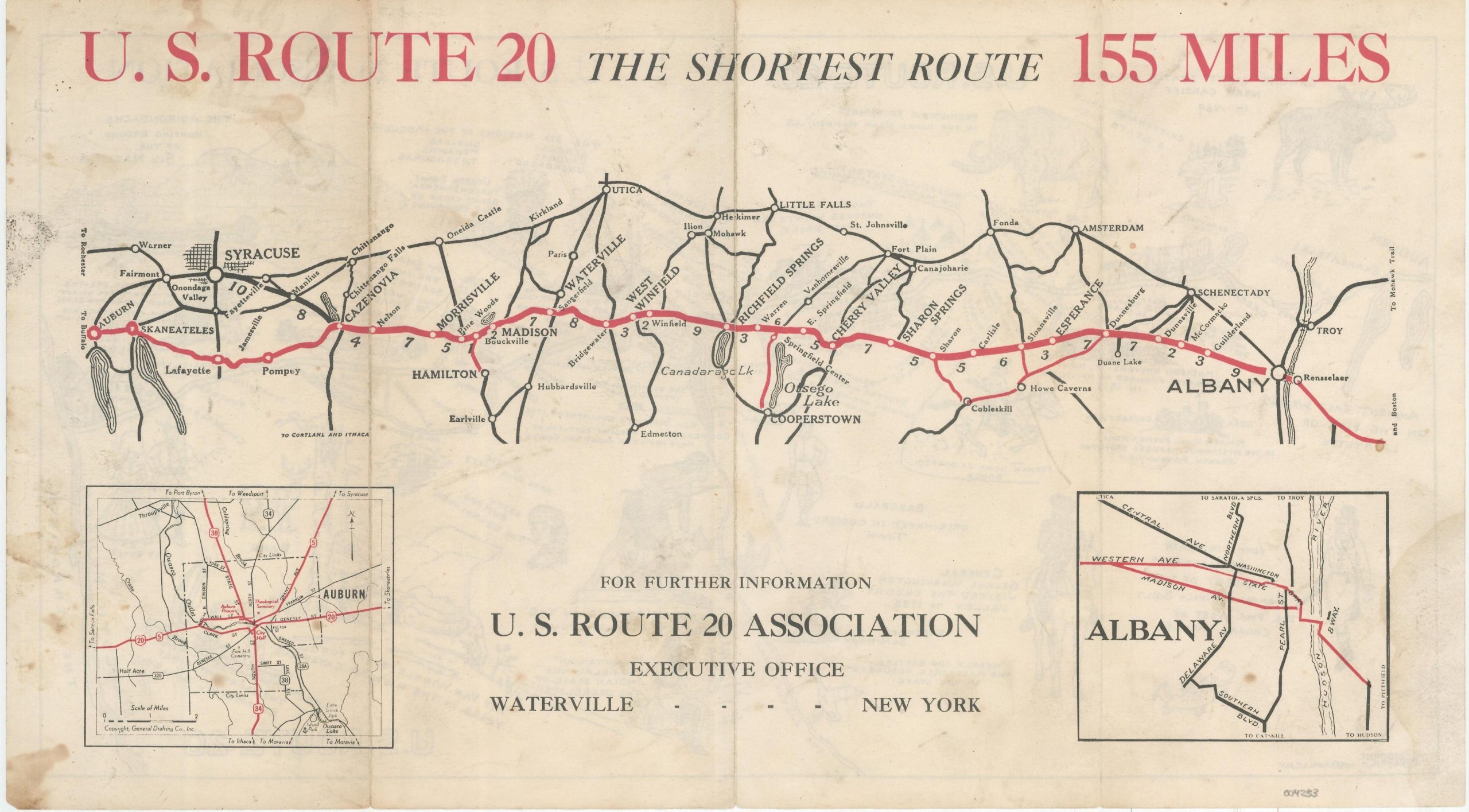
U.S. Route 20 The Shortest Route 155 Miles
U.S. Route 20 – Today’s New York State Scenic Byway
Out of stock
Description
This interesting double-sided road map was published by the U.S. Route 20 Association of Waterville, New York to promote the motor route between Albany and Auburn, near Syracuse.
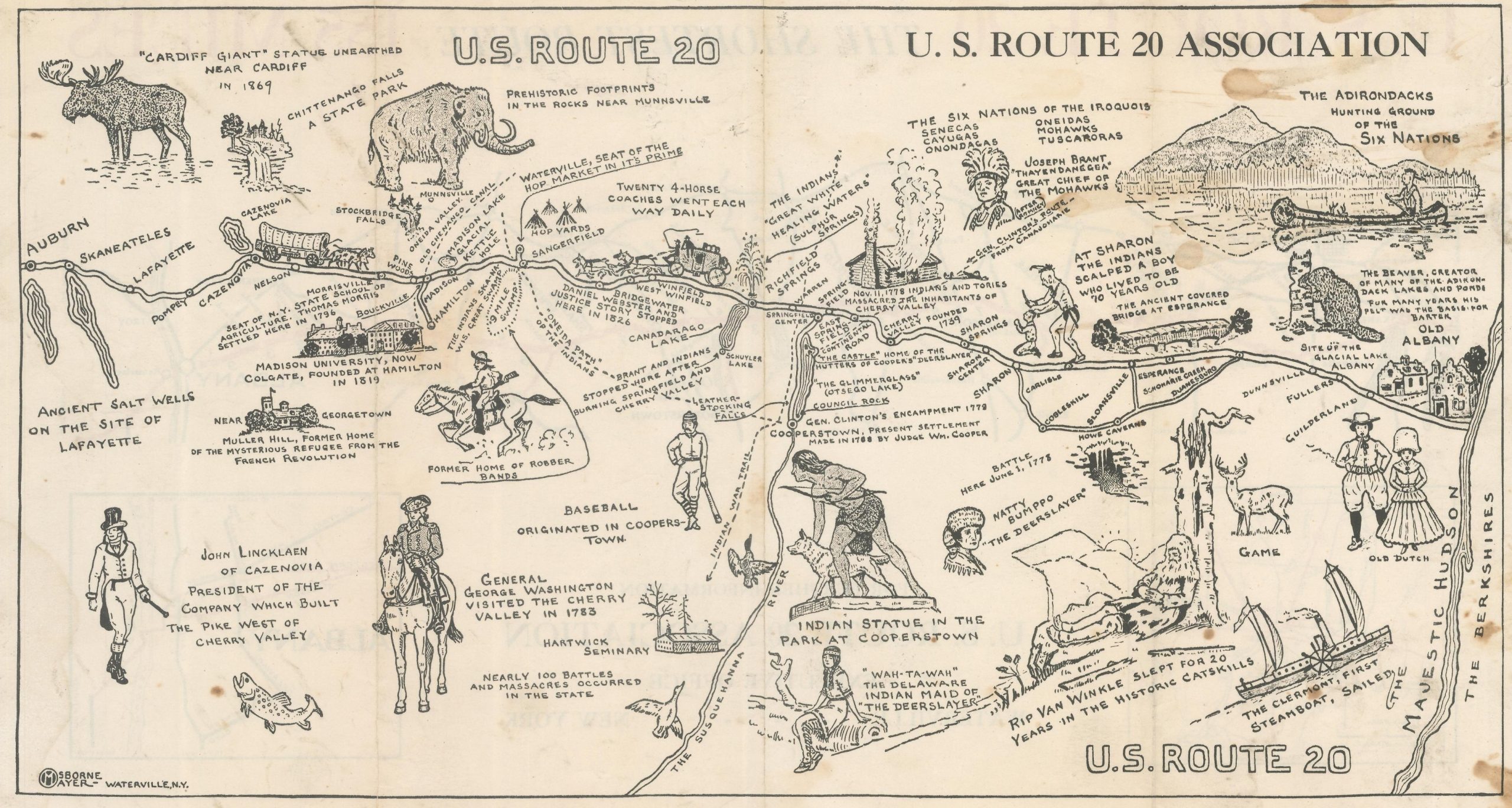
Maps created by the General Drafting Company highlight the highway in red, with distances between points noted and insets in the lower corners showing city plans of each endpoint. The verso presents a pictorial map designed by Osborne Mayer (also of Waterville) that highlights the deep history of the region.
Map Details
Publication Date: c. 1930
Author: Osborne Mayer and General Drafting Company
Sheet Width (in): 15.9
Sheet Height (in): 8.8
Condition: B-
Condition Description: Heavy soiling visible throughout, most evident on the left side of the map. Creasing along fold lines and small edge tears. Fair condition overall.
Out of stock