[U.S. Highway 1 Strip Map]
$75.00
Uncle Sam’s First Choice!
1 in stock
![[U.S. Highway 1 Strip Map] - Image 2](https://curtiswrightmaps.com/wp-content/uploads/map_3.38x22.16_08-19-25_inv007437c-scaled.jpg)
![[U.S. Highway 1 Strip Map] - Image 3](https://curtiswrightmaps.com/wp-content/uploads/map_3.37x22.15_08-19-25_inv007437c-scaled.jpg)
Description
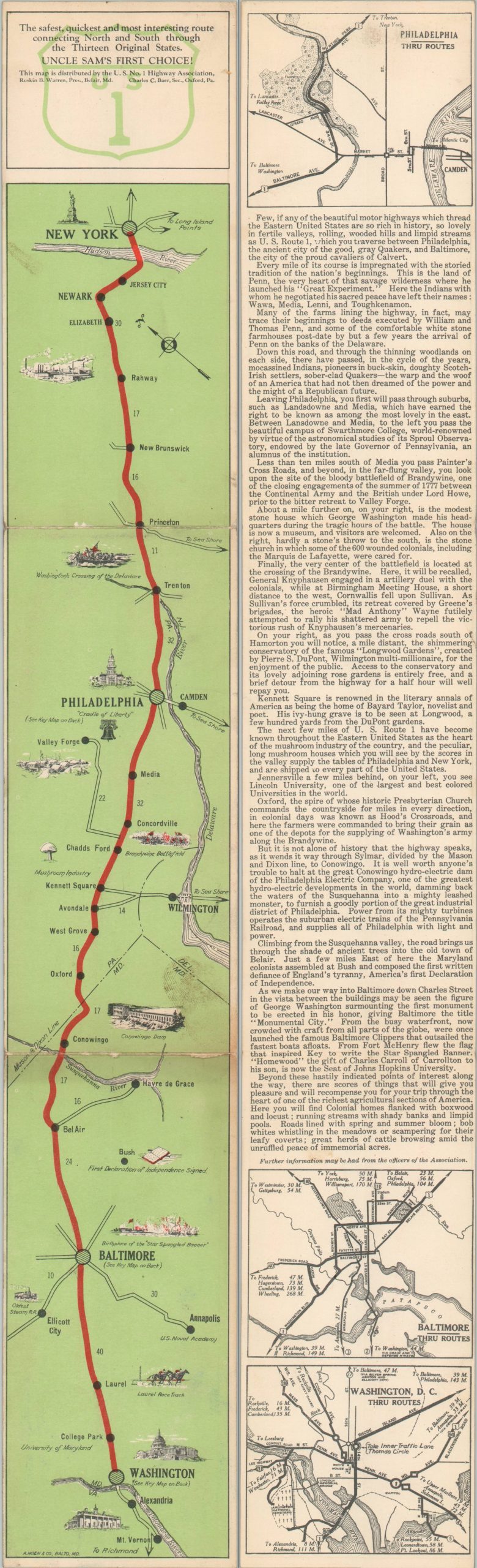
“The safest, quickest, and most interesting route connecting North and South through the Thirteen Original States” – Top.
This fun little strip map folds into a convenient glove box size and shows the route of U.S. Highway 1 between New York (top) and Washington, D.C. (bottom). Distances between points are noted and small vignettes highlight many of the local landmarks, historic sites, and notable industries. Descriptive text and street plans of Philadelphia, Baltimore, and D.C. are provided on the verso.
The map was published in Baltimore around 1930 by the firm of August Hoen & Co. Issued by the U.S. No. 1 Highway Association and dated based on the presence of the Conowingo Dam (completed in 1928).
Map Details
Publication Date: c. 1930
Author: A. Hoen & Co.
Sheet Width (in): 22
Sheet Height (in): 3.25
Condition: B+
Condition Description: Long strip map, folded twice. Light soiling (a dirty thumbprint) in the lower right, near a moderately toned crease. A bit of other light wear and spotting. Good condition overall.
$75.00
1 in stock