U.S. 80 San Diego to Savannah via Vicksburg Mississippi
$60.00
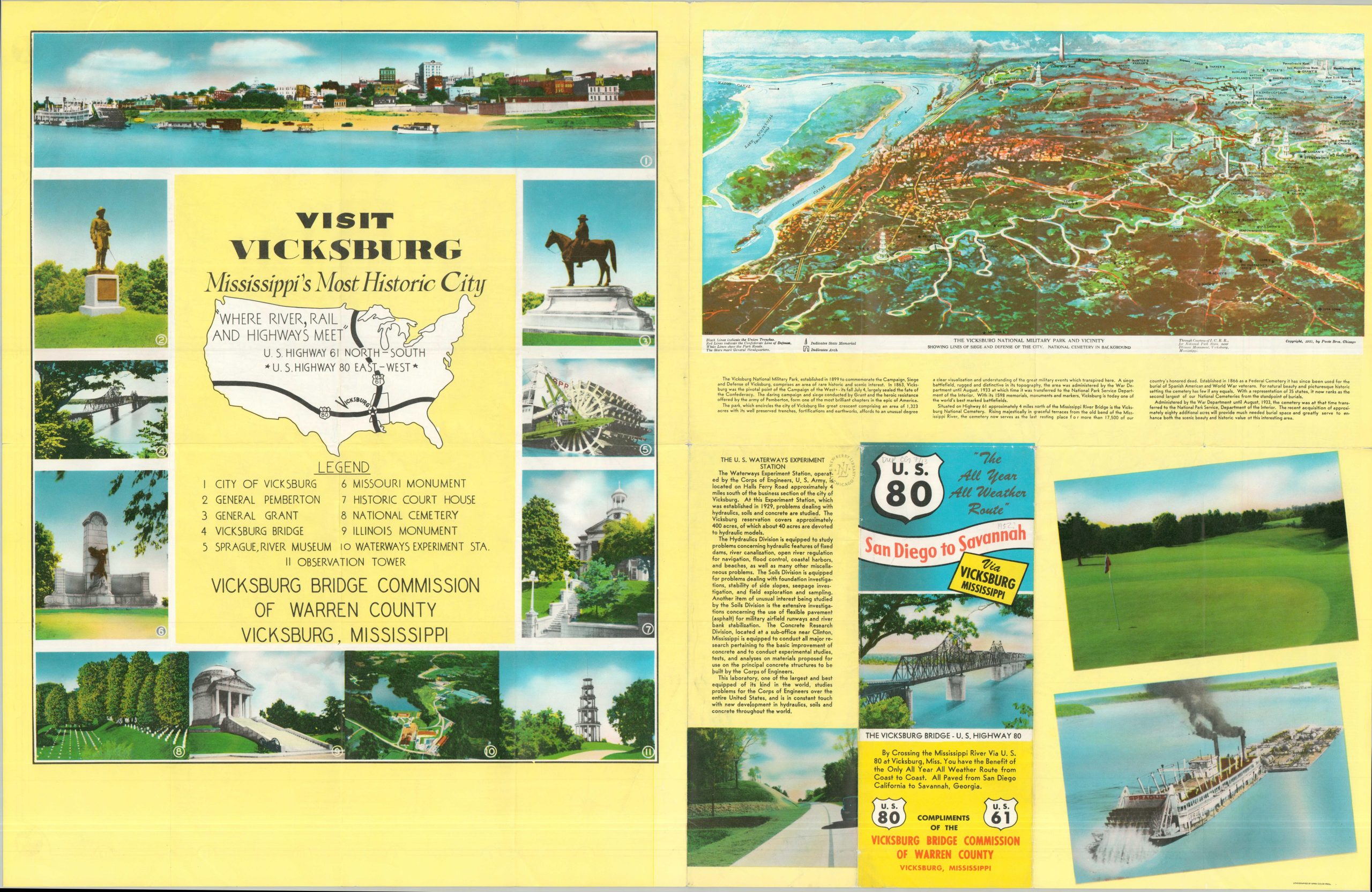
Visit Vicksburg, Mississippi’s Most Historic City, “Where River, Rail and Highways Meet”
1 in stock
Description
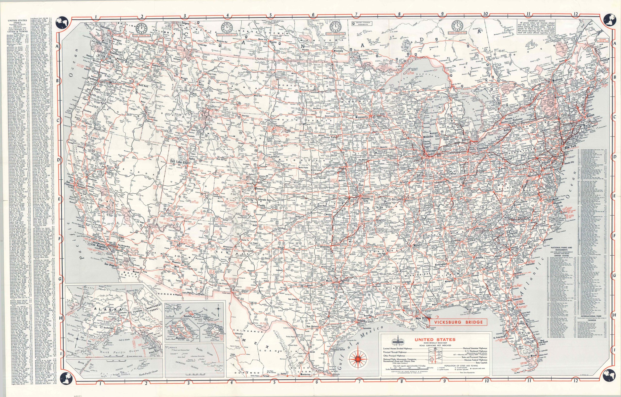
This detailed 1962 road map of the United States highlights the strategic position of the Vicksburg Bridge, carrying U.S. Highway 80 across the Mississippi River. The growing network of U.S. Interstate Highways is emphasized throughout, and a comprehensive index of National Parks and Monuments is provided in the lower right. The verso is a bit more lively, with an illustrated view of Vicksburg National Military Park and a colorful promotion encouraging the reader to visit Vicksburg.
The map was designed by Rand McNally & Company and distributed compliments of the Vicksburg Bridge Commission of Warren County. Lithographed by MWM Color Press. The view, by Poole Brothers, has a copyright date of 1925!
Map Details
Publication Date: c. 1975
Author: Rand McNally
Sheet Width (in): 33.25
Sheet Height (in): 21.75
Condition: B+
Condition Description: Double-sided map brochure with creasing and wrinkling along folds and light wear along the outer edges. Creased corners and ex-libris rubberstamp on the verso. Very good condition overall.
$60.00
1 in stock