
Typus Orbis Terrarum
$395.00
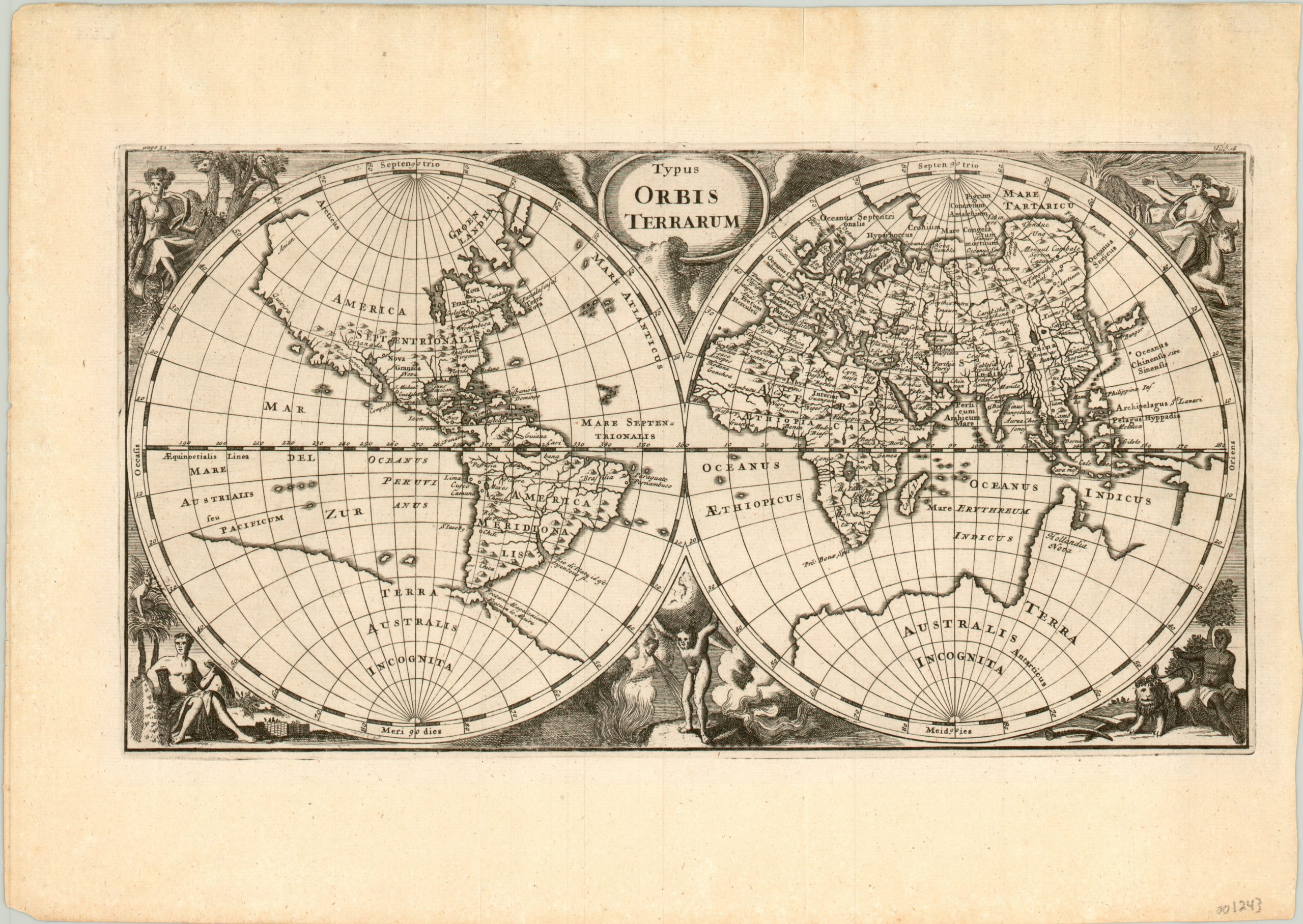
Charming double hemisphere world map from the early 18th century.
1 in stock
Description
This attractive world map captures many of the 17th and 18th centuries’ most persistent cartographic myths.
An enormous southern continent, Terra Australis Incognita, is shown and was suspected to exist as a counterbalance to the landmass of the Northern Hemisphere. Lake Parime in South America, the Mountains of the Moon in South Africa, an east/west oriented Japan, and an extended northwestern coast of America (featuring both Anian and Quivira) are also shown, among others.
Allegorical female figures in each corner represent the four inhabited continents while Atlas can be seen holding aloft the globe in the middle.
The map was published in a London edition of Philipp Cluver’s Introductio in Universam Geographicam in 1711. The atlas was first issued in the early 1640’s and was reproduced in over 40 editions during a century of publication.
Map Details
Publication Date: 1711
Author: Philipp Cluver
Sheet Width (in): 13.30
Sheet Height (in): 9.50
Condition: A
Condition Description: A few wrinkles in the margins, but otherwise in fine condition. A bold, crisp impression on a clean sheet.
$395.00
1 in stock