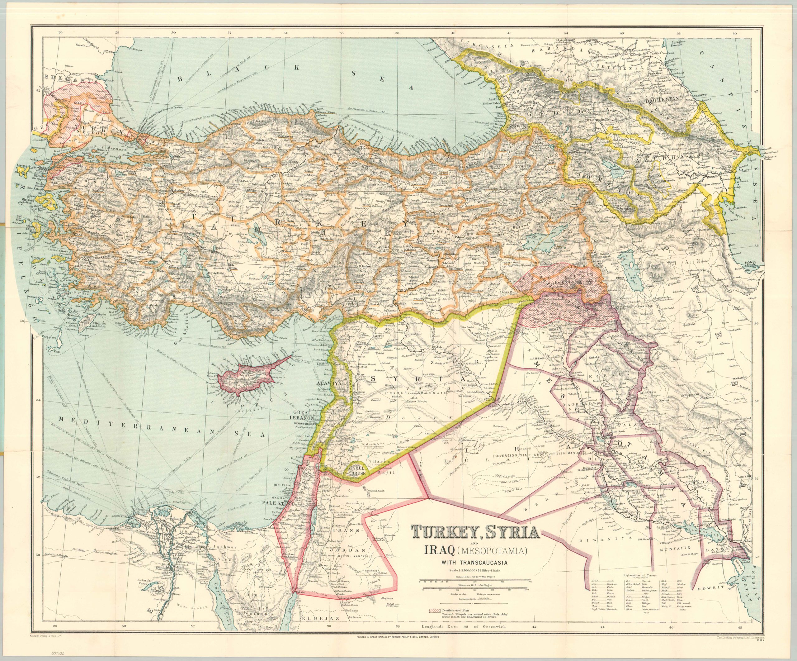
Turkey, Syria, and Iraq (Mesopotamia) with Transcaucasia
A reoriented Middle East after the Treaty of Ankara.
Out of stock

Description
This incredibly detailed map of the Middle East was published around 1926 by George Philip & Son, Ltd. of London and Liverpool. The region had undergone incredible political transformations in the preceding few years, reflected in the presence of an independent Turkey, Western mandates in Syria and Trans-Jordan, and British-influenced Iraq. Demilitarized zones are shaded in red, reflecting ongoing negotiations from the Treaty of Lusanne (1923) and the Treaty of Ankara (1926).
What the map fails to show is the millions of lives that were utterly changed by these border changes. The Armenian genocide is likely the most well-known of these collective tragedies, but forced population transfers took place across the former Ottoman Empire. Greeks in Anatolia, Jews in Palestine, Kurds in Mesopotamia, Christian Assyrians, and numerous other Muslim minority groups were expelled from their traditional homelands or migrated in large numbers to escape hardship and prejudice.
Map Details
Publication Date: c. 1926
Author: George Philip & Son, Ltd.
Sheet Width (in): 25.4
Sheet Height (in): 21.25
Condition: A
Condition Description: Pocket map folded into 24 segments and affixed to original yellow paper covers. A few clean marginal splits along folds have been repaired on the verso, but overall in very good condition.
Out of stock