Turkey Run State Park
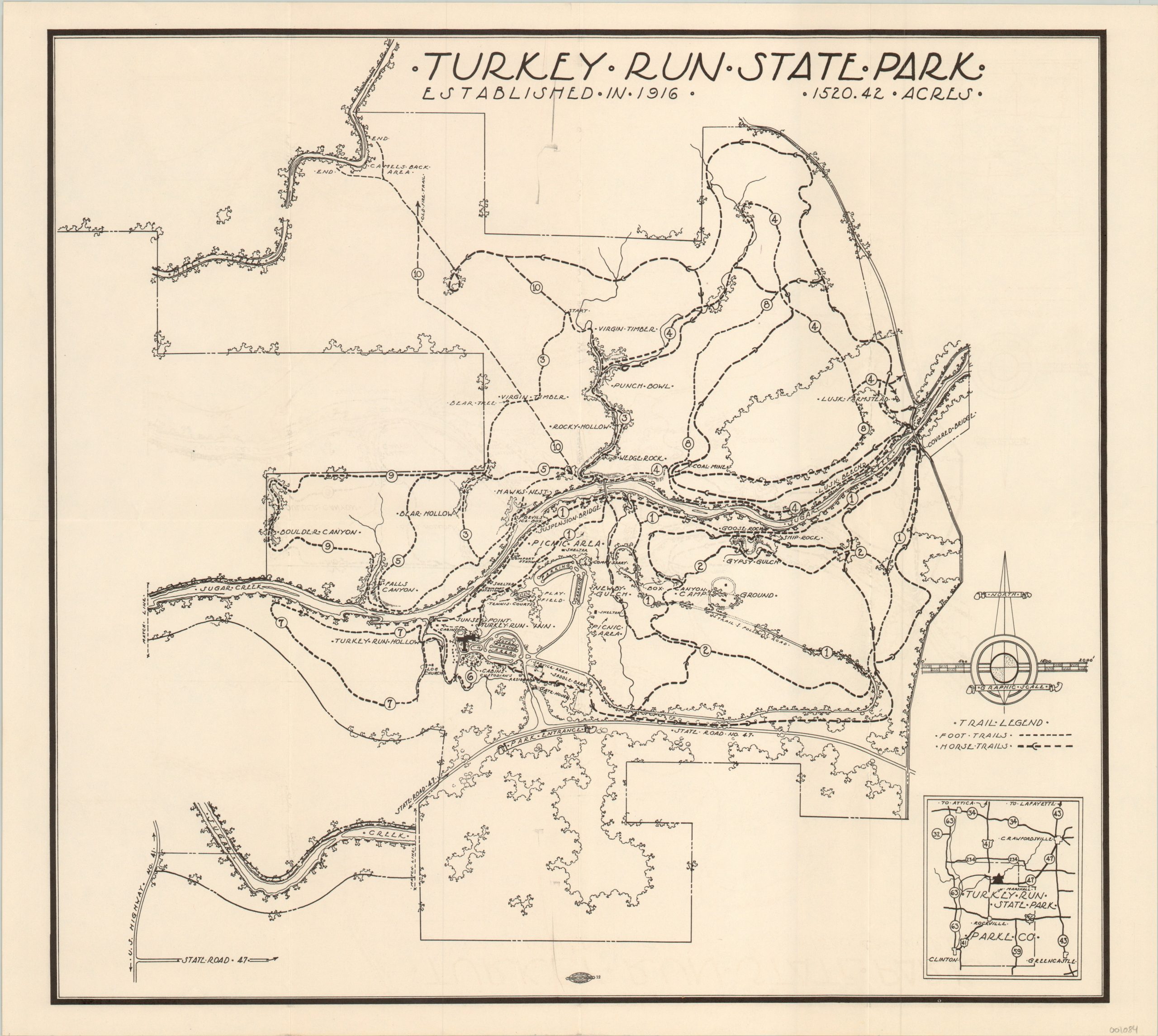
Early map from Indiana’s second state park.
Out of stock
Description
Indiana’s state park system was established in 1916 to celebrate the state’s centennial, and one of its earliest acts was to purchase the land that would ultimately become Turkey Run at public auction. The name for the second state park (the first was purchased just a few months earlier) likely originated from the flocks of wild turkeys that would gather in the gorges (or “runs”), where they could be easily trapped by early settlers.
The map was likely published shortly after the construction of the Turkey Run Inn in 1919, and shows the available foot trails and horse trails that serve the park’s 1,500 + acres. Major natural and man-made attractions, like rocks, mines, parking areas, campgrounds and picnic areas are also individually labeled.
Map Details
Publication Date: c. 1920
Author: Anonymous
Sheet Width (in): 17.90
Sheet Height (in): 15.90
Condition: B+
Condition Description: Minor wear and faint ink smudges along the originally issued fold lines. Faint offsetting visible on the left half of the sheet, but overall the map is clean and in very good shape.
Out of stock

