
Treasure Hunter’s Tourist Map of Fishing, Boating, Skin Diving on the Florida Keys, Marathon and Key West
$75.00
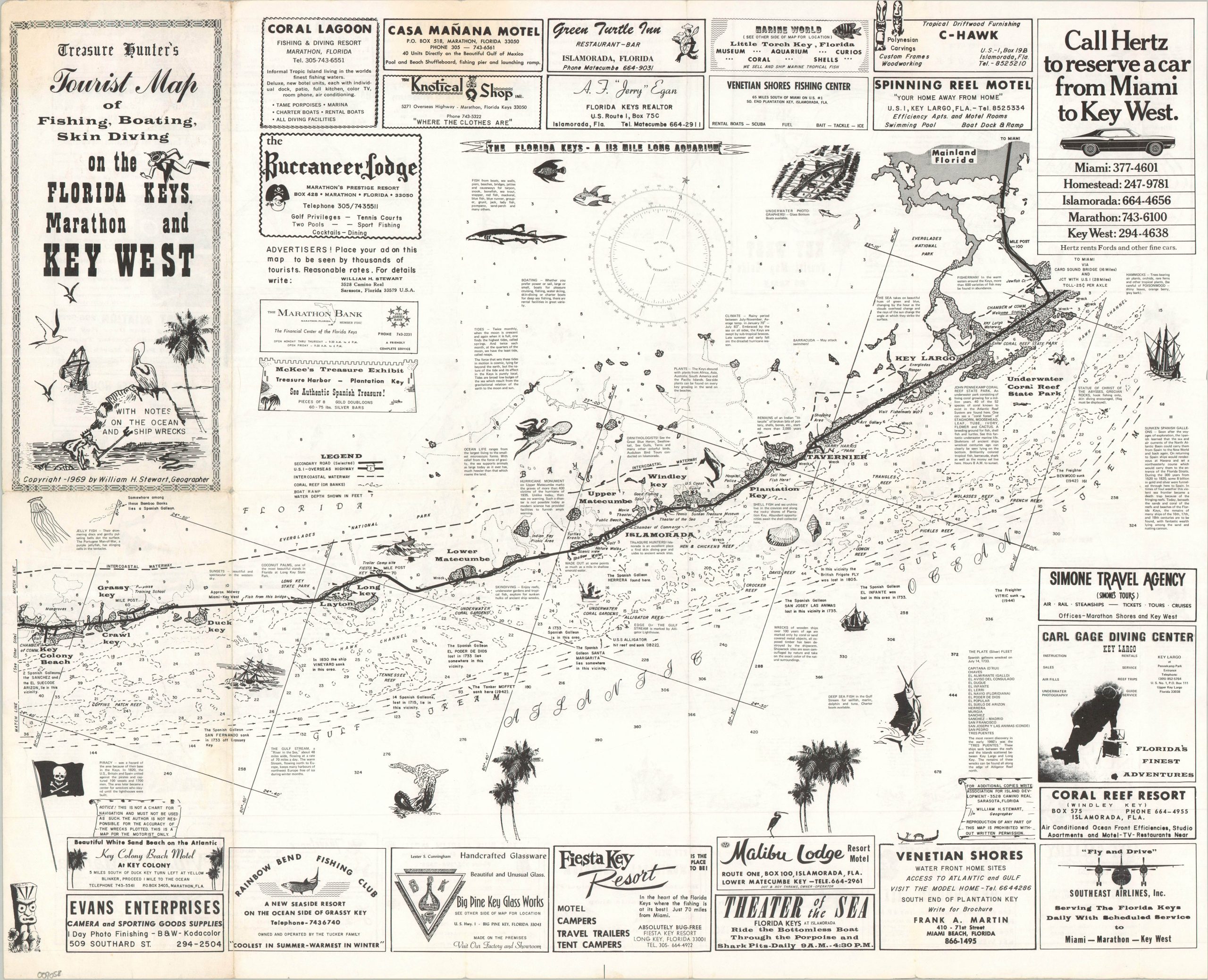
A charming 1960s guide to ‘A 113-mile Long Aquarium.’
1 in stock
Description
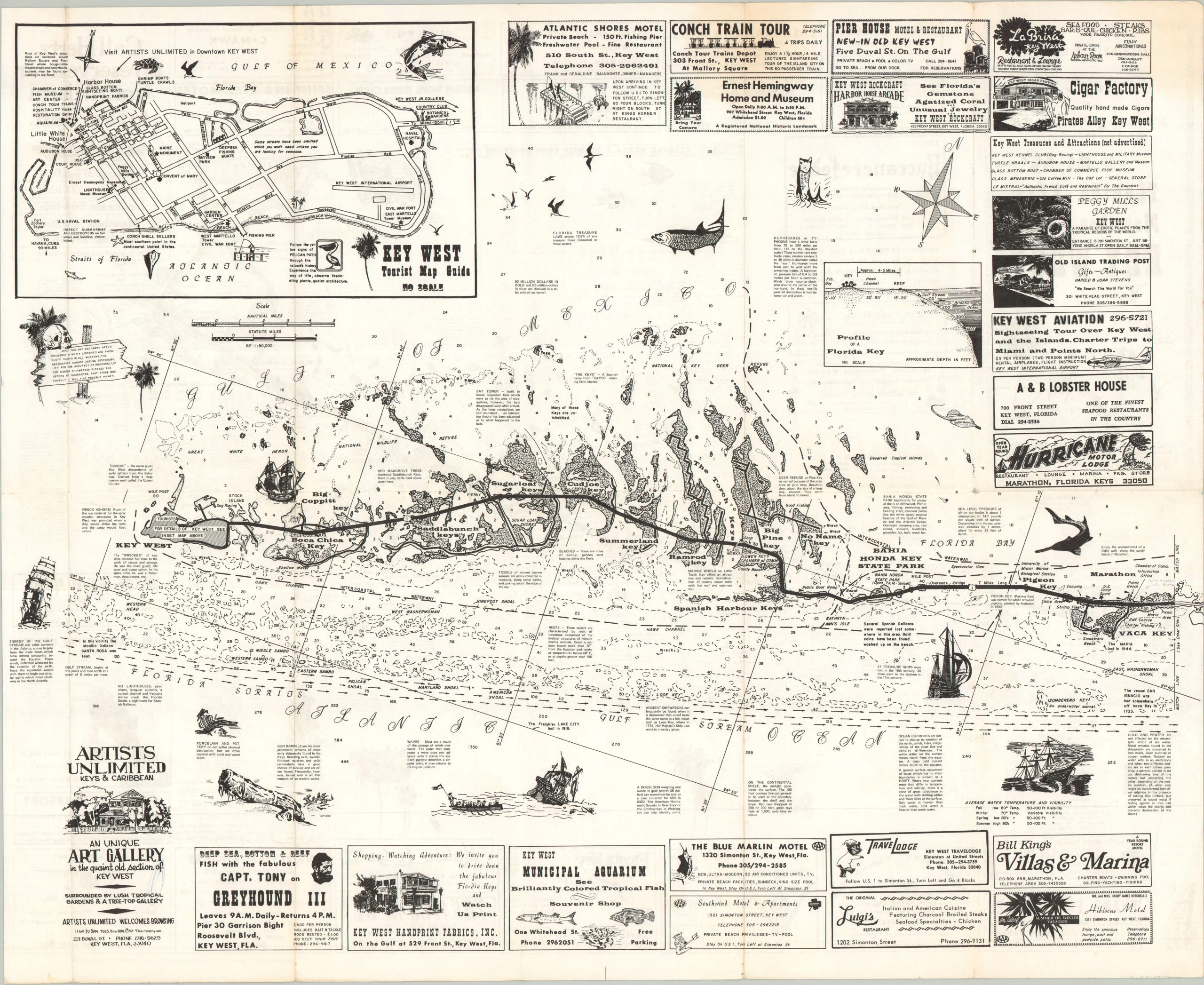
This lively map of the Florida Keys was copyrighted and published by Sarasota-based geographer William H. Seward in 1969. The Florida Overseas Highway boldly bisects the image, connecting the numerous islands along the archipelago. However, terrestrial details are relatively sparse compared to the adjacent coasts, which are filled with depth soundings, navigational hazards, shipwreck sites, and fishing spots. Dozens of advertisements fill the negative spaces, along with a street plan of Key West, an aerial profile of the Keys, and decorative elements.
Map Details
Publication Date: 1969
Author: William H. Stewart
Sheet Width (in): 23.00
Sheet Height (in): 18.75
Condition: A-
Condition Description: Double-sided map brochure with light wear and some faint discoloration along original folds. Faint marginal wear, including a bit of creasing and a few tiny tears. Good to very good condition overall.
$75.00
1 in stock