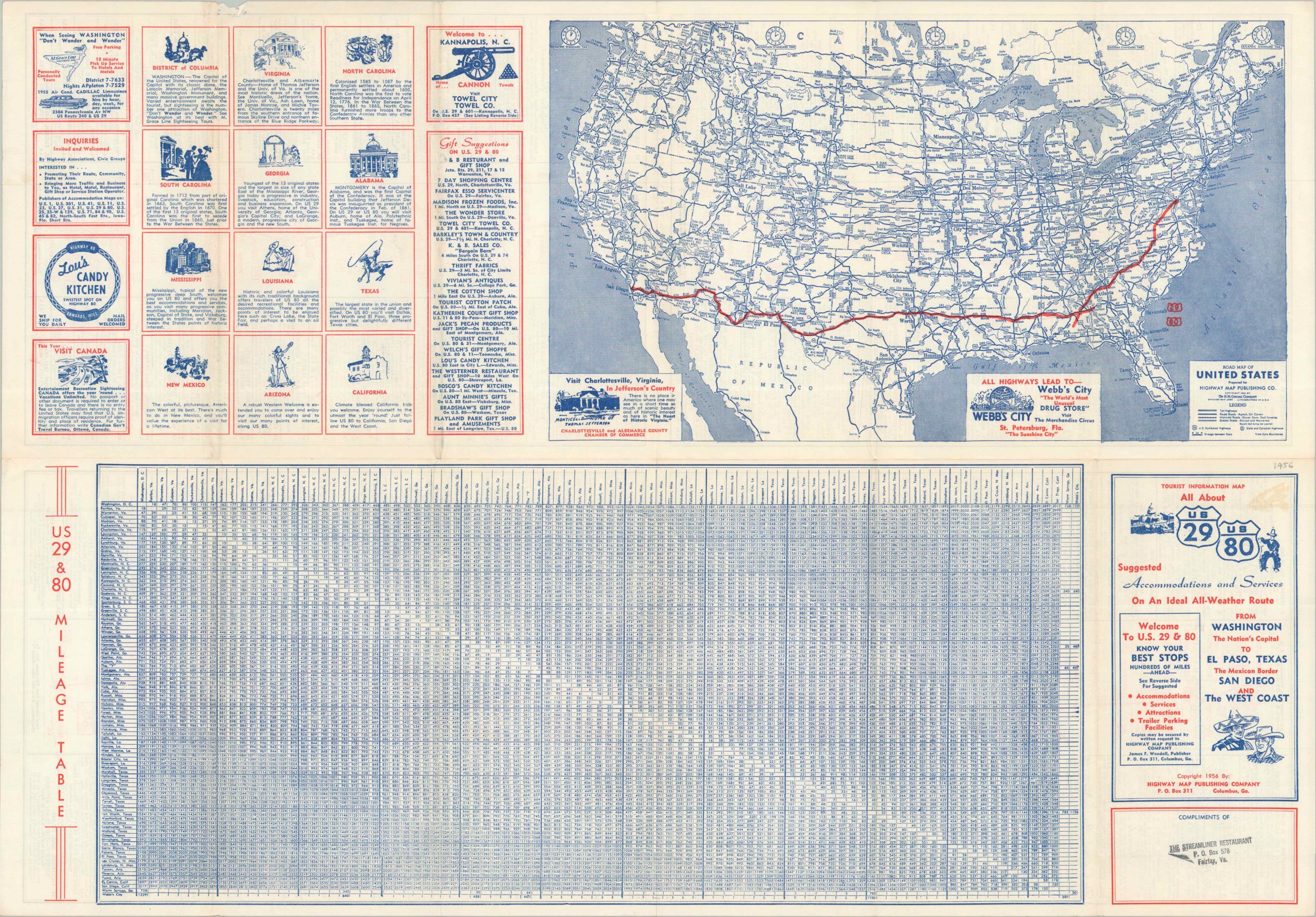
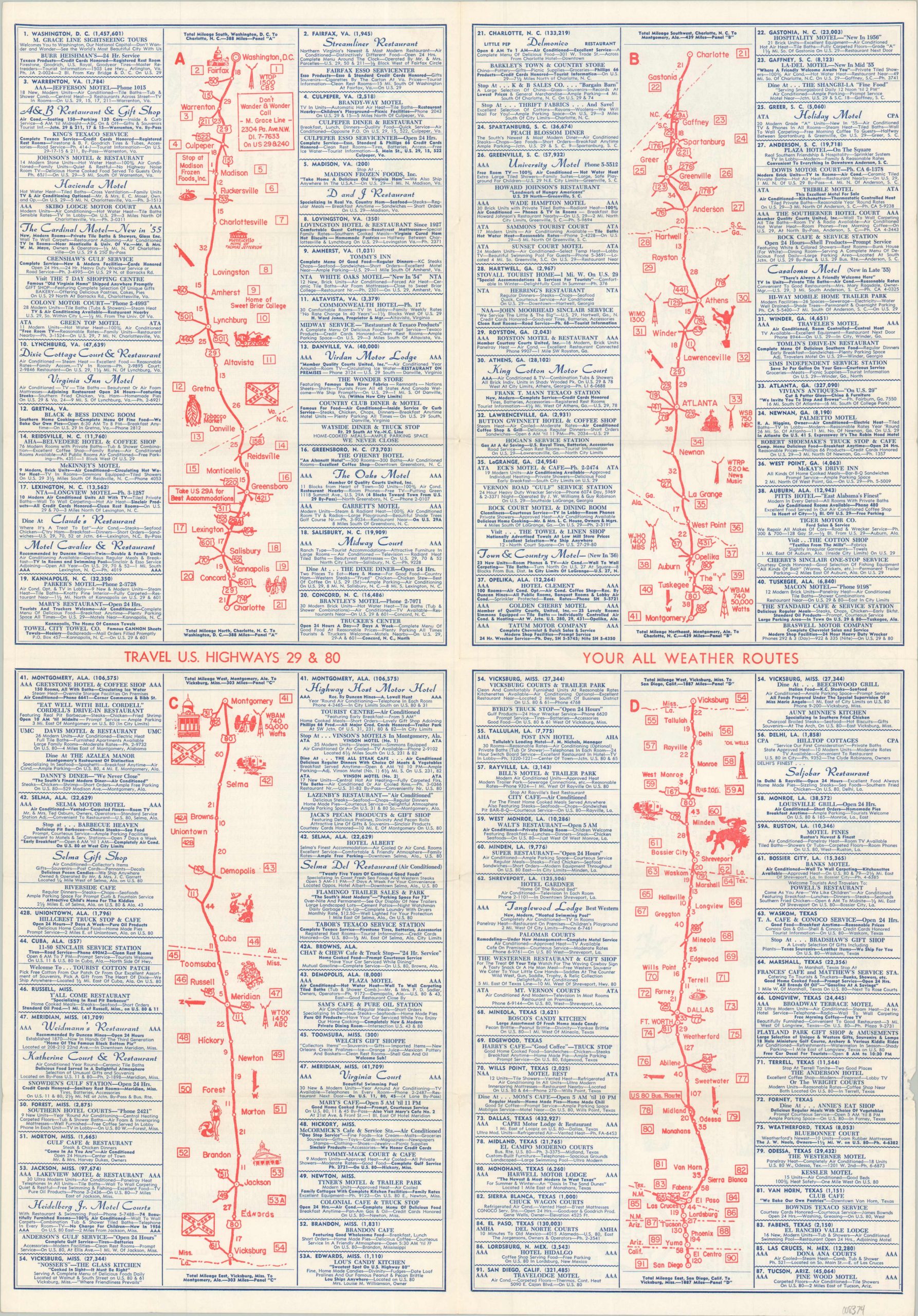
Travel U.S. Highways 29 & 80 Your All Weather Route
$95.00
Suggested Accommodations and Service On An Ideal All-Weather Route
1 in stock
Description
This interesting travel guide was published in the mid-1950s to promote a specific transcontinental automobile route connecting Washington, D.C. and San Diego. The path along U.S. Highways 29 and 80 is broken into four images and takes the motorist through eleven different states. The linear strip maps note connecting highways, radio towers, and locations of interest, with adjacent text promoting local restaurants, hotels, and other tourist amenities. The verso provides a comprehensive mileage table and a road map of the United States, by the H.M. Gousha Company, that highlights the route in red.
Copyrighted in 1957 by the Highway Map Publishing Company of Columbus, Georgia (publisher James F. Woodall). One of a number of similar mid-century maps issued by the firm to promote specific highway routes. According to the front cover, this example was distributed compliments of the Streamliner Restaurant in Fairfax, Virginia.
Map Details
Publication Date: 1956
Author: Highway Map Publishing Company
Sheet Width (in): 18.90
Sheet Height (in): 26.75
Condition: A
Condition Description: Double-sided map folder with light wear and some faint wrinkling along folds. A bit of marginal tears in the lower right that just touches the border. Very good condition overall.
$95.00
1 in stock