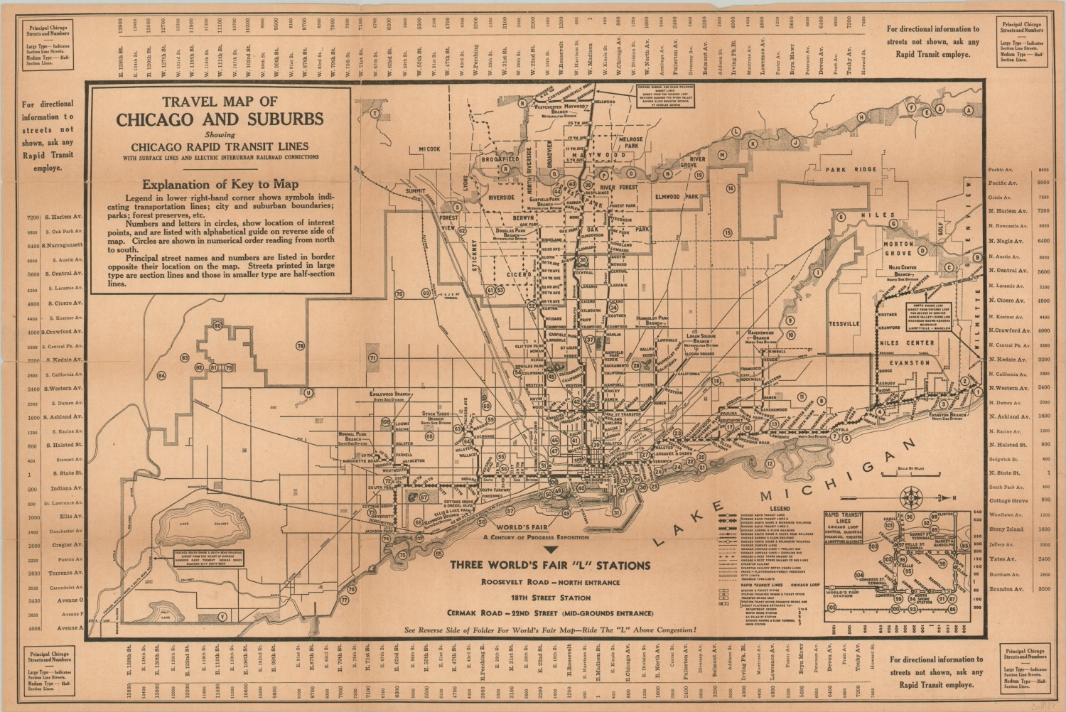
Travel Map of Chicago and Suburbs
“When you see Chicago – Ride the ‘L’ above Congestion!” [verso]
Out of stock
Description
The transportation system of Chicago was a complicated myriad of services prior to incorporation by the Chicago Transit Authority in 1947. This map, issued in conjunction for the 1933 Century of Progress Exhibition, highlights one of the primary cogs in the wheel of urban transit – the Chicago Rapid Transit Lines.
These elevated electrified railways, known colloquially as the ‘L’, extended well into the outer suburbs and provided an affordable, convenient way to access the fair. An inset map in the lower right shows details on the Loop, with additional details on the complicated inner and outer systems provided on the verso. Also present are a diagram of the fairgrounds, information on local attractions, and a list of Rapid Transit stations.
Map Details
Publication Date: 1933
Author: Chicago Rapid Transit Company
Sheet Width (in): 20.75
Sheet Height (in): 13.75
Condition: B
Condition Description: Paper is toned and brittle with age, with numerous areas of separation repaired on the verso with archival tape. A few small edge tears may persist, though the image remains intact and in good condition. Mild to moderate discoloration visible along former fold lines.
Out of stock