
Towns and Villages Along the Cease-Fire Line
$110.00
Mapping the results of the Six-Day War.
1 in stock
Description
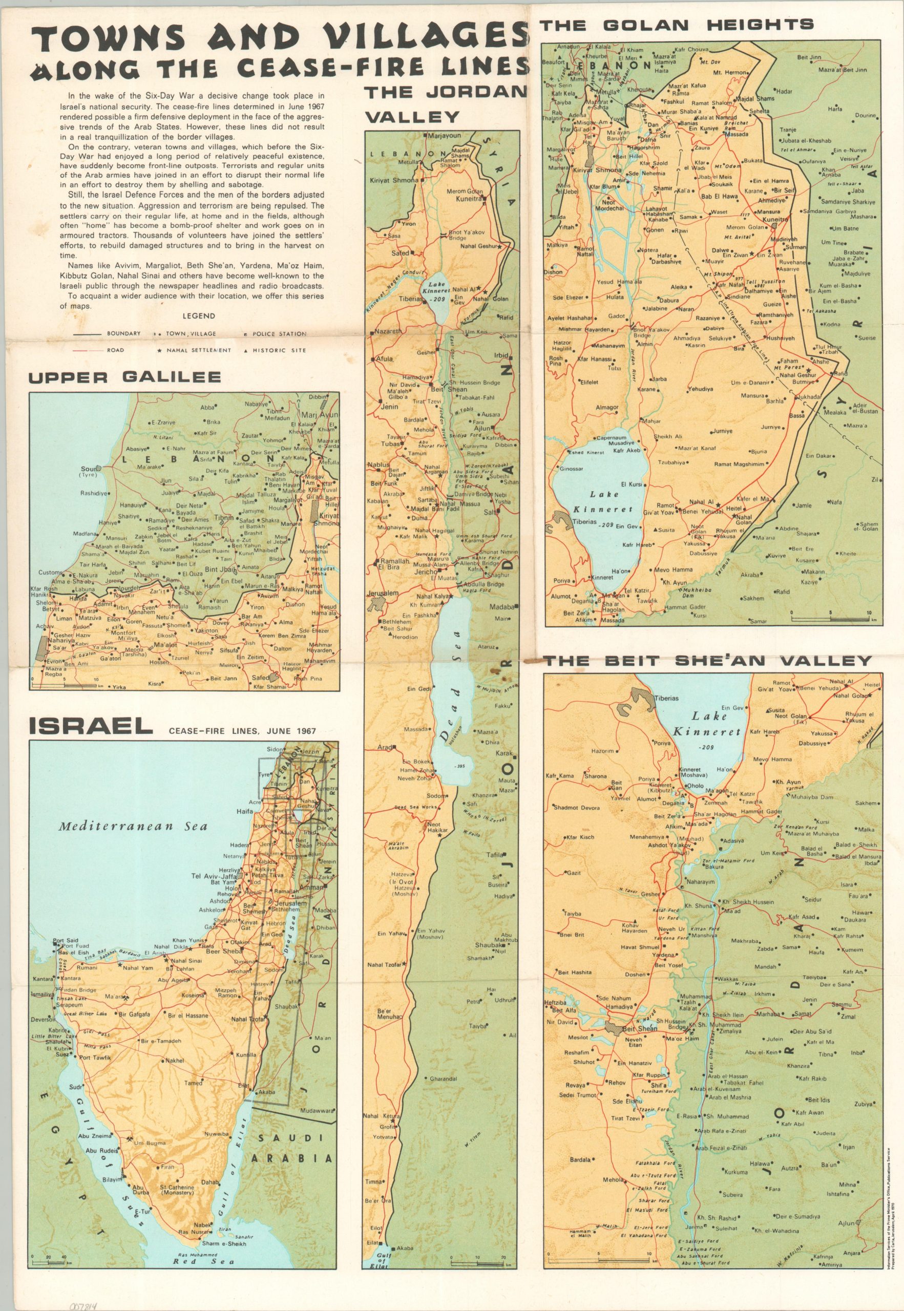
This multi-part map outlines the various border regions around lands conquered after the Six-Day War of 1967. Text in the upper left provides a brief (and biased) summary of the political situation. A key map of Israel in the lower left uses four shaded boxes to indicate the areas represented in the other maps; Upper Galilee, the Jordan Valley, the Golan Heights, and the Beit She’an Valley.
Each image highlights Israeli territory, with roads, settlements, police stations, and historic sites (all used variously to legitimize territorial claims) are noted according to the legend in the upper left. Disputed boundaries with Syria are particularly evident in the Golan Heights.
The map was prepared in Jerusalem by Carta in April, 1970. Published by the Information Services of the (Israeli) Prime Minister’s Office.
Map Details
Publication Date: 1970
Author: Information Services of the Prime Minister's Office
Sheet Width (in): 13.40
Sheet Height (in): 19.40
Condition: B
Condition Description: Folded broadsheet on thick paper, creased and moderately worn along old folds. Several dark rust spots affect the center of the image, with further (lighter) spotting visible in the upper left corner. About good condition overall.
$110.00
1 in stock