
Town of Ridgecrest & China Lake Area
$150.00
Ephemera related to the formative years of NAWS China Lake.
1 in stock
Description
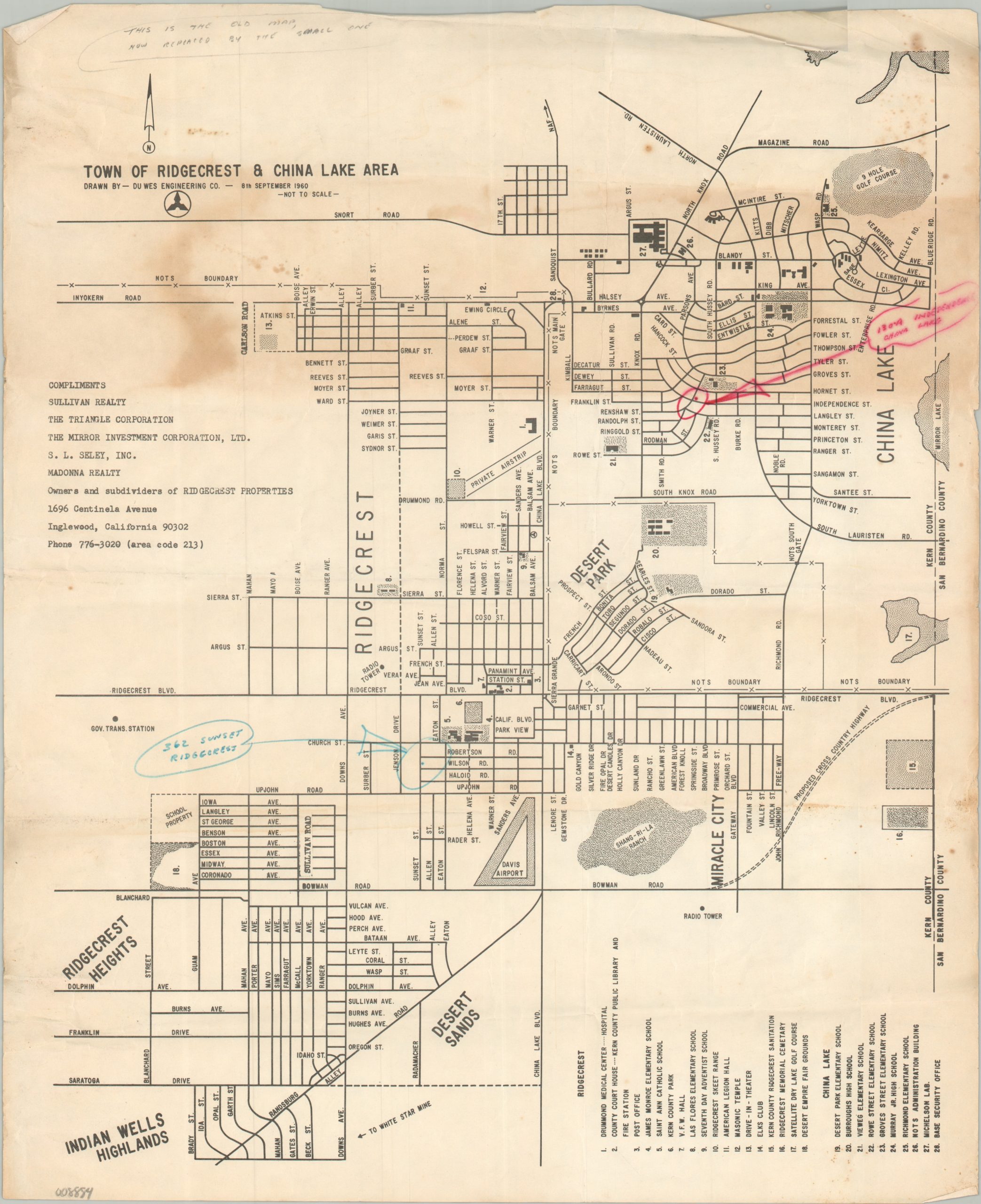
During World War II, both the U.S. Navy and the California Institute of Technology required expansive new grounds for testing rockets and aviation ordnance. A remote landing field in the Mojave Desert, built in the 1930s by the Works Progress Administration, was transferred to the Navy for that purpose and designated as Naval Ordnance Test Station (NOTS) China Lake in 1943. The facility expanded significantly in the following years, eventually requiring dedicated residential communities. Ridgecrest, officially incorporated in 1963, was the largest of these planned towns.
This map and booklet were issued by a local developer and the U.S. Government, respectively, to help inform the hordes of new residents about their local amenities. The map, drawn by Du Wes Engineering Company and dated 1960, offers a straightforward street plan of Ridgecrest and the China Lake area, noting transportation lines, major buildings, and more. It was distributed by Sullivan Realty, and several old markings indicate it was likely owned by one of the firm’s employees. Additional annotations are present in the descriptive volume, issued in 1966 by the Government Printing Office. In particular, Ridgecrest is circled on the tissue overlay atop a panoramic photograph.
Map Details
Publication Date: 1960-1966
Author: Du West Engineering Company
Sheet Width (in): 13.75
Sheet Height (in): 16.75
Condition: B-
Condition Description: Single-sided map (size given) and accompanying 28 pp. booklet, both in rough shape, with significant dampstaining, creasing, spotting, and wear. Old annotations throughout reflect prior use and offer an interesting story. Fair condition.
$150.00
1 in stock