Total War Battle Map
$250.00
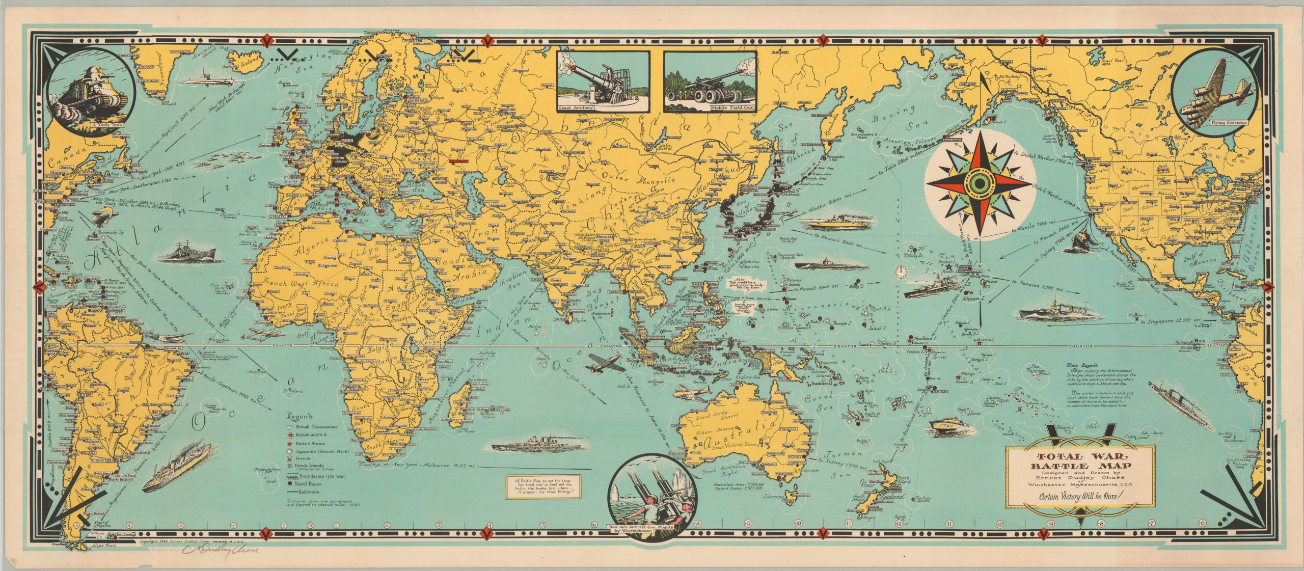
Chase’s autographed pictorial world map showing the war as it unfolded.
Description
This spectacular patriotic map shows the global conflict of WWII unfolding throughout the world, centered on the Pacific Theater. German and Japanese countries and occupational regions are colored in black and a legend identifies the locations of Allied naval bases, colonial possessions, railroads and political boundaries. America’s vehicles of war prowl the seas, including submarines, fighter planes, transports, warships and PT boats. Inset illustrations show further military hardware in the form of (somewhat inaccurate) tanks, coastal batteries, mobile artillery, anti-aircraft, and the Flying Fortress. These were appropriate symbols of American technological prowess that did much to offset early Axis gains in the war. Strategic bombing, artillery barrages, air superiority, and the convoy system all used this material advantage to great success.
Annotations throughout the map provide information on the International Date Line, distances across the Pacific, and geographic features to aid the audience in comprehending the geopolitical situation of the war. A small text box also alludes to a hint in the border – the Morse Code symbol for the letter “V” – for Victory!
The map was drawn by the famed pictorial artist Ernest Dudley Chase. Chase produced over 50 maps during his career in the first half of the 20th century, including three separate versions of the map seen here – a dual sided pamphlet, single sheet poster (this example), and folded post card. The artist’s meticulous attention to detail, colorful palette, and comprehensible format allowed the American public to learn a great deal about the war from his maps. His maps were also popular among veterans, who appreciated the lighthearted image as a family-friendly memento from their service.
For more information on the Total War Battle Map, check out my blog post here.
Map Details
Publication Date: 1943
Author: Ernest Dudley Chase
Sheet Width (in): 36
Sheet Height (in): 16
Condition: B
Condition Description: The map is in very good condition, with bright color and a full image. As with many folded maps, this one has experienced some separation along the fold lines, including a large 4" tear in the lower left that has been reinforced on the verso. Some pen marks under the compass rose.
$250.00

