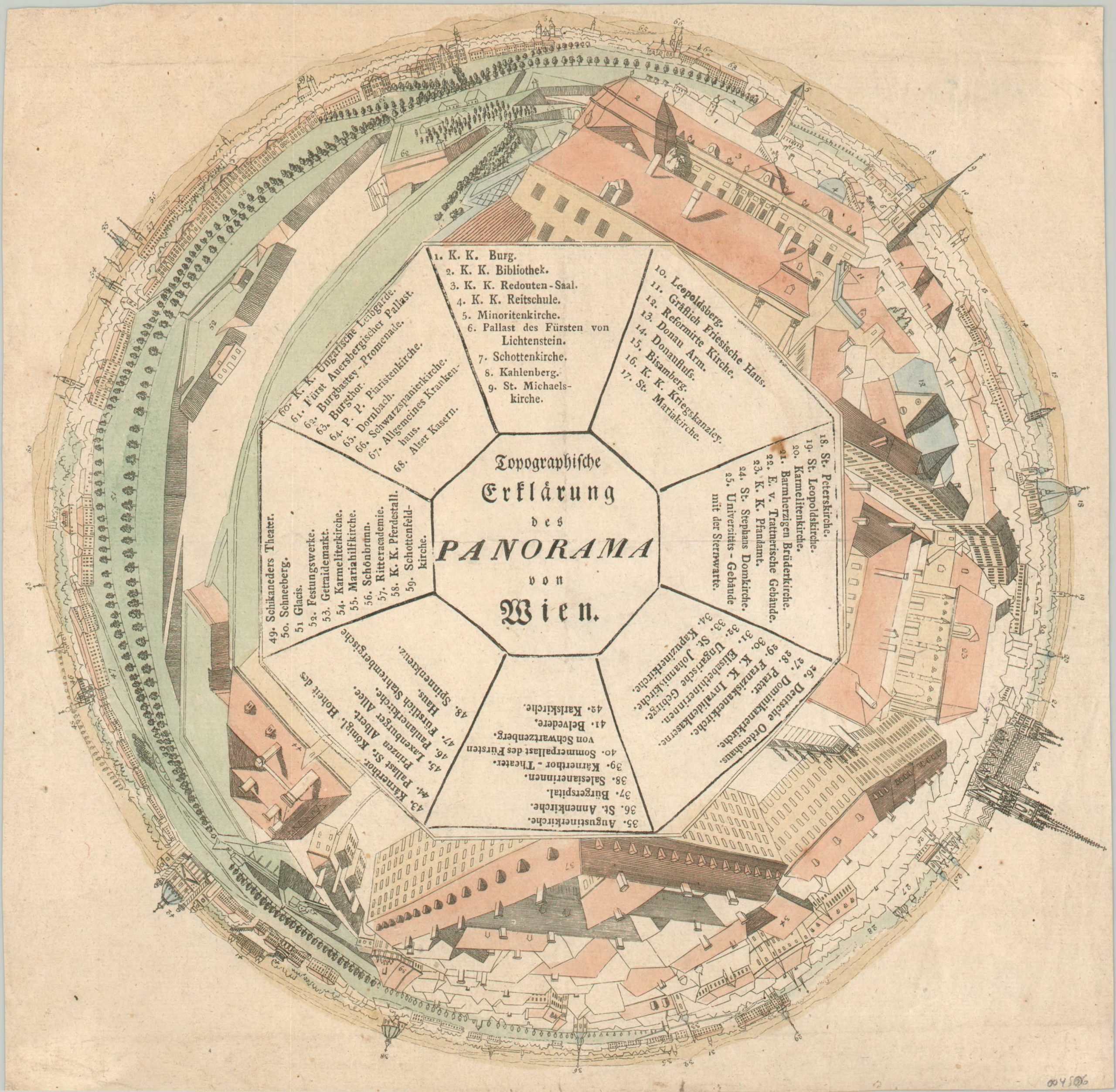
Topographische Erklärung des Panorama von Wien [Vienna, Austria]
A scarce surviving pictorial representation of the second-ever ‘panorama.’
Out of stock
Description
This rare panoramic view provides an incredible overview of the Austrian capital of Vienna during the first decade of the 19th century. The 360-degree pictorial scene is based on a huge painting by William Barton and includes 68 typeset locations of interest corresponding to their approximate geographic locations. It was published around 1805 and would have been a tremendous source of civic pride for the Viennese citizenry after Napoleon’s successful (but bloodless) capture of the city that year.
[Translated from the Vienna Museum] The inventor of the panorama, Robert Barker, opened the first panorama rotunda on the European continent in the Vienna Prater in 1801 with a panoramic view of London. The huge painting stretched along the wall could be viewed from the centrally located visitor platform. Due to the weak lighting and the extremely realistic painting style, it created the illusion of actually being at the depicted location. The low admission prices attracted so many visitors that today the panorama is considered the first mass medium. In 1803, Barker’s successor, William Barton, sketched the city of Vienna from the tower of the Augustinian Church. The well-known painter Laurenz Janscha(1749–1812) and Carl Postl (1769–1818) subsequently executed the approximately 300 square meter oil painting, on which one can see the Belvedere, the Spinnerin am Kreuz, Schönbrun, but also the mountains across the roofs of the inner city of the Vienna Woods and the Danube.
The present topographical explanation of the panorama of Vienna was already created for the Viennese public, and was then probably especially important from 1806 for the visitors of the panorama painting at the following exhibition locations such as Leipzig, Berlin, Hamburg and Munich, who the city did not knew from personal experience. It is uncertain whether there were linguistically adapted explanation sheets for the presentations in Copenhagen, Stockholm, St. Petersburg and Paris. In any case, the distribution of the print, actually the only surviving pictorial representation of this Prater panorama, must have been correspondingly large.
Sources: Vienna Museum Catalog; Swann Auction Galleries; Library of Vienna;
Map Details
Publication Date: 1805
Author: William Barton
Sheet Width (in): 10.1
Sheet Height (in): 22.3
Condition: B+
Condition Description: Soft creasing and small tears visible along the outer edges of the sheet. One or to spots visible within the image (most evident in center-right) and a strip of adhesive residue visible on the verso. Good to very good overall.
Out of stock

