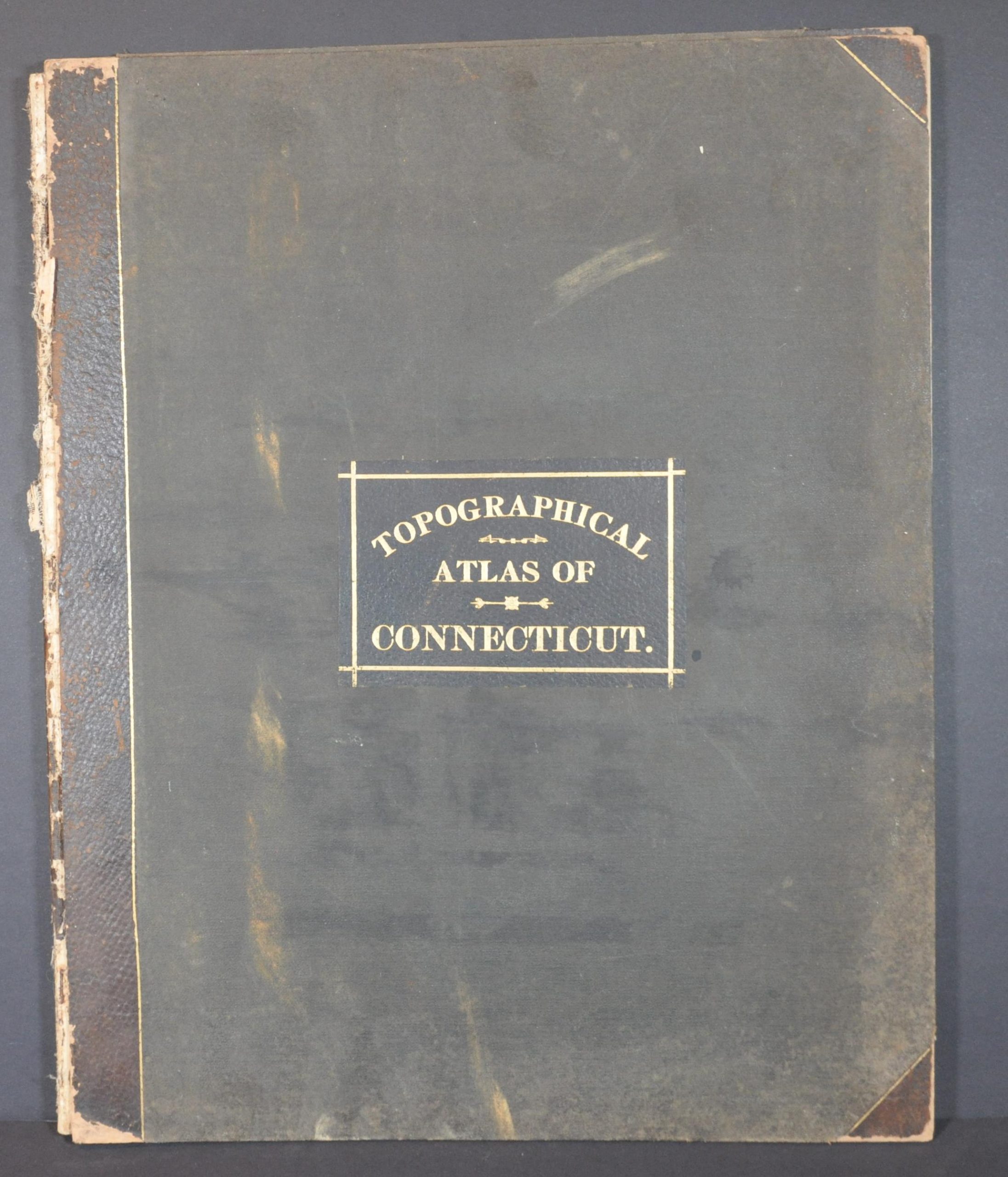
Topographical Atlas of the State of Connecticut
$350.00
Complete topographic atlas of Connecticut from the late 19th century.
1 in stock


Description
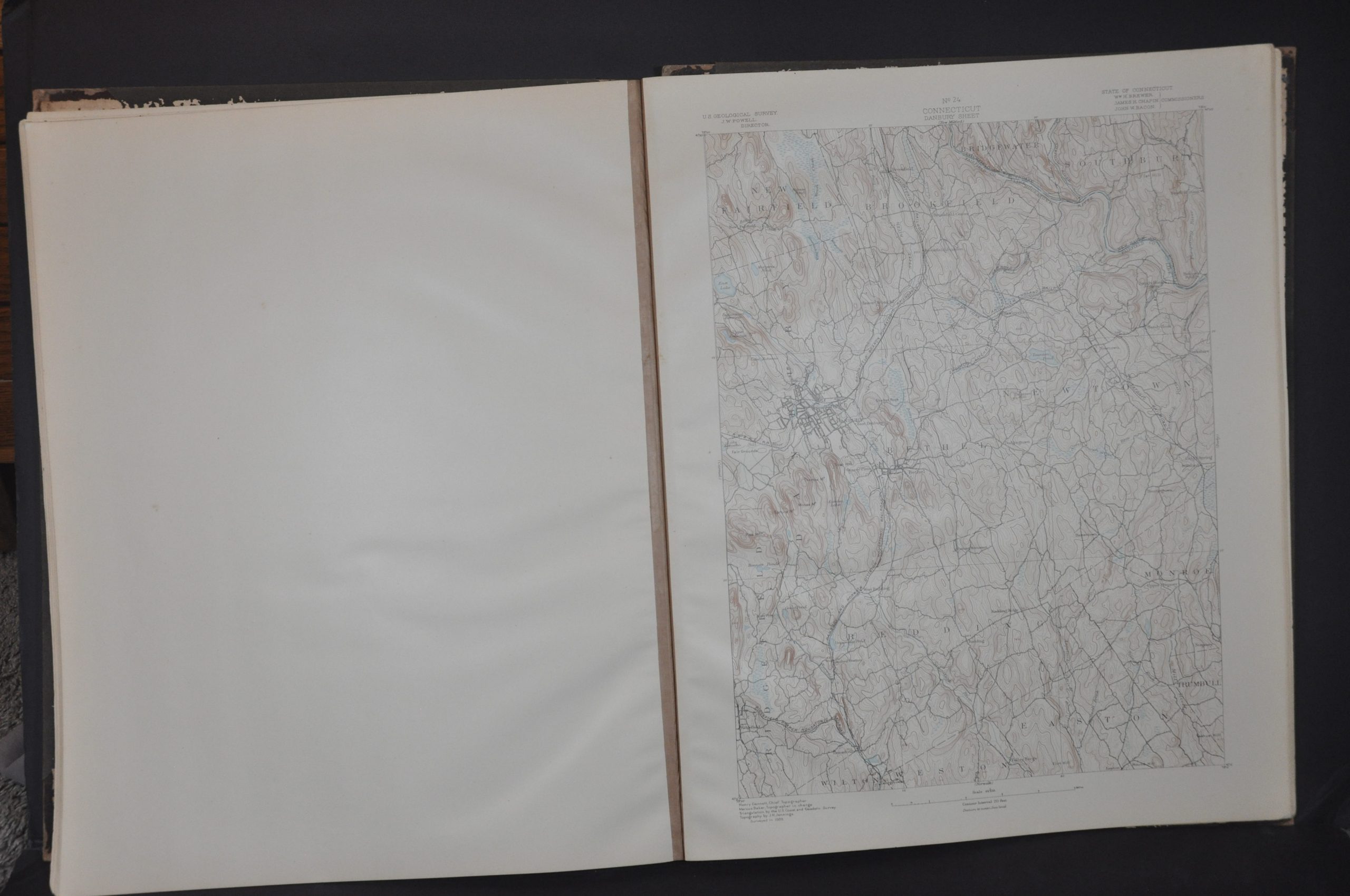
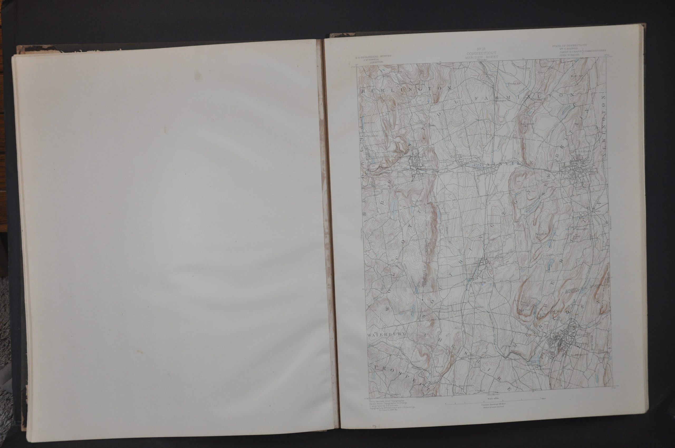
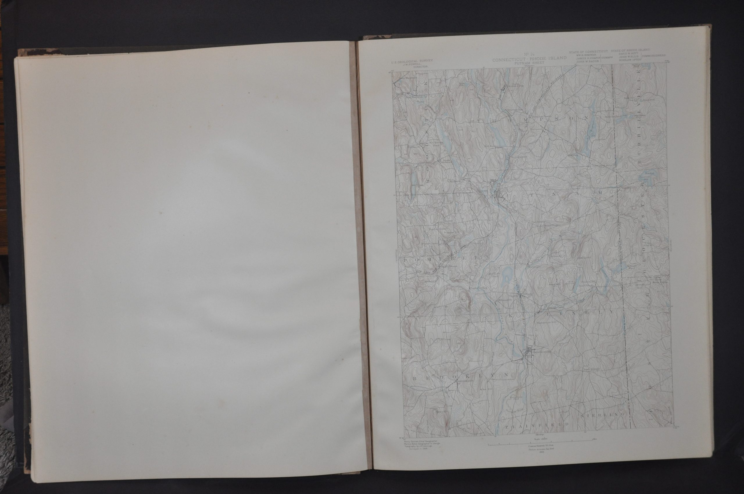
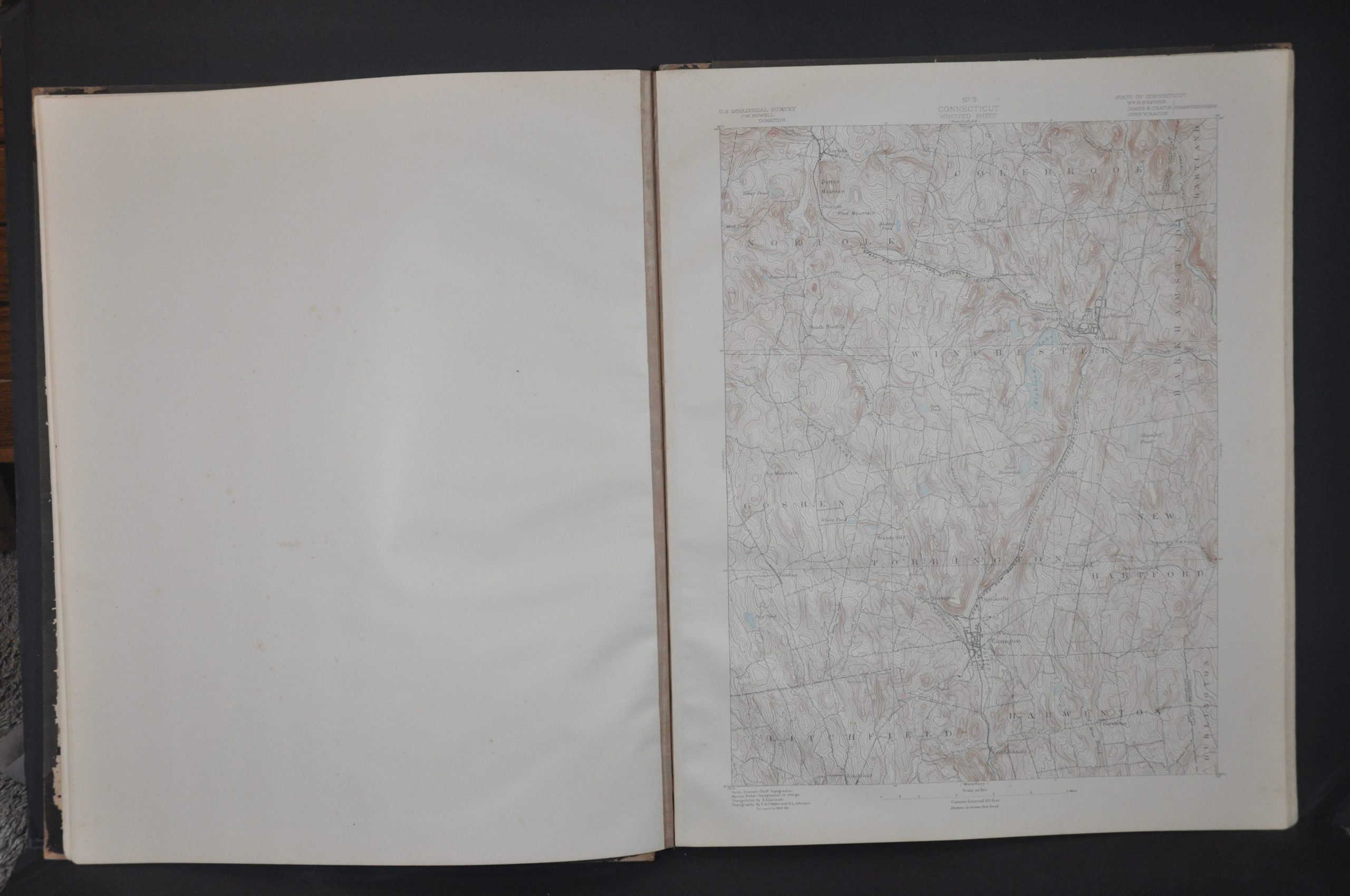
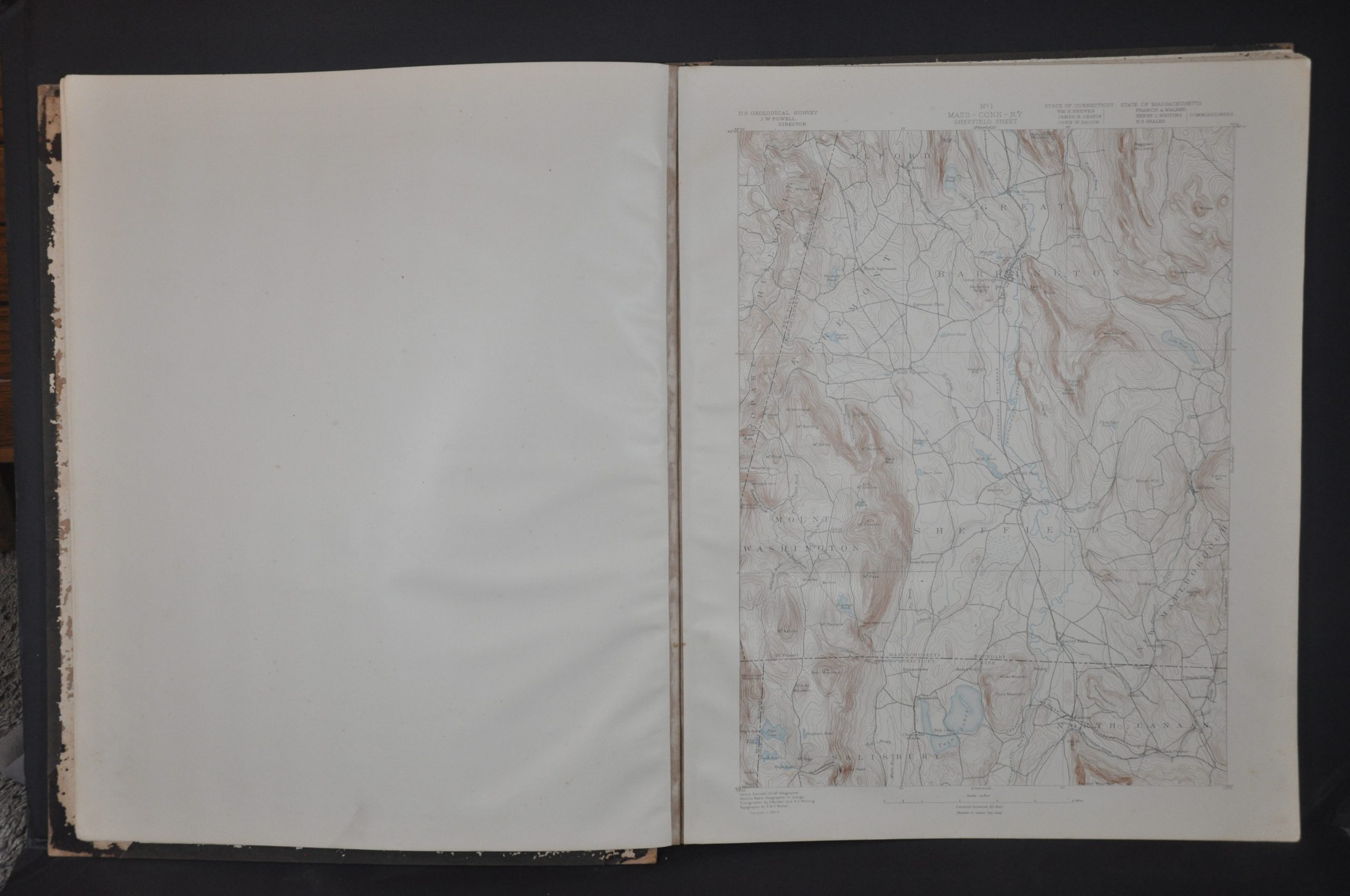
This fascinating topographic atlas of Connecticut was compiled and published in 1893 as a joint effort between state officials and the United States Geological Survey under John Wesley Powell, the famous explorer. It would be one of Powell’s last works with the U.S.G.S, as he resigned the directorship the following year and was replaced by Charles Walcott.
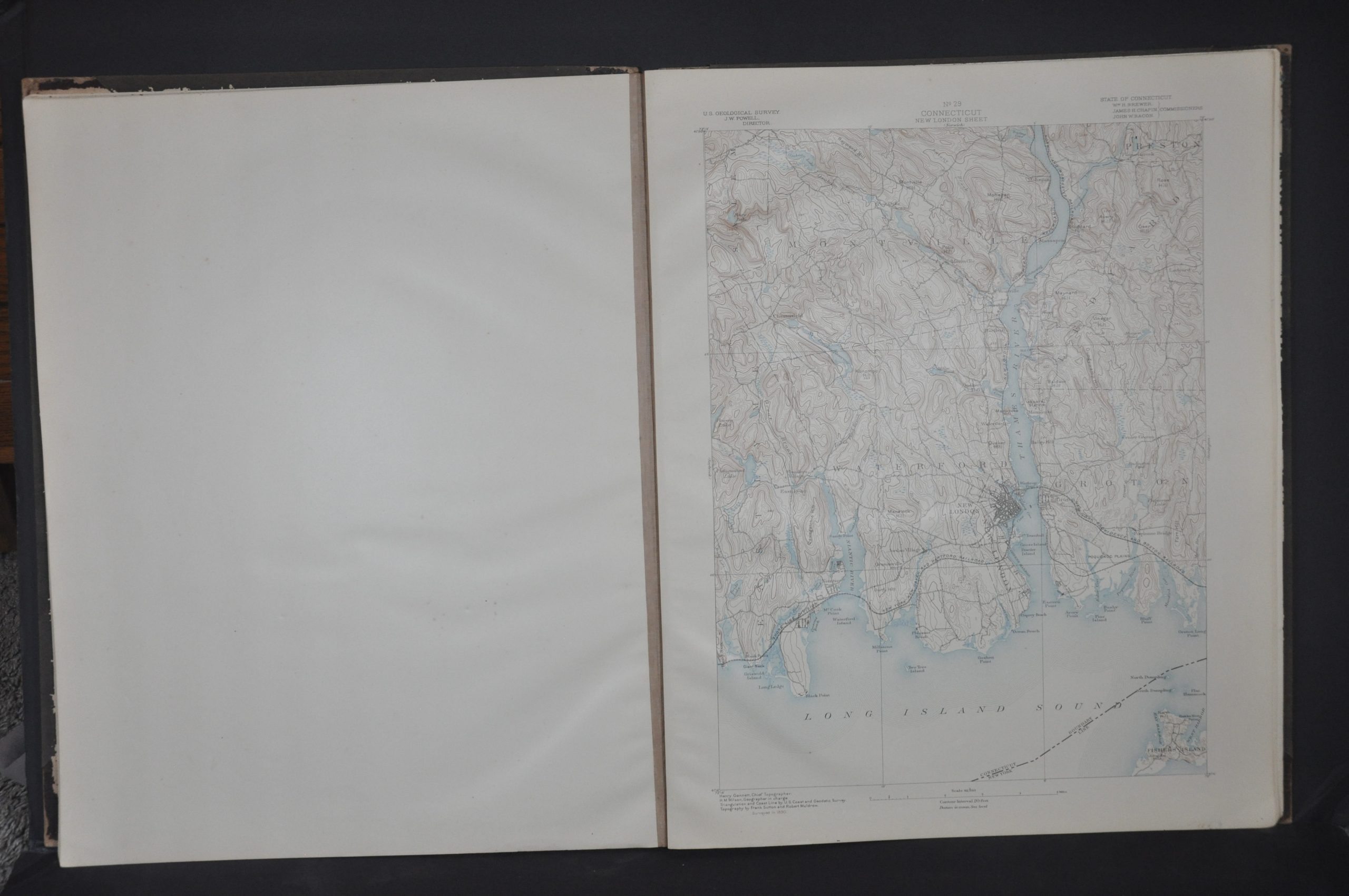
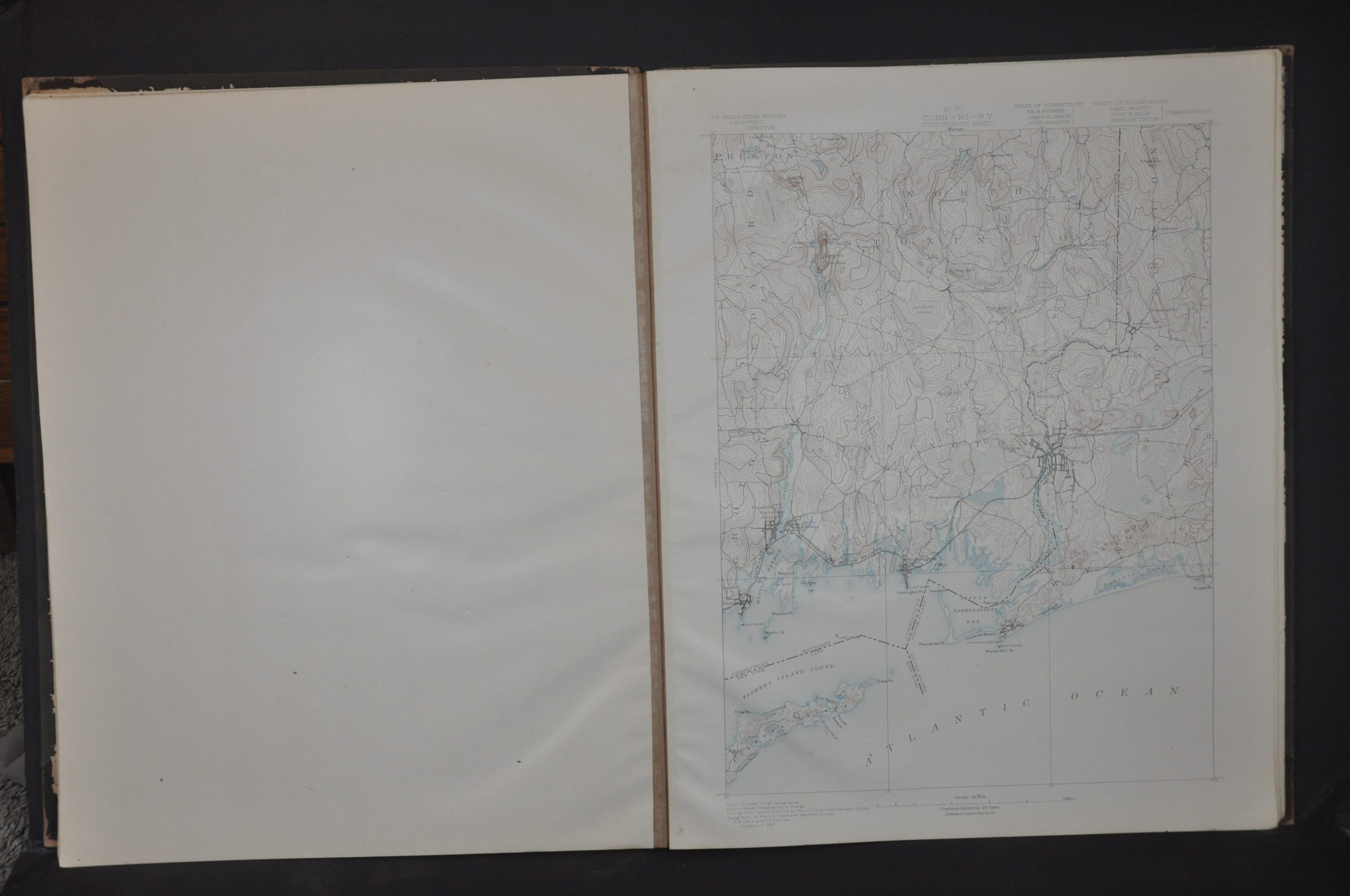
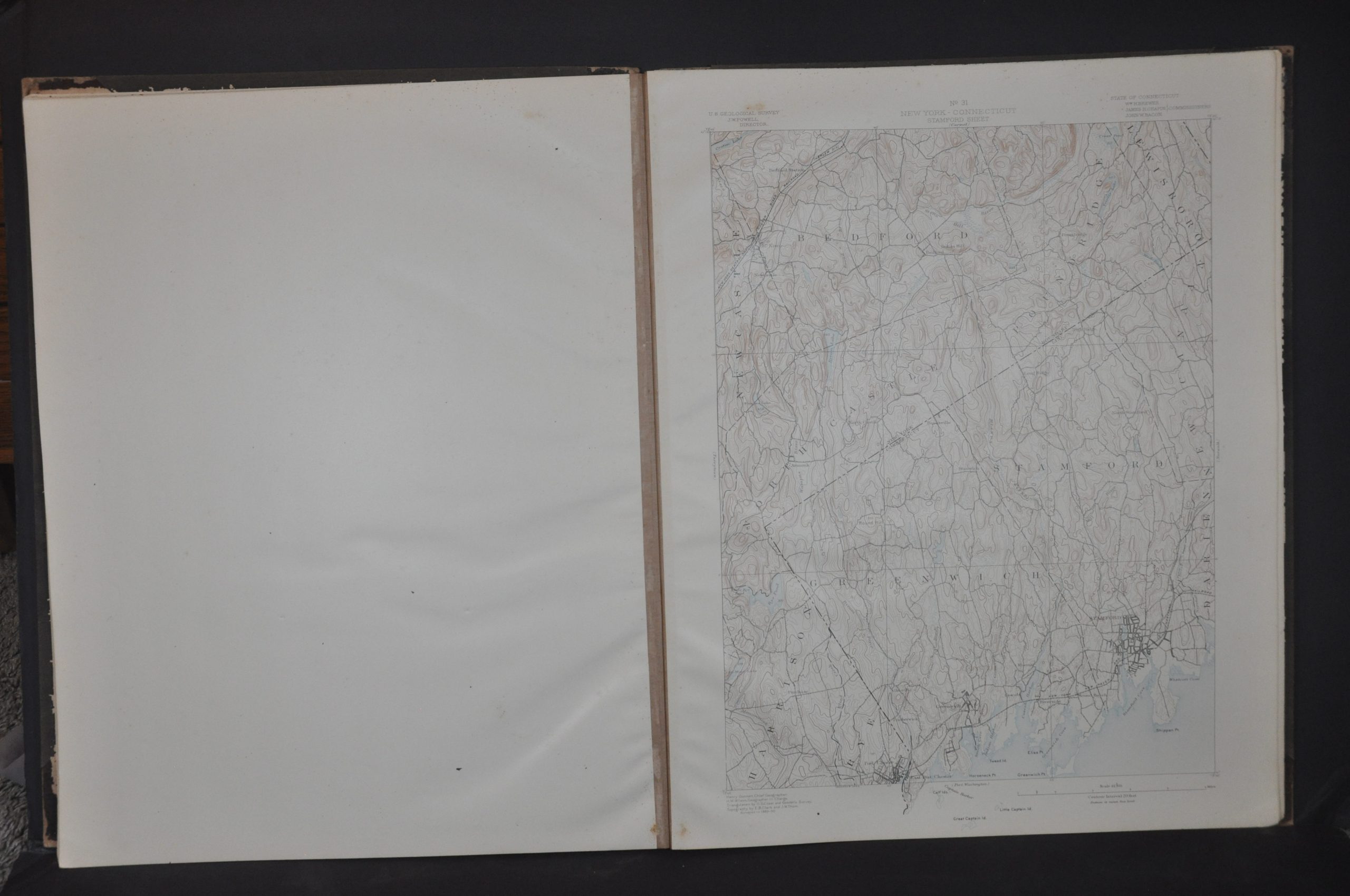
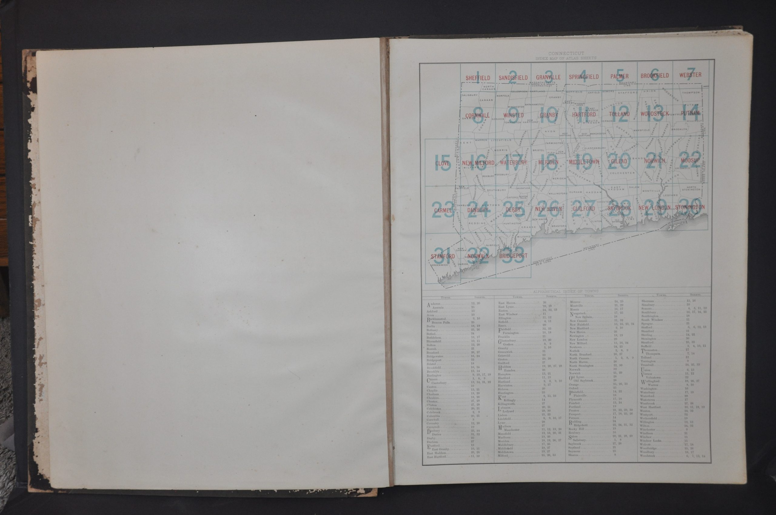
The atlas includes an index of cities and a map that outlines the area covered by each of its 33 subsequent sheets, including a large area of Massachusetts along the northern border. Each single page presents a detailed snapshot of the landscape contours, prominent geographic features, transportation routes, and patterns of settlements, even down to outlines of individual buildings.
Map Details
Publication Date: 1893
Author: United States Geological Survey
Sheet Width (in): 16.5
Sheet Height (in): 20.75
Condition: B+
Condition Description: Complete atlas (35 unpaginated sheets) with boards bound in original quarter leather and black cloth, with a gilt title block. The spine and hinges have disintegrated, resulting in both covers separating from the contents. End sheets show heavy wear and the title page is moderately soiled and spotted, but otherwise contents are very good. Light wear and faint soiling visible in the margins, consistent with age and use. Interestingly, one of the sheets (No. 27) has been marked with an exhibit number dated to 1973, indicating it was used as part of a court case that year.
$350.00
1 in stock