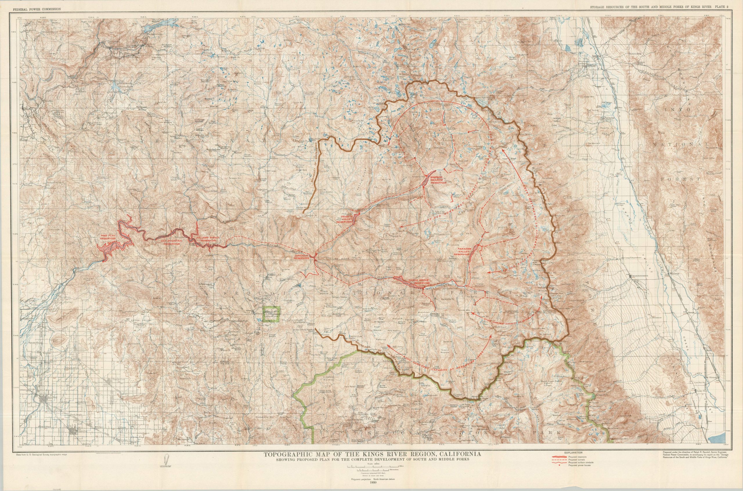
Topographic Map of the Kings River Region, California Showing Proposed Plan for the Complete Development of South and Middle Forks
$110.00
Plans to irrigate California’s Central Valley during the Great Depression.
1 in stock
Description
This detailed topographic map was compiled by the United States Geological Survey and published (with overprinted updates) by the Federal Power Commission, under the direction of Ralph Randell, in 1930. It shows a large area of the Sierra Nevada in Central California, including portions of the Sequoia, Sierra, and Inyo National Forests.
The region depicted also contains the middle and south forks of the King’s River, highlighting recommended improvements to help mitigate seasonal droughts, generate electricity, and improve flood control. Several reservoirs and proposed power houses are noted in red, along with miles of proposed tunnels and surface conduits to carry water to thirsty residents and parched farms. Conflicting interests (conservation vs. industrialization, private property vs. public good, county vs. state, etc.) would result in numerous cancellations and delays, though the Pine Flat Dam was ultimately completed in 1954.
Map Details
Publication Date: 1930
Author: Ralph Randell
Sheet Width (in): 44.5
Sheet Height (in): 29.5
Condition: A
Condition Description: Color lithographed sheet, sharply creased along original folds. A bit of light wear in the margins and faint wrinkling, consistent with age. Very good condition overall.
$110.00
1 in stock