
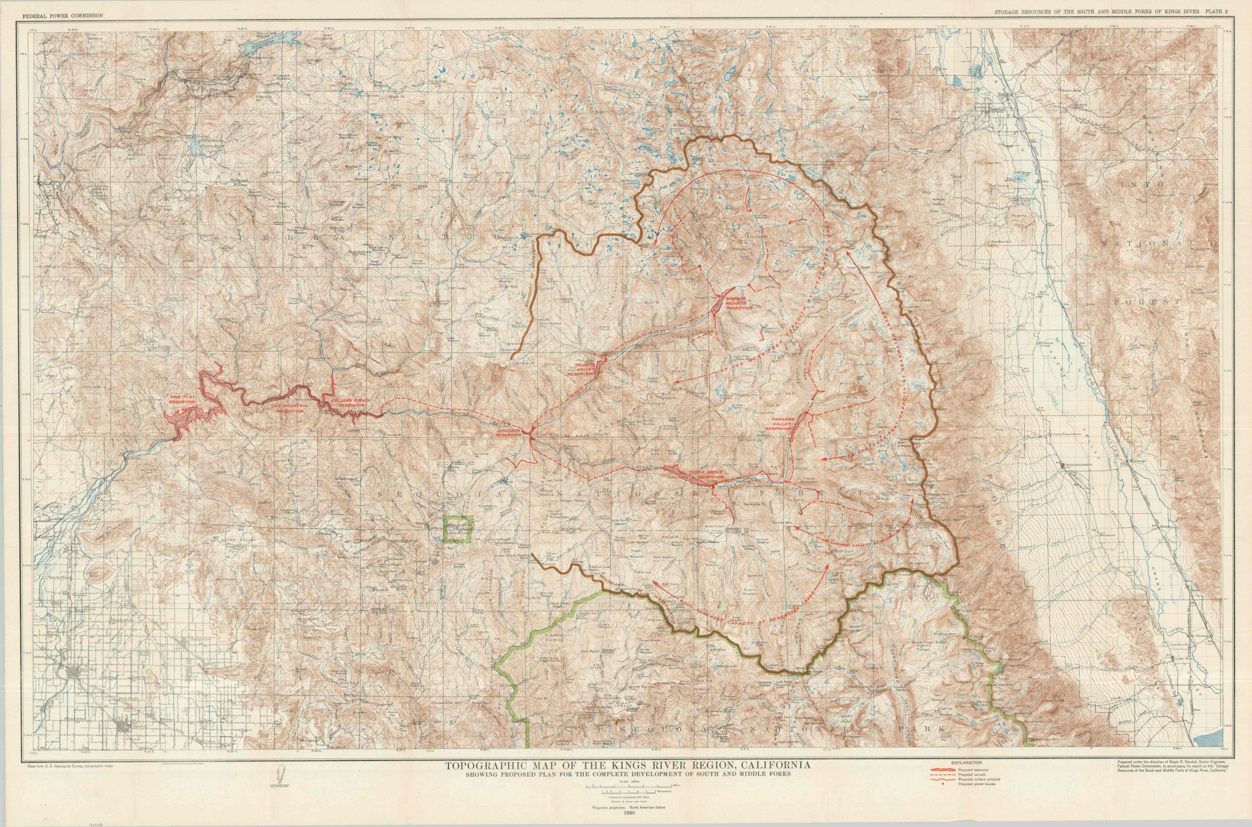
Topographic Map of the Kings River Region, California Showing Proposed Plan for the Complete Development of South and Middle Forks
$80.00
Harnessing the power of the King’s River in Central California.
1 in stock
Description
Water rights for the agriculturally fertile Central Valley of California have been hotly contested ever since the area was widely settled in the late 19th century. In the early 1920s, urgent action was needed, as seasonal changes in rainfall led to significant droughts and uncertainty about the availability of irrigation. Various parties, including the Army Corps of Engineers, U.S. Bureau of Reclamation, and Kings River Water Association, sought to create a series of dams and reservoirs to alleviate the issue, plus add potential hydroelectric power to the growing region.
This map, published in 1930 by the Federal Power Commission, highlights numerous proposed improvements across the south and middle forks of California’s Kings River. Several reservoirs, tunnels, power houses, and surface conduits are highlighted in red throughout a large section of the Sierra Nevada between the Owens Valley (right) and the San Joaquin Valley (left). General Grant National Park and Sequoia National Park are outlined in green and a fascinating variety of features – ranches, meadows, mountain peaks, schools, etc. – are labeled throughout.
Map Details
Publication Date: 1930
Author: Federal Power Commission
Sheet Width (in): 44.00
Sheet Height (in): 29.25
Condition: A
Condition Description: Color printed map, sharply creased along original folds. A bit of faint offsetting visible in the margins from the red ink. Very good condition overall.
$80.00
1 in stock