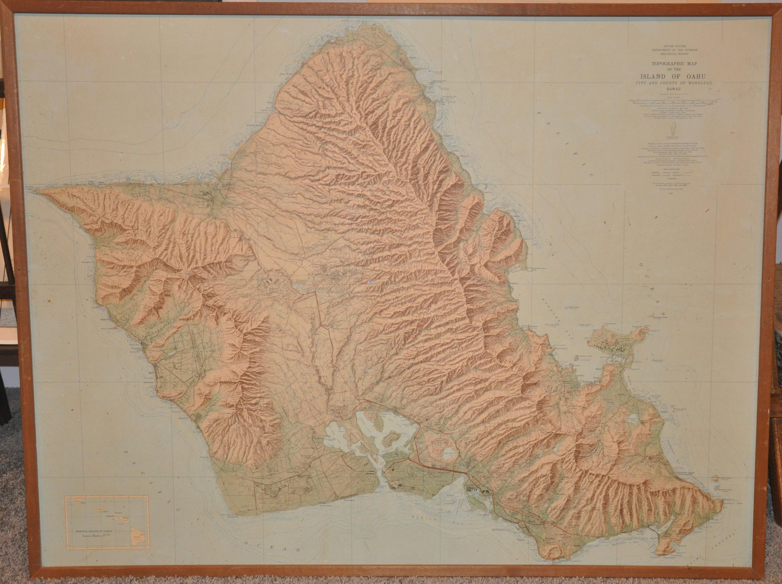
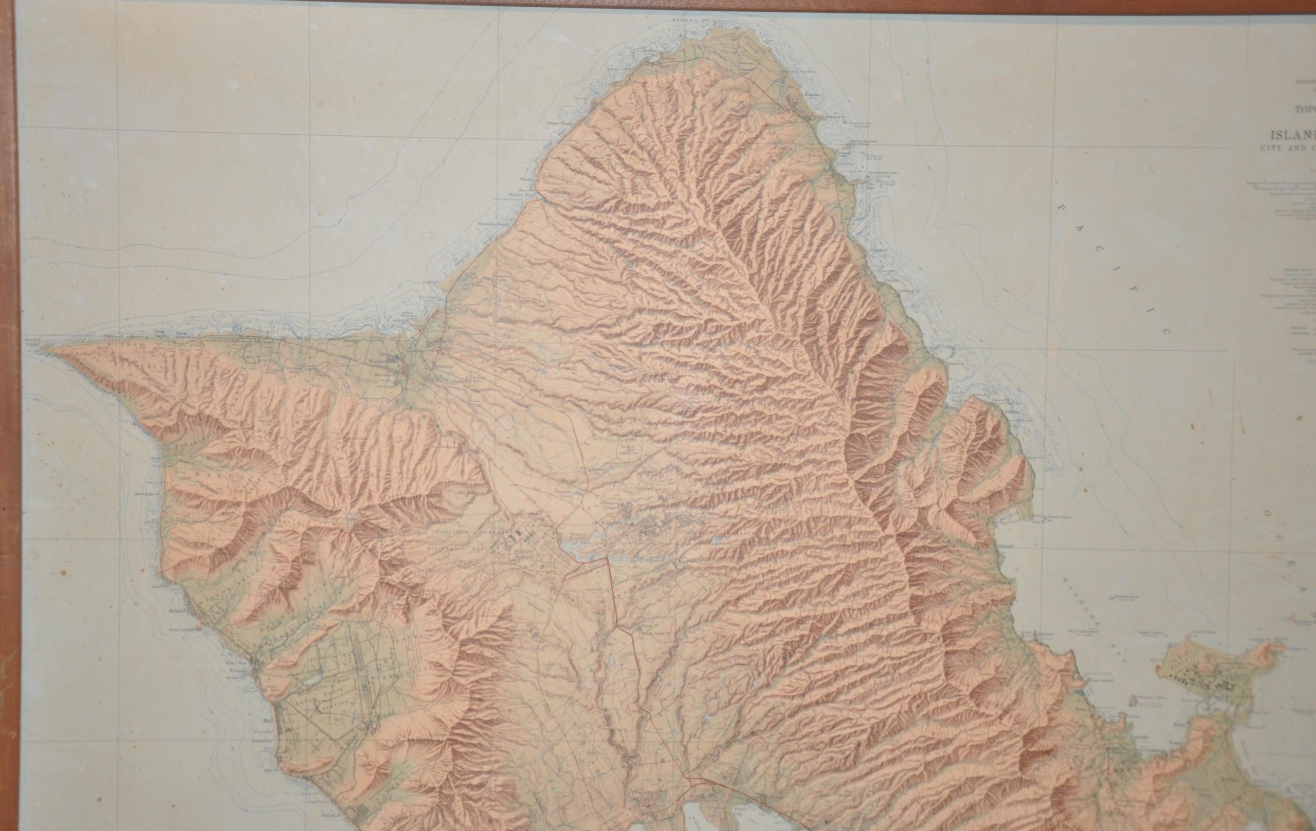
Topographic Map of the Island of Oahu
$350.00
Cold-War era USGS topographic survey of Oahu.
1 in stock


Description
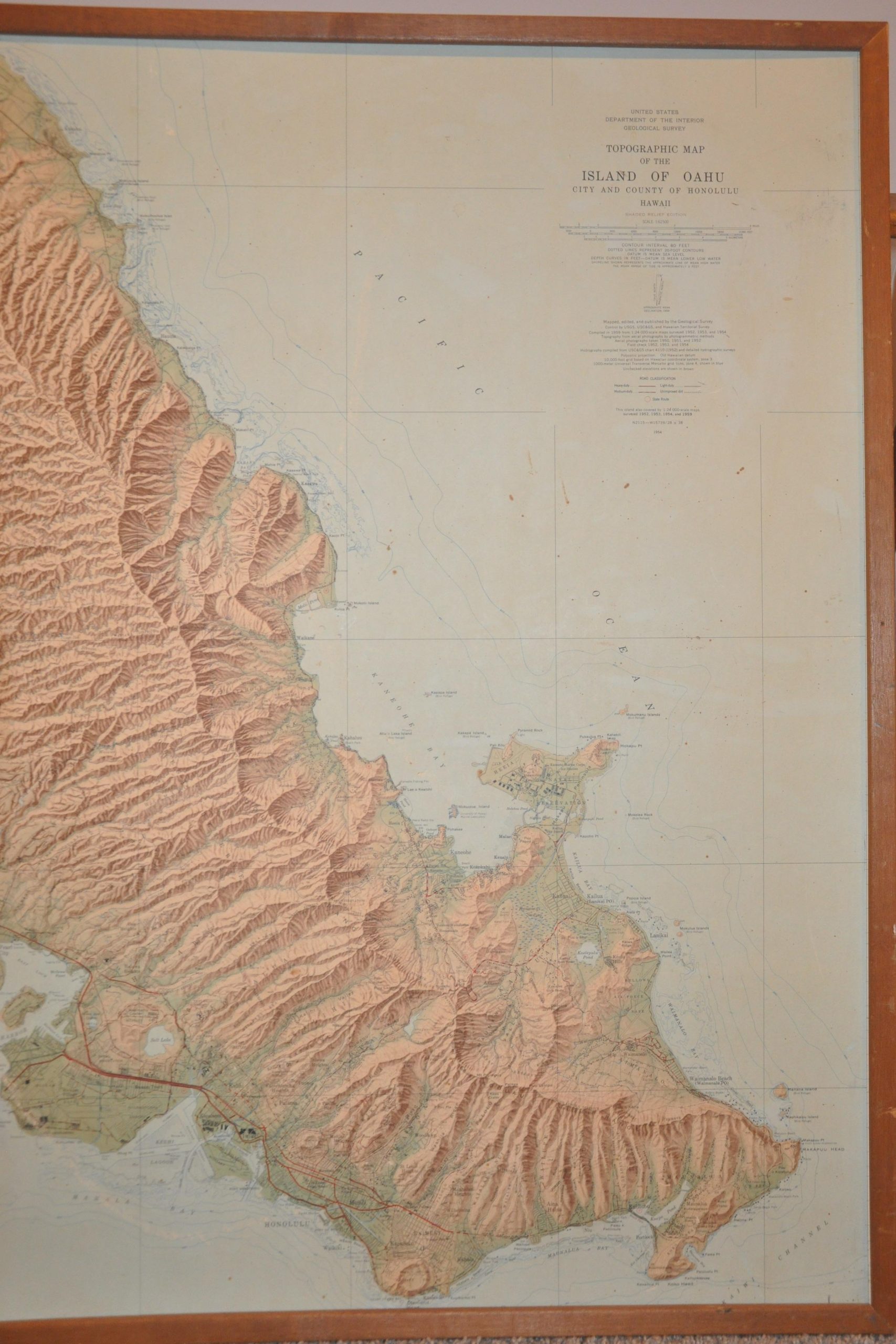
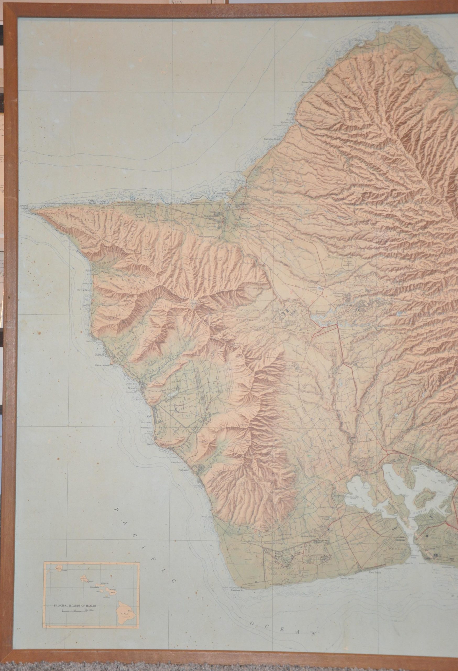
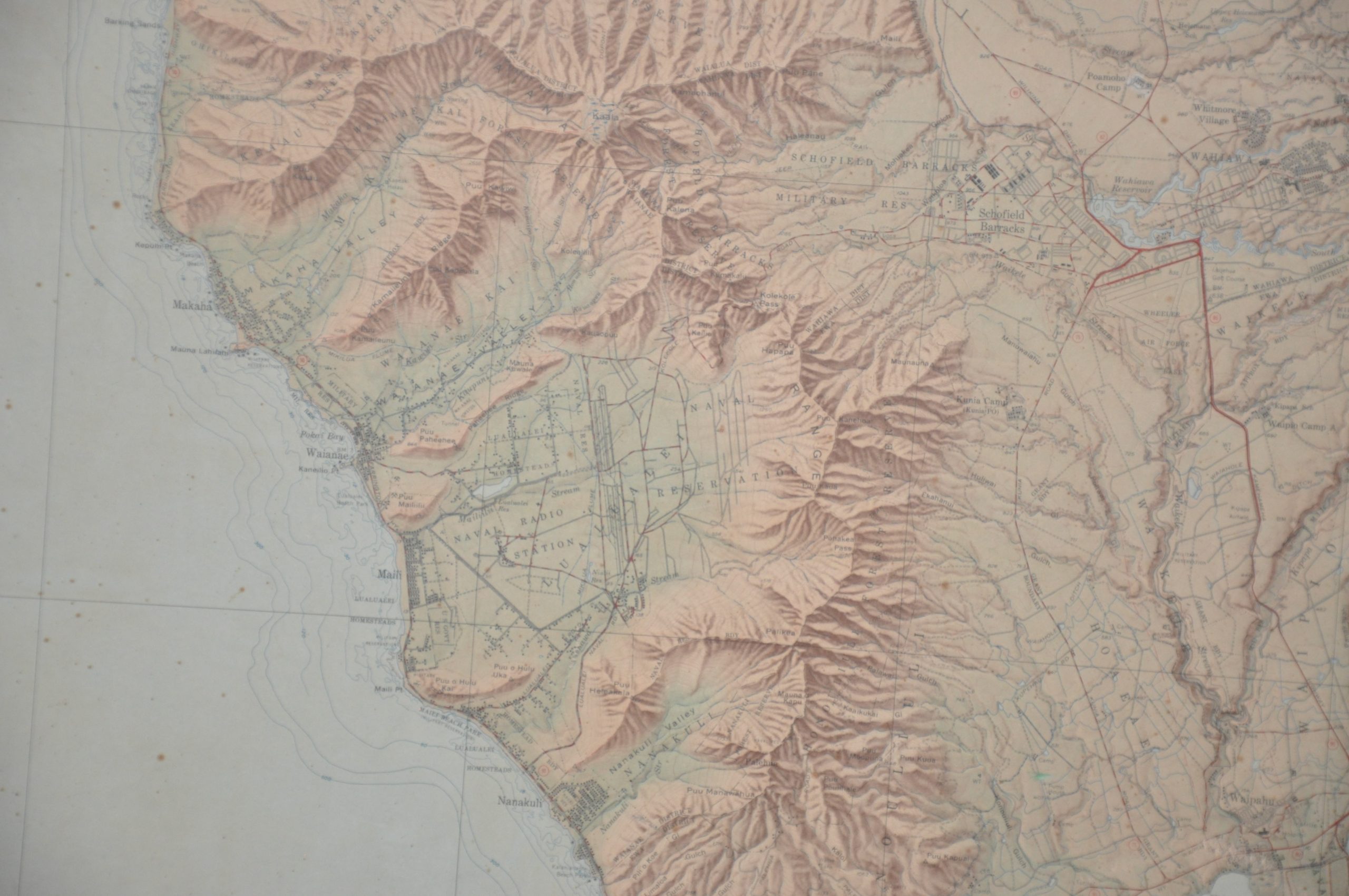
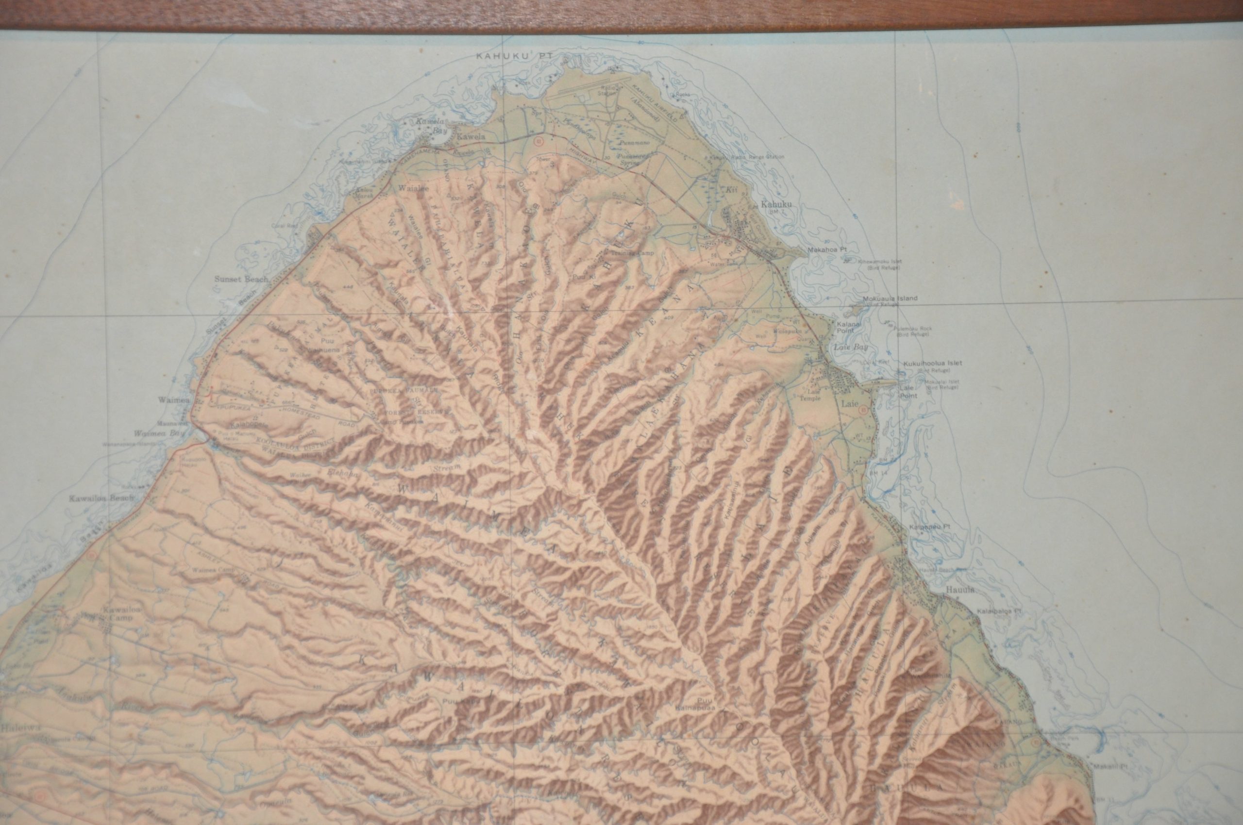
This eye-catching map of the Hawaiian Island of Oahu was originally issued by the United States Geographic Survey in 1952, though this example has been updated to 1959 according to the text below the title. Shaded relief provides a vibrant overview of Oahu’s mountainous terrain, steep valleys, and broad coastal plains. Four types of road classification are identified according to the legend in the center-right while geographic features, important buildings, and cities are labeled throughout. An inset in the lower left shows the principal islands of the Hawaiian archipelago.
The image reflects a vast military presence that dates back to 1860, when the American government first (albeit temporarily) leased a portion of Honolulu for use as a coaling station. Fort Shafter, the first permanent Army base, opened in 1907 and can be seen just northwest of Honolulu.
Map Details
Publication Date: 1959
Author: U.S.G.S.
Sheet Width (in): 44.5
Sheet Height (in): 34.25
Condition: B
Condition Description: Large map affixed to a backing board and mounted within a brown wooden frame. Scattered spotting visible throughout the image and several spots of abrasion have resulted in streaks of white spots, most evident running from Honolulu to Pearl Harbor. Fair to good condition, with a rustic look that remains attractive and interesting.
$350.00
1 in stock