[Tokyo City Map]
$295.00
Japanese tourism to Tokyo in the early 20th century.
1 in stock
Description
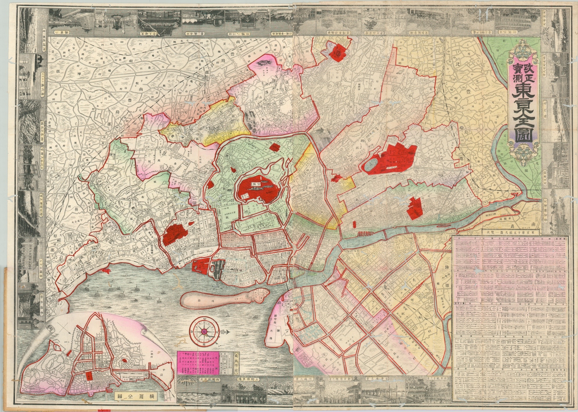
This attractive woodcut map of Tokyo was published locally in 1906 (Meiji 39) and uses stenciled wash color to attractively highlight various neighborhoods and public spaces (dark red). The municipality had only been officially established less than two decades prior, and the map captures the tremendous growth and development since Emperor Meiji moved the capital there in 1869.
The image is oriented with east at the top of the page and is surrounded by 29 views of popular attractions, temples, and important buildings. These are oriented so that the map can be viewed from all four sides. An inset map in the lower left shows the port of Yokohama, Japan’s second-largest city and a hub of industry and Western influence in the early 20th century.
Blocks of dense text provide supplemental information on the organization of greater Tokyo, while a key in the lower center identifies the symbols used to denote various features within the map. An elaborate production highlighting both imperial power and the city of Tokyo as the cultural, political, and economic center of Japan.
Map Details
Publication Date: 1906
Author: Unknown
Sheet Width (in): 28.60
Sheet Height (in): 20.10
Condition: C
Condition Description: Pocket map folded into 18 panels and affixed to original stiff boards. Apart from the normal creasing and light discoloration, there are unfortunately numerous offsetting wormholes scattered across much of the image.
$295.00
1 in stock


