Tobacco Map of Cuba
$50.00
The cigar industry attempting to recover from a 1933 general strike in Cuba.
1 in stock
Description
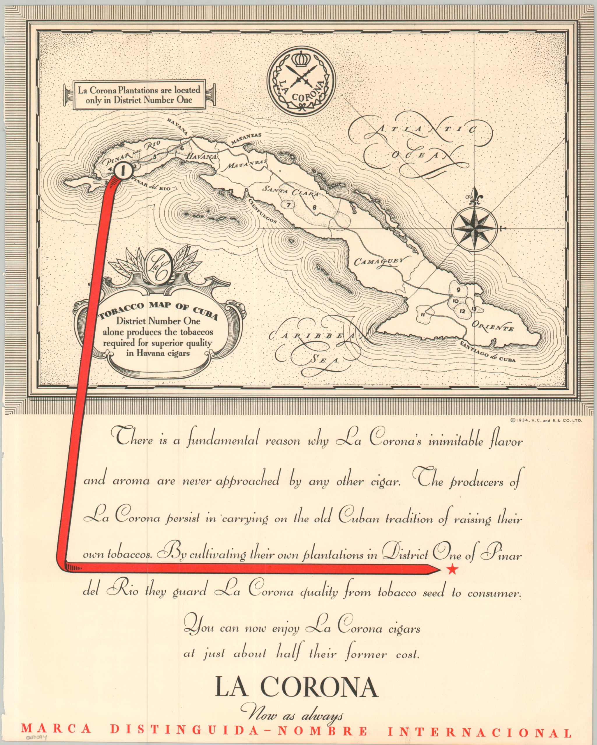
This simple little map, issued in a 1934 issue of Fortune Magazine, shows the island of Cuba divided into thirteen different tobacco-growing districts. Accompanying text assures the audience that La Corona Plantations are only located in District Number One and District Number One alone produces the tobaccos required for superior quality Havana cigars. Plus, the cigars are now available at just about half their former cost!
This clever marketing ploy, issued by La Corona owners Henry Clay & Bock & Co. Ltd, is likely related to a massive strike in Cuba in 1933 (of which tobacco pickers and cigar rollers played a large part). The year prior, due to another strike and high tariffs, the company built a factory in Trenton, New Jersey that remains one of the city’s distinctive architectural landmarks.
Map Details
Publication Date: 1934
Author: Henry Clay & Bock & Co. Ltd
Sheet Width (in): 11.25
Sheet Height (in): 13.8
Condition: B+
Condition Description: Black and white map on the upper half of a single sheet, disbound from Fortune Magazine. Moderate wear along the outer edges and creased corners. About good condition overall.
$50.00
1 in stock