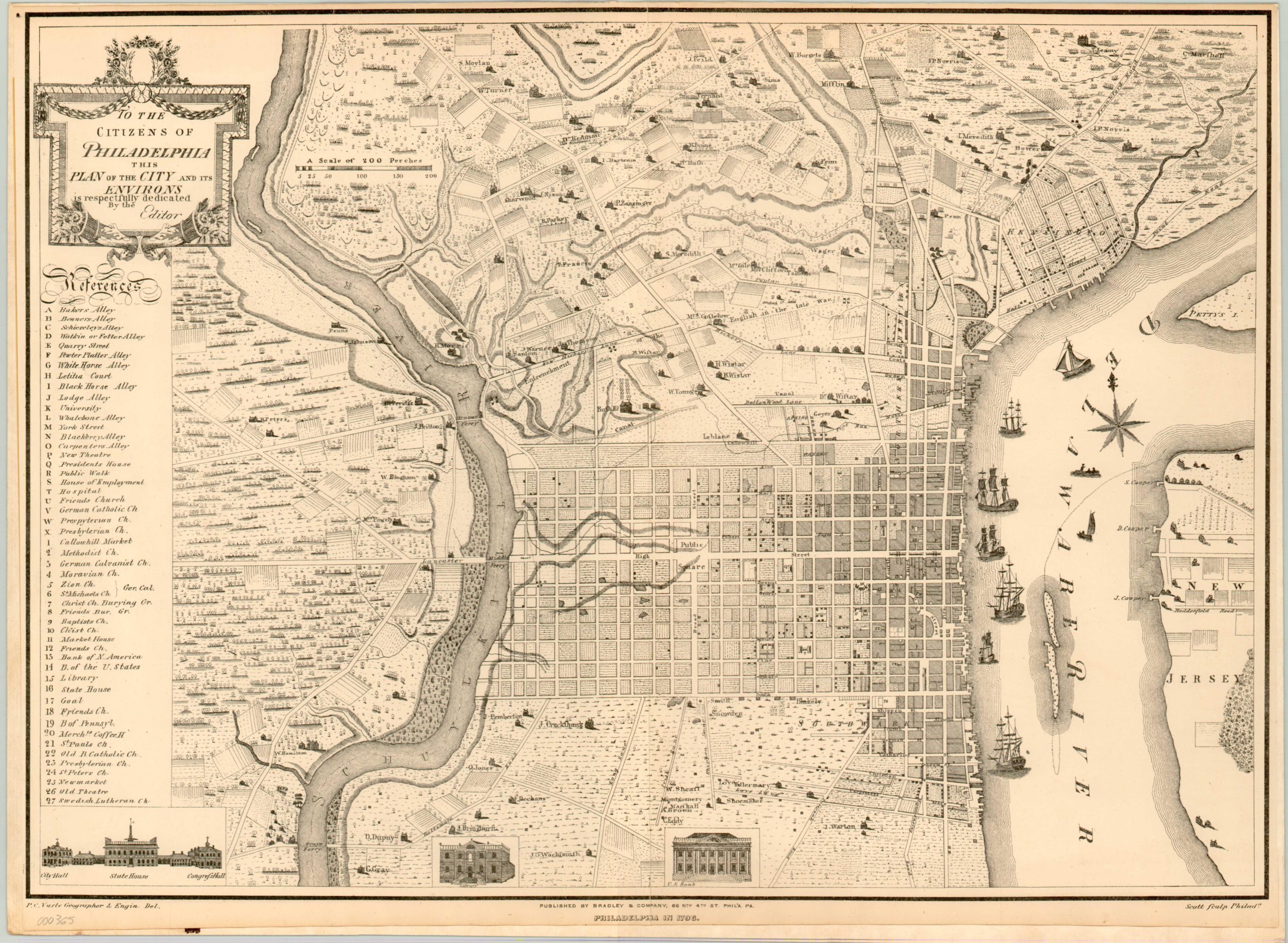
To the Citizens of Philadelphia, this Plan of the City and its Environs
$175.00
Lovely antique reprint of a city plan of Philadelphia in 1796.
Description
Based on an important (and expensive!) map of Philadelphia by Peter Charles Varlé, Charles Kauffman released this reprint of the historic plan 100 years later, published in Philadelphia by Bradley & Co. It shows the city when it was still the capital of the United States and a key on the left hand side identifies 27 locations of interest.
Details are provided on individual buildings, and show early expansion away from the Delaware and towards the Schuylkill River. Sailing ships can be seen in the former waterway along with a portion of the New Jersey Coast. North of the city is largely rural, with scattered landholders labeled individually. Several profile views are situated along the bottom border, including City Hall, the State House, Congress Hall, the library, and the Bank of the United States.
Map Details
Publication Date: 1895
Author: Bradley & Co.
Sheet Width (in): 21.00
Sheet Height (in): 15.50
Condition: C
Condition Description: This early reproduction is in good shape, with trimmed edges and some marginal soiling. Unfortunately a previous owner has mounted it to a backing board.
$175.00

