
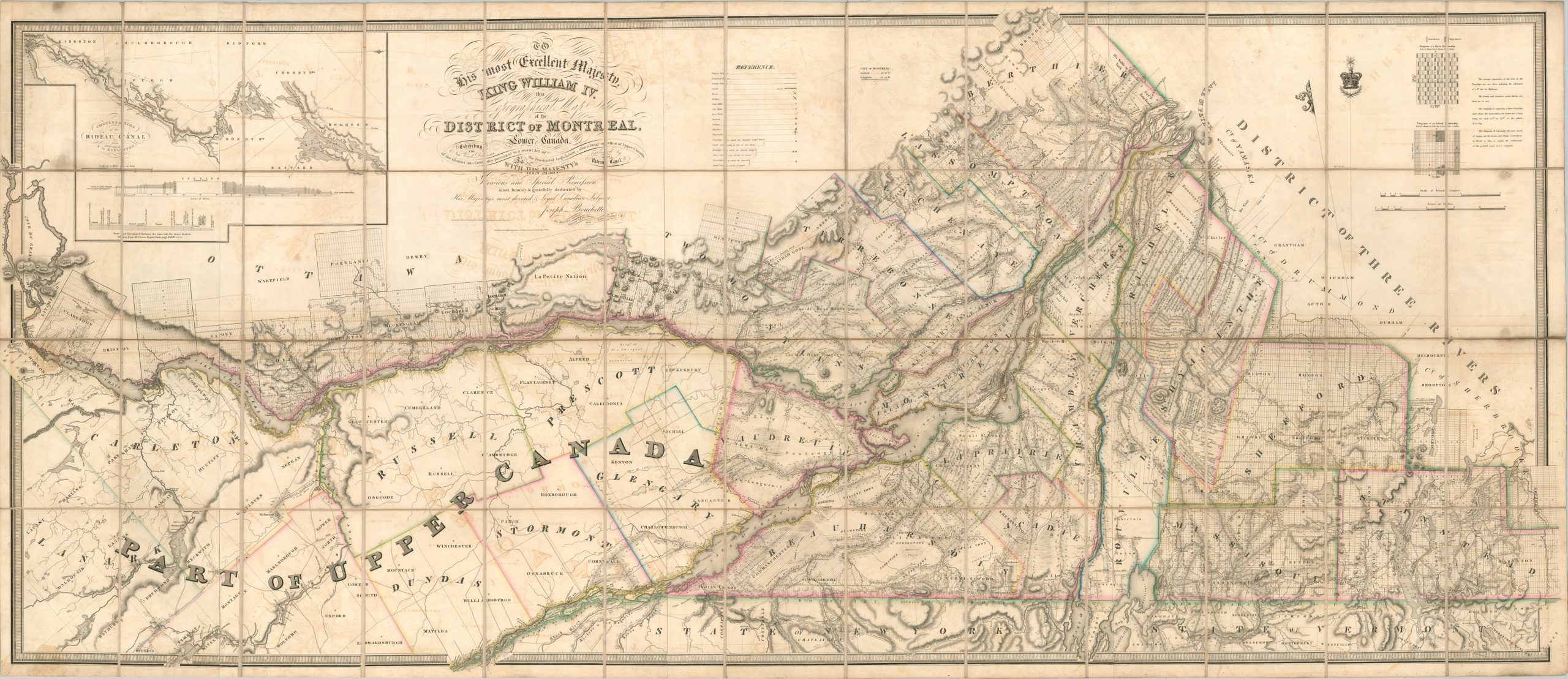
To his most Excellent Majesty King William IV this Topographical Map of the District of Montreal, Lower Canada
An incredible, ‘hitherto unequaled’, map of the (former) Montreal District in British Canada.
Out of stock

Description
This impressive 1831 cartographic production covers a large portion of the modern-day Canadian provinces of Quebec and Ontario. At the time of publication, much of the area had been encompassed by the Montreal District, which was reorganized into the Province of Lower Canada by the Constitutional Act of 1791. That political reassessment is one of the focal points of the map, which uses original color to distinguish the borders of the various electoral districts.
The legislation also called for the establishment of ‘clergy reserves’, tracts of land set aside for the financial support of the Church of England. Diagrams in the upper right corner explain the surveying process for these plots in further detail. Convents and churches are among the numerous features identified throughout the image. A legend in the upper center notes the symbols for important industries (mines, mills, colleges), transportation (ferries, canals, bridges), and communication infrastructure (telegraph lines). Topography is depicted with delicately engraved hachures and small pictorial elements reflecting forests, farmland, and marshes.
A large portion of the map’s image is dedicated to the adjacent province of Upper Canada. Details are quite sparse, reflecting a lack of population and development. The 1826 establishment of The Canada Company hoped to change all that. The private organization founded by John Galt purchased all the Crown and clergy reserves available (almost 2.5 million acres) in 1827 for just over 340,000 pounds. Many of its possessions throughout Upper Canada are noted with small stars or crosses, as indicated in the legend.
Another important factor in provincial development was the Rideau Canal, connecting the Ottawa River with the Cataraqui River and Lake Ontario. Described by the map’s author as Canada’s Erie Canal, the artificial waterway opened the year after printing and was instrumental in the transportation of goods and settlers to the interior. An inset in the upper left shows the course of the canal between Ottawa and Kingston, along with an elevation diagram noting the position of each lock.
The map was created by Joseph Bouchette, Survey General of Lower Canada, and published by James Wyld in London in 1831. Engraved by J. & C. Walker. Designed to accompany Bouchette’s influential The British Dominions in North America. As described by Rumsey;
Essentially, this map of Montreal District and the sister map of Quebec are of the same large scale of the 1815 Map of Lower Canada, but actually enlarge the area of coverage (the mother map was already over ten feet long) to a combined length of over fifteen feet, all with massive updating to show the growth of settlement and survey.
Sources: OCLC# 54068316; Winearls 515; Jonathan Clark House Museum; David Rumsey Map Collection; Bibliotheque nationale de france
Map Details
Publication Date: 1831
Author: Joseph Bouchette
Sheet Width (in): 90.5
Sheet Height (in): 39.25
Condition: B
Condition Description: Huge map, printed on four sheets, dissected into 52 segments and mounted on old, but sturdy, linen. Original outline color. Moderate offsetting visible from the heavy text, most evident near the title block. Mirrored spots of discoloration, about 4 total each the size of a golf ball, can be seen on the left and right sides of the sheet. Ex-libris, with old bookplate on the front covers (when folded). About good condition overall
Out of stock