
Time Capsule Classroom Research Unit World War II
$45.00
Learning about WWII (from an American perspective) during the late 1960s.
1 in stock
Description
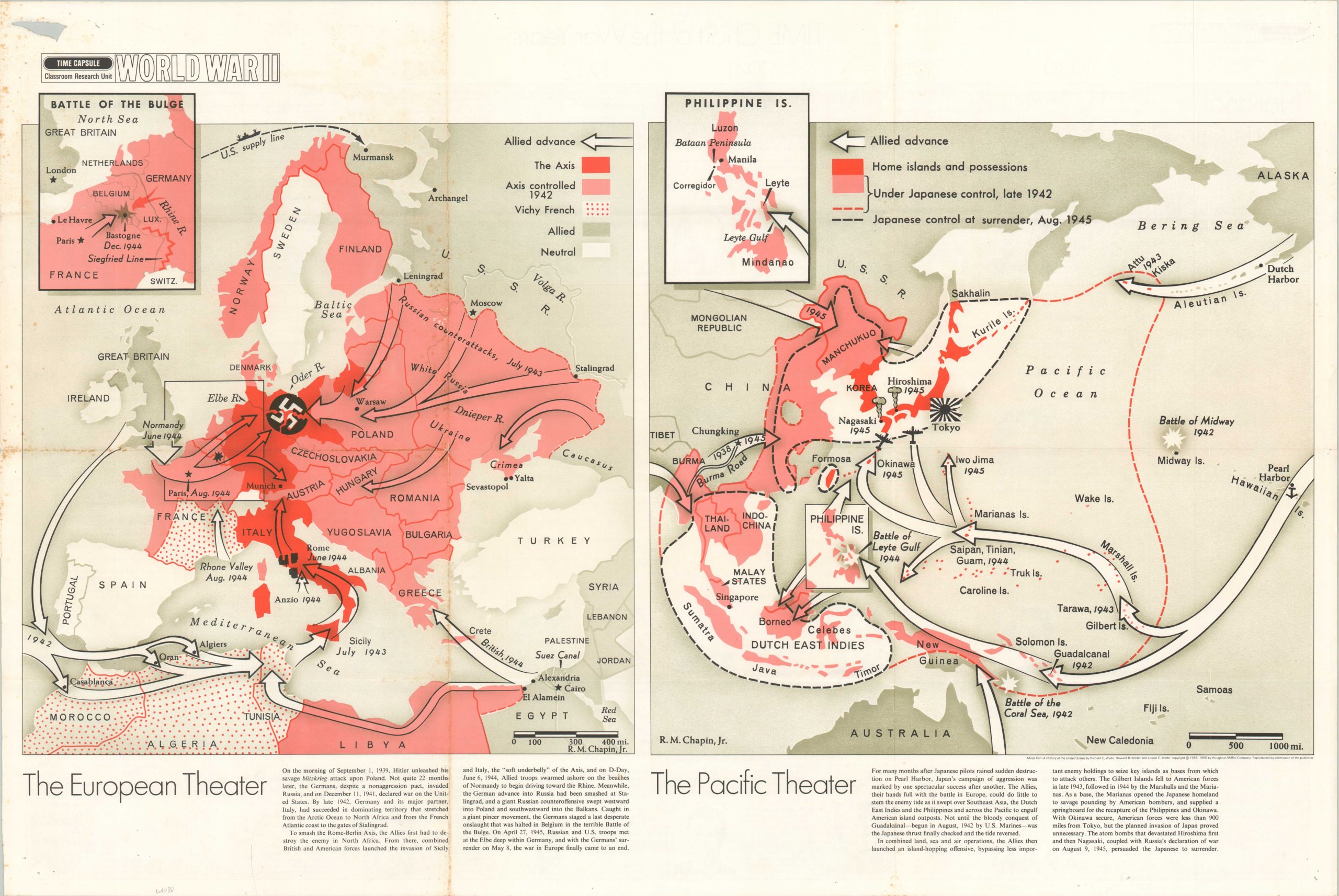
This pair of cartographic images provides a relatively simple overview of the major events that took place during World War II. Axis, Allied, and neutral territories are shown across the Pacific and European Theaters. Arrows, symbols, and dotted lines add further context Commentary at the bottom of the page offers a relatively objective historical summary. The maps were originally designed by Robert M. Chapin, Jr. and published in A History of the United States by Richard C. Wade. Republished here by TIME, Inc. in 1968 for classroom educational purposes.
Chapin was a professionally trained architect who found jobs to be in low demand during the Great Depression. He took a job in the photo department at Newsweek in 1933, where he apparently picked up a knack for cartographic design. By 1937, he was hired by Time (a rival of Newsweek) as the head of the cartography department, a position he would hold until his retirement in 1970. During his long tenure at Time, Chapin’s prolific output helped establish a pattern for 20th-century newsroom cartography. The use of bold colors, uncluttered design, and legible typography was immensely popular, and the maps were reprinted for distribution in classrooms and public spaces throughout the country. Despite their widespread appeal, the maps are uncommon on the market and often overlooked in institutional collections.
Map Details
Publication Date: 1968
Author: R.M. Chapin, Jr.
Sheet Width (in): 35.75
Sheet Height (in): 23.75
Condition: B+
Condition Description: Several holes, including one about 2" long (upper left) visible in the margins. Light toning and wear along old fold lines. About good condition overall. Blank on verso.
$45.00
1 in stock