
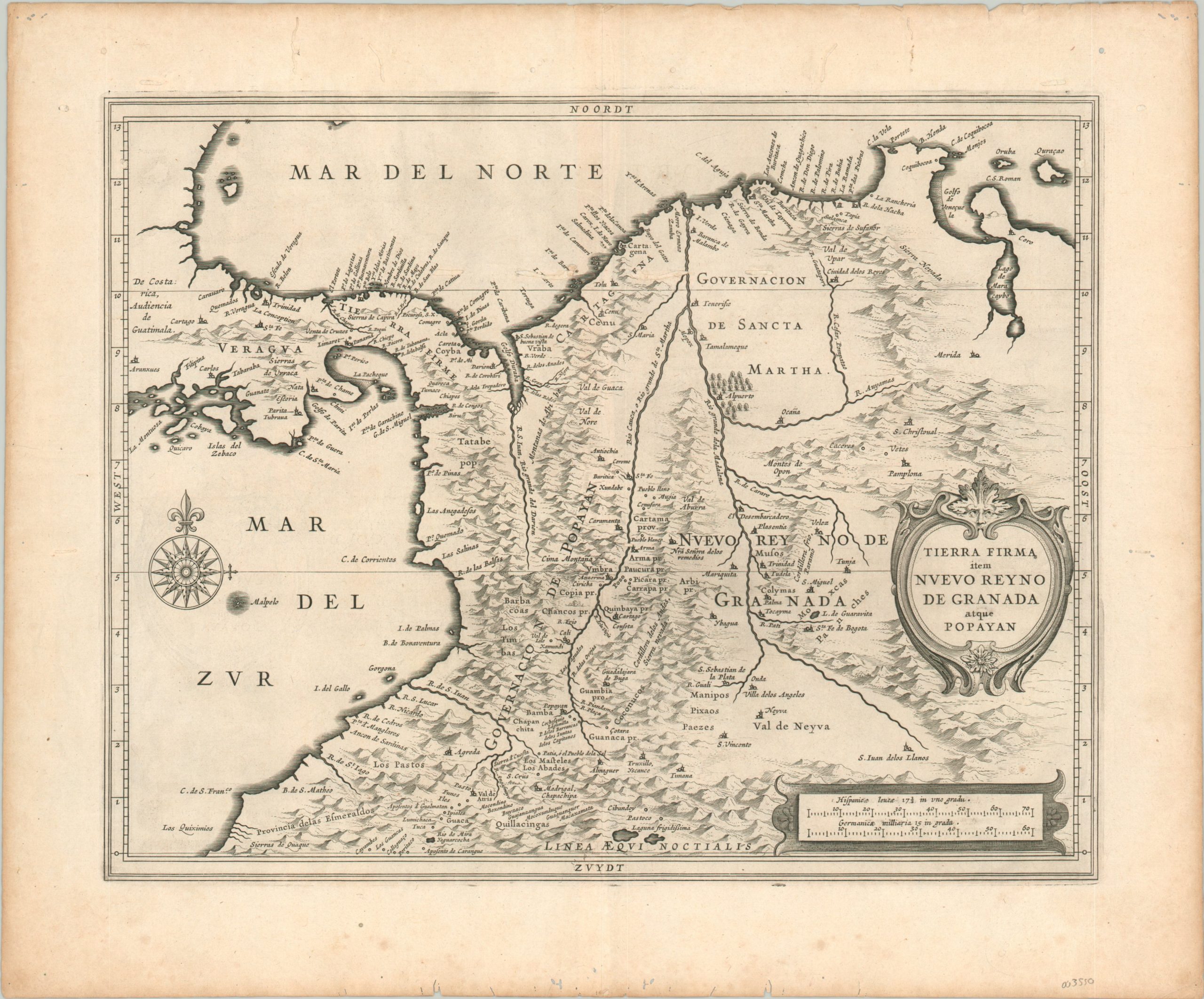
Tierra Firma item Nuevo Reyno de Granada atque Popayan
$595.00
The provinces of New Granada – the gem in the crown of the Spanish Americas.
1 in stock
Description
This finely engraved map covers portions of Central and South America that approximate to the modern-day countries of Panama and Colombia. Around the time of publication, the region was organized as the Kingdom of New Granada; itself comprised of various provinces and governates labeled throughout the image.
As part of the Viceroyalty of Peru (formerly Tierra Firme), New Granada contained several cities that were vital to the overseas trade network of the Spanish Empire. Notably, silver from the mines of Potosi was shipped along the Pacific Coast to Panama, where it was hauled overland for export to Europe via Nombre de Dios or Portobelo. Cartagena was also a critical port in the transportation of precious metals, pearls, and slaves.
Pictorial topography emphasizes the region’s exceptionally rugged terrain. These mountains and highlands are home to an indigenous people known as the Muisca. Starting the 1530s, Spanish conquistadors came into conflict with these tribes during their perennial search for gold, and by 1540 the area had been almost entirely subjugated under the authority of the new capital at Santa Fe de Bogotá.
The map was published in Leiden in 1630 as part of Johannes de Laet’s Nieuwe Wereldt often Beschrijvinghe van West-Indien (Description of the West Indies). The work was originally issued in 1625 and contained ten maps – this is from the slightly updated version that contained fourteen maps and an additional 100 pages of text, reflecting the increased interest of the Dutch in the New World.
Described by Philip Burden as “arguably the finest description of the Americas published during the seventeenth century,” the maps in de Laet’s work were based directly off the cartography of Hessel Gerritsz, considered by some to be the foremost mapmaker of the Dutch Golden Age of Cartography. Gerritsz was the exclusive cartographer for the Dutch East India Company and had access to some of the most up-to-date information available. His maps are generally only available in manuscript form and those published by de Laet are some of the few available to collectors today.
Johannes de Laet was no slouch, either, and he used meticulous research and contemporary sources when compiling his geographic data. As a director of the newly formed Dutch West India Company, the latest information from private correspondence, manuscripts, and other company secrets would have also been made available when compiling the maps.
Sources: Shirley (BL Atlases) G.LAET-1b, Burden,
Map Details
Publication Date: 1630
Author: Johannes de Laet
Sheet Width (in): 16.60
Sheet Height (in): 13.60
Condition: B+
Condition Description: Scattered spots of worming and light spotting visible in the margins. Four spots of worming, immediately opposite the centerfold, can be seen just above the 11th parallel and have been professional repaired, though not reconstituted. Good to very good overall.
$595.00
1 in stock