Thru Kansas Over Royal Roads
A quirky tourism brochure for the Royal Roads of Kansas.
Out of stock


Description
This interesting brochure/road atlas was printed in Wichita by the Western Lithograph Company on behalf of the Kansas Chamber of Commerce in the late 1920’s. The contents highlight the efforts of the Kansas legislature in improving the roads since the passage of the Federal Aid Highway Act of 1921.
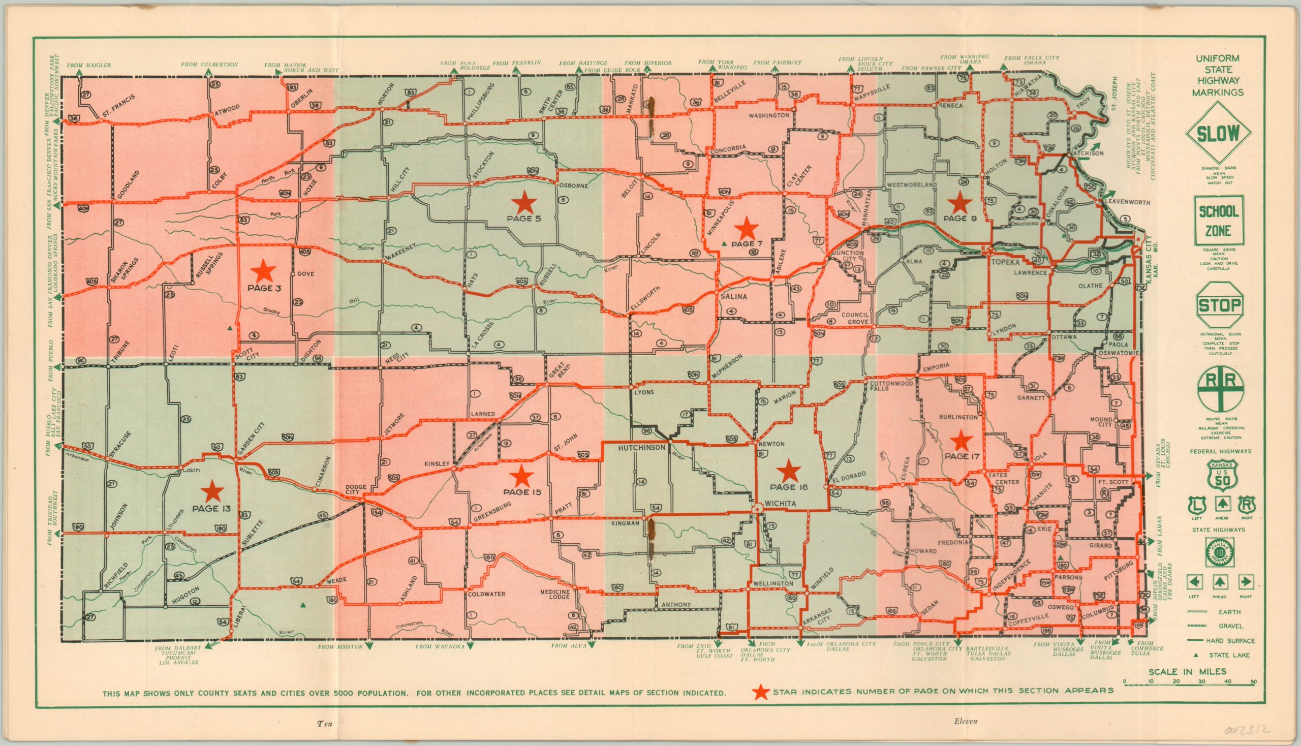
The state is divided across 8 different maps, in addition to a centerfold index sheet identifying highway markings and road signs. Each page reflects the dirt, gravel, and paved routes available to the motorist, plus distances between points, locations of interest, towns, and geographic features. Text and photographs accompanying the maps provide an interesting reflection on the contemporary attitudes of self-promotion and tourism.
The first full page highlights how ‘Kansas is 1st in percent of American born citizens’ while aquaplaning (a predecessor to water skiing), ‘a typical scene along ROYAL ROADS in Kansas’ (see photo), and a collage of relatively non-descript hotels are other notable examples.
Map Details
Publication Date: c. 1929
Author: Western Lithograph Company
Sheet Width (in): 15.75
Sheet Height (in): 8.90
Condition: A-
Condition Description: 22 pp. brochure with stapled bindings and color pictorial wrappers, folded over once. Small tear along the top of the front cover and a small spot in the upper right corner of the first six pages. Includes a bit of rust staining on the centerfold index map.
Out of stock